Entrada de cueva
Gouffre de Pou Meyssen
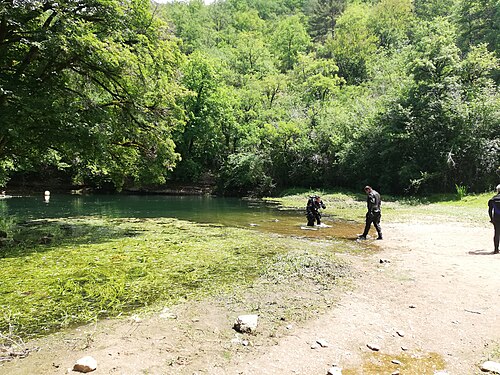
A small pool at the foot of a cliff in a dry valley above Cabouy that gives a second way into the flooded Ouysse river, about 800 m upstream of Cabouy underground.
Pou Meyssen lies at the foot of a cliff in a rock recess behind a thicket of dogwood, about 1 km up the dry valley from Cabouy on foot or by a stony track off the Rocamadour–Couzou road. The pool is about 6 m long and 2.5 m wide and its level varies with the seasons.
Below the pool a chamber of boulders lies at about 10 m. Downstream the gallery averages 14 to 20 m deep towards Cabouy; upstream it rises to about 9 m before levelling between 14 and 16 m. The Subaqua account of the 2011-2014 re-lining says the small pool clouds up immediately when divers enter, so the team fixed a rope from the surface to a T-junction with the main line, signed for the Pou Meyssen exit and for Cabouy 800 m away.
El entorno
A narrow, easily silted entrance pool leading into the large underground Ouysse river passage.
Condiciones
Visibility at the entrance is frequently lost as soon as divers enter the small pool; water level varies seasonally.
Rangos típicos de fuentes publicadas, no condiciones actuales.
Otras entradas a Réseau de l'Ouysse (Cabouy – Pou Meyssen)
Solo para orientación, no para navegación. Los puntos huecos son aproximados.
Cada dato de esta página, con su fuente (8)
| Dato | Estado | Fuente |
|---|---|---|
| The entrance pool is about 6 m long and 2.5 m wide and its level varies with the seasons. | Verificado | [1] |
| A boulder chamber lies at about -10 m; the downstream gallery averages -14 to -20 m and the upstream gallery stabilises between -14 and -16 m. | Verificado | [1] |
| The small pool clouds up immediately and the sediment raised on entry often wipes out visibility. | Verificado | [2] |
| A rope fixed above the pool joins the main line at a T marked 'Sortie/Exit Pou Meyssen' and 'Cabouy 800 m'.Installed during 2011-2014 re-lining; present condition not verified. | Verificado | [2] |
| The fiche gives directions but no access rules. | Reportado | [1] |
| Area-level position near N 44.79 E 1.59, derived from the FFS fiche (N 44°47'27" E 1°35'34"). | Verificado | [1] |
| Area-level position near N 44.79 E 1.59. | Verificado | [1] |
| The sources consulted publish no qualification, permit or registration requirement set by a land manager or access body for this site.Absence of a published rule, not confirmation that none exists. | Reportado | [1] |
Verificado: declarado por una fuente oficial o primaria que consultamos directamente. Reportado: basado únicamente en una fuente secundaria. Fuentes en conflicto: la nota recoge ambas versiones. Puede estar desactualizado: la fuente más reciente que encontramos es antigua.
Redactado con nuestras propias palabras a partir de las fuentes anteriores. Reportar una corrección