洞窟入口
Gouffre de Pou Meyssen
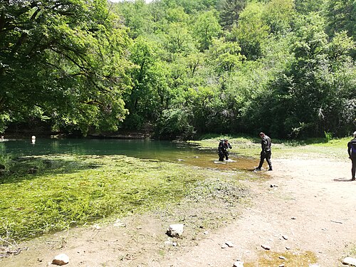
A small pool at the foot of a cliff in a dry valley above Cabouy that gives a second way into the flooded Ouysse river, about 800 m upstream of Cabouy underground.
Pou Meyssen lies at the foot of a cliff in a rock recess behind a thicket of dogwood, about 1 km up the dry valley from Cabouy on foot or by a stony track off the Rocamadour–Couzou road. The pool is about 6 m long and 2.5 m wide and its level varies with the seasons.
Below the pool a chamber of boulders lies at about 10 m. Downstream the gallery averages 14 to 20 m deep towards Cabouy; upstream it rises to about 9 m before levelling between 14 and 16 m. The Subaqua account of the 2011-2014 re-lining says the small pool clouds up immediately when divers enter, so the team fixed a rope from the surface to a T-junction with the main line, signed for the Pou Meyssen exit and for Cabouy 800 m away.
環境
A narrow, easily silted entrance pool leading into the large underground Ouysse river passage.
コンディション
Visibility at the entrance is frequently lost as soon as divers enter the small pool; water level varies seasonally.
公表資料からの一般的な範囲であり、現在のコンディションではありません。
他のエントランス({n}) Réseau de l'Ouysse (Cabouy – Pou Meyssen)
方向確認用であり、ナビゲーション用ではありません。白抜きのドットはおおよその位置を示しています。
このページのすべての情報とその出典 (8)
| 情報 | ステータス | 出典 |
|---|---|---|
| The entrance pool is about 6 m long and 2.5 m wide and its level varies with the seasons. | 確認済み | [1] |
| A boulder chamber lies at about -10 m; the downstream gallery averages -14 to -20 m and the upstream gallery stabilises between -14 and -16 m. | 確認済み | [1] |
| The small pool clouds up immediately and the sediment raised on entry often wipes out visibility. | 確認済み | [2] |
| A rope fixed above the pool joins the main line at a T marked 'Sortie/Exit Pou Meyssen' and 'Cabouy 800 m'.Installed during 2011-2014 re-lining; present condition not verified. | 確認済み | [2] |
| The fiche gives directions but no access rules. | 報告済み | [1] |
| Area-level position near N 44.79 E 1.59, derived from the FFS fiche (N 44°47'27" E 1°35'34"). | 確認済み | [1] |
| Area-level position near N 44.79 E 1.59. | 確認済み | [1] |
| The sources consulted publish no qualification, permit or registration requirement set by a land manager or access body for this site.Absence of a published rule, not confirmation that none exists. | 報告済み | [1] |
確認済み:直接開いた公式または一次情報源による記載。報告ベース:二次情報源のみによるもの。情報が競合:注釈に両方のバージョンを記載。最新情報でない可能性あり:確認できた最新の情報源が古い。
上記のソースをもとに、独自の言葉でまとめています。 修正を報告する