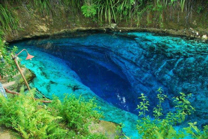
Enchanted River (Hinatuan)
A popular spring-fed swimming spot in Mindanao whose pool hides an underwater cave entrance at about 30 m. Tidal flow and a halocline change cave conditions sharply; no dive access procedure is published.
The spring pool at the head of the Enchanted River is a busy public attraction managed by the Hinatuan municipality as an eco-tourism area. The cave entrance lies about 30 m down in the pool.
Filipino Cave Divers reports describe seawater entering on high tides, a halocline around 33 m, and a cave that cannot be entered near its peak outflow. The same reports note a partial ceiling collapse found in 2013 and concern that heavy visitor numbers may harm a fragile ecosystem.
환경
Spring pool over an underwater cave; brackish to salt water can intrude with the tide, with a halocline recorded at 33 m.
컨디션
Conditions depend on the tide: FCD divers recorded inward current, seawater and very poor visibility above the halocline at high tide, and still, very clear water at another tide state.
현재 상태가 아닌 공개된 자료의 일반적인 범위입니다.
방향 파악용이며 내비게이션용이 아닙니다. 빈 점은 대략적인 위치입니다.
이 페이지의 모든 정보와 출처 (6)
| 정보 항목 | 상태 | 출처 |
|---|---|---|
| The river starts from an underwater cave entrance at 30 m depth. | 보고됨 | [1] |
| On a high-tide dive divers met seawater, an inward current and very poor visibility until a halocline at 33 m; on another dive there was no current and very clear water.Observations from August 2013. | 보고됨 | [2] |
| The team found recent cave-in sites with loose limestone on the ceiling in August 2013. | 보고됨 | [2] |
| The municipality owns 27 hectares around the river and has declared it an eco-tourism area.As of March 2015. | 보고됨 | [1] |
| FCD gives the coordinates 8.458886 N, 126.354667 E.Public tourist site. | 보고됨 | [1] |
| FCD gives the coordinates 8.458886 N, 126.354667 E.Public tourist site. | 보고됨 | [1] |
확인됨: 직접 열람한 공식 또는 1차 출처에서 명시된 정보입니다. 보고됨: 2차 출처에서만 확인된 정보입니다. 출처 간 상충: 비고에 두 가지 내용이 모두 기재되어 있습니다. 최신 정보가 아닐 수 있음: 확인된 가장 최근 출처가 오래된 경우입니다.
위의 출처를 바탕으로 자체적으로 작성했습니다. 수정 사항 제보