Вход в пещеру
King Pot
A technical pothole on the east side of Kingsdale whose downstream sumps were dived to Keld Head in the 1991 through-trip. Caving access is by courtesy call at Braida Garth; the CNCC warns only very capable parties should attempt it.
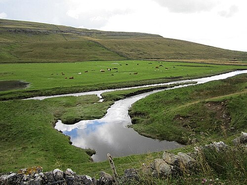
King Pot is a vertical cave (pothole) on access land on the east side of Kingsdale. In June 1991 a team led by Rupert Skorupka, diving downstream from King Pot, joined their line to that of divers working upstream from the Keld Head side, and in August 1991 the 3,000 m through-trip to Keld Head was completed.
Reaching the sumps requires serious dry caving first: the CNCC notes technical squeezes and advises that the trip be very thoroughly researched and attempted only by very capable parties.
Среда погружения
Dry vertical caving with technical squeezes leading to downstream sumps of the Kingsdale system.
Другие входы в Kingsdale system (Keld Head)
Для общей ориентации, не для навигации. Незакрашенные точки обозначают приблизительное положение.
Каждый факт на этой странице с указанием источника (4)
| Факт | Статус | Источник |
|---|---|---|
| A courtesy call at the landowner's farm is required; the cave is on access land.CNCC page updated 2026-06-01. | Подтверждено | [1] |
| Technical squeezes mean the trip should be very thoroughly researched and undertaken only by very capable parties. | Подтверждено | [1] |
| In June 1991 Rupert Skorupka's team, diving downstream from King Pot, joined lines with divers working upstream; the 3,000 m through-trip to Keld Head followed in August 1991. | Подтверждено | [2] |
| The CNCC gives SD 70790 77380 (about 54.191 N, 2.449 W) for King Pot.Given at area precision. | Подтверждено | [1] |
Подтверждено: указано официальным или первичным источником, который мы открывали. Сообщается: только из вторичного источника. Источники расходятся: в примечании приведены обе версии. Может устареть: самый свежий найденный нами источник датирован давно.
Написано нашими словами на основе приведённых выше источников. Сообщить об ошибке