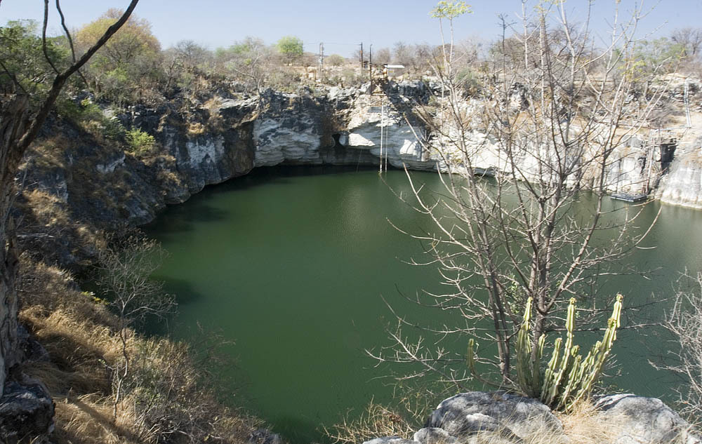
Lake Otjikoto
Type III: CMAS sinkhole type (as reported in 2009) [1] (Classification reported in a 2009 newspaper article; no current CMAS document was found to confirm it.). Эти категории взяты из самой схемы наименований и описывают уровень подготовки, которого требует сайт.
A heritage sinkhole lake near Tsumeb whose 'underwater museum' of 1915 weapons lies at about 41-55 m. Diving has been limited to organised and authorised groups.
Divers enter Lake Otjikoto from its shore; in 2009 an entry ladder reached down to 6 m. Below, named features step down the wall from about 28 m, and the dumped weapons lie at roughly 45-55 m. One 2025 report says divers need to be qualified to at least 50 m to explore them.
The lake is a public heritage site where visitors pay to view it from the rim, but diving is not open to casual visitors. Earlier reports describe dives run through the Namibian Underwater Federation and authorised operators, and training use by police divers. Current diving arrangements should be confirmed with the National Heritage Council of Namibia.
Среда погружения
Still, fresh water in a steep-sided sinkhole, about 22 C near the surface and 18 C lower down in 2009, with visibility up to about 15 m. Narrow caves lead off at depth.
Условия
Temperature and visibility from 2009; the water level rose sharply after the 2025 rains.
Типичные диапазоны из опубликованных источников, не текущие условия.
Для общей ориентации, не для навигации. Незакрашенные точки обозначают приблизительное положение.
Каждый факт на этой странице с указанием источника (8)
| Факт | Статус | Источник |
|---|---|---|
| The dumped weapons and other features lie at about 28-55 m, including the armaments at 45-55 m. | Сообщалось | [1] [2] |
| In 2009 the entry ladder reached 6 m. | Может быть устаревшим | [1] |
| About 22 C near the surface and 18 C deeper, visibility up to 15 m (2009). | Может быть устаревшим | [1] |
| Divers must be qualified to 50 m or deeper to explore the underwater museum. | Сообщалось | [2] |
| In 2009 Lake Otjikoto was described as a Type III sinkhole under the CMAS classification. | Может быть устаревшим | [1] |
| Administered by the National Heritage Council of Namibia in 2017, with a viewing fee; diving limited to organised and authorised groups. | Может быть устаревшим | [3] [1] |
| In 2017 the site was open 08:00-17:00, Monday to Sunday.2017 newspaper report; re-check before use. | Может быть устаревшим | [3] |
| Area-level coordinates for a public heritage site beside the B1 road. | Сообщалось | [4] [2] |
Подтверждено: указано официальным или первичным источником, который мы открывали. Сообщается: только из вторичного источника. Источники расходятся: в примечании приведены обе версии. Может устареть: самый свежий найденный нами источник датирован давно.
Написано нашими словами на основе приведённых выше источников. Сообщить об ошибке