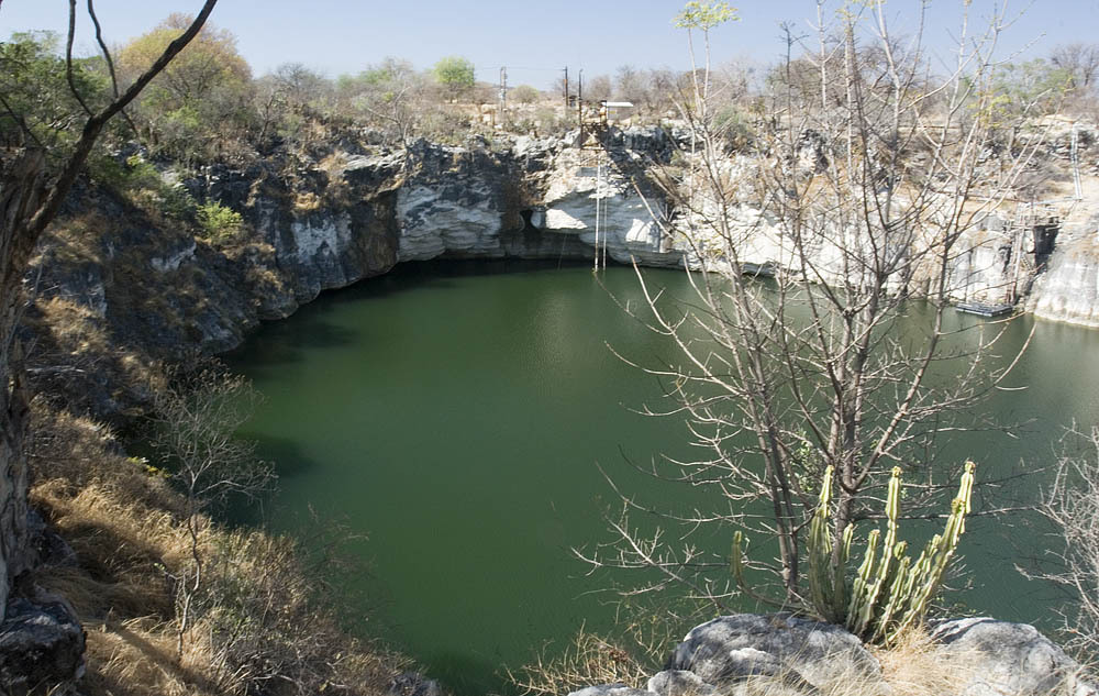
Lake Otjikoto
Type III: CMAS sinkhole type (as reported in 2009) [1] (Classification reported in a 2009 newspaper article; no current CMAS document was found to confirm it.). 以下分类采用该认证体系自身的命名方式,用于描述该潜点所需的培训级别。
A heritage sinkhole lake near Tsumeb whose 'underwater museum' of 1915 weapons lies at about 41-55 m. Diving has been limited to organised and authorised groups.
Divers enter Lake Otjikoto from its shore; in 2009 an entry ladder reached down to 6 m. Below, named features step down the wall from about 28 m, and the dumped weapons lie at roughly 45-55 m. One 2025 report says divers need to be qualified to at least 50 m to explore them.
The lake is a public heritage site where visitors pay to view it from the rim, but diving is not open to casual visitors. Earlier reports describe dives run through the Namibian Underwater Federation and authorised operators, and training use by police divers. Current diving arrangements should be confirmed with the National Heritage Council of Namibia.
环境
Still, fresh water in a steep-sided sinkhole, about 22 C near the surface and 18 C lower down in 2009, with visibility up to about 15 m. Narrow caves lead off at depth.
环境条件
Temperature and visibility from 2009; the water level rose sharply after the 2025 rains.
典型范围来自已发表资料,不代表当前实际状况。
仅供方位参考,不可用于导航。空心圆点为大致位置。
本页所有信息及其来源 (8)
| 信息条目 | 状态 | 来源 |
|---|---|---|
| The dumped weapons and other features lie at about 28-55 m, including the armaments at 45-55 m. | 已报告 | [1] [2] |
| In 2009 the entry ladder reached 6 m. | 信息可能已过时 | [1] |
| About 22 C near the surface and 18 C deeper, visibility up to 15 m (2009). | 信息可能已过时 | [1] |
| Divers must be qualified to 50 m or deeper to explore the underwater museum. | 已报告 | [2] |
| In 2009 Lake Otjikoto was described as a Type III sinkhole under the CMAS classification. | 信息可能已过时 | [1] |
| Administered by the National Heritage Council of Namibia in 2017, with a viewing fee; diving limited to organised and authorised groups. | 信息可能已过时 | [3] [1] |
| In 2017 the site was open 08:00-17:00, Monday to Sunday.2017 newspaper report; re-check before use. | 信息可能已过时 | [3] |
| Area-level coordinates for a public heritage site beside the B1 road. | 已报告 | [4] [2] |
已核实:来自我们直接查阅的官方或主要来源。已报告:仅来自二手来源。来源存在冲突:注释中列出两种版本。可能已过时:我们找到的最新来源已有一定年代。
由我们根据上述来源以自己的文字整理撰写。 提交更正