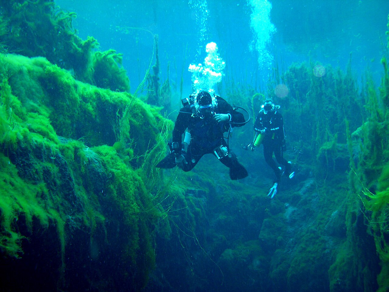
Piccaninnie Ponds (First Pond, Chasm and Cathedral)
Basic Cave: CDAA site rating [3] [1] (The park page uses the older wording 'sinkhole category'.). هذه الفئات مأخوذة من المخطط المُسمَّى ذاته؛ وتصف مستوى التدريب الذي يتطلبه الموقع.
The dive area of the Piccaninnie Ponds Conservation Park: a shallow weedy pond, a deep fissure called the Chasm and a white limestone chamber called the Cathedral. Closed to diving and snorkelling until further notice after an algae outbreak (park notice published July 2024).
The park service allows divers into three parts of the ponds: the First Pond, an open depression about 10 m deep with a silt floor and abundant aquatic life; the Chasm, a narrow sinkhole that drops beyond 100 m; and the Cathedral, an enclosed area of limestone formations about 35 m deep. Diving has always been limited to members of the Cave Divers Association of Australia with the required rating, booked in hourly slots.
The ponds are prized for clarity and for plants growing deep below the surface. In a notice published in July 2024 the park service suspended all diving and snorkelling while vegetation and fauna recover from a filamentous algae outbreak, and it was not issuing permits when this record was checked.
البيئة
Spring-fed fresh water rising through limestone into a shallow pond, a deep open fissure and an enclosed chamber. Aquatic plants grow to about 15 m below the surface.
الظروف
The park service describes visibility as excellent, potentially beyond 40 m, in normal conditions. A filamentous algae outbreak has damaged aquatic vegetation, and the water has been closed to divers and snorkellers since the park notice of July 2024.
نطاقات اعتيادية من مصادر منشورة، لا ظروف آنية.
المرافق
Interpretive information shelter, toilets, accessible toilets and a divers' changing shelter. Camping is not permitted.
للتوجه العام، لا للملاحة. النقاط المفرغة تحديد تقريبي.
كل حقيقة في هذه الصفحة مع مصدرها (11)
| حقيقة | الحالة | المصدر |
|---|---|---|
| The CDAA site directory rates Piccaninnie Ponds (5L72) Basic Cave.The park page requires divers to be 'rated at sinkhole category', older CDAA terminology. | موثق | [3] |
| The First Pond is an open depression about 10 m deep with a silt floor. | موثق | [1] |
| The Chasm is a sinkhole over 100 m deep; the park limits divers to a maximum depth of 36.5 metres (120 feet).100 m is a lower bound ('over 100m'); the state environment department says the springs exceed 110 m (s4). The Cathedral is about 35 m deep. | موثق | [1] |
| Underwater visibility is excellent and may exceed 40 m.Typical clarity, not current conditions. | موثق | [1] |
| Aquatic vegetation grows up to 15 metres below the surface. | موثق | [4] |
| Piccaninnie Ponds remains closed for immersive water activities until further notice; entry into the water for diving and snorkelling is not permitted and permits are not being issued, after a filamentous algae outbreak.Alert published 2024-07-11 and still shown on the park page on 2026-10-14. | موثق | [1] [2] |
| Divers must be current financial CDAA members rated at sinkhole category, dive with a minimum of one and a maximum of three other divers each holding a permit, stay above 36.5 m and dive only in the First Pond, Chasm and Cathedral.Applies when permits are issued. | موثق | [1] |
| Permits are issued individually on an annual or single basis and must be bought and booked online before arrival, in one-hour slots with up to two sessions per person per day.Fee amounts are not published on the park page. | موثق | [1] |
| Facilities include an interpretive shelter, toilets, accessible toilets and a divers' changing shelter; camping is no longer permitted. | موثق | [1] |
| Coordinates are the mapped centre of the conservation park.Park-level point. | موثق | [5] |
| Coordinates are the mapped centre of the conservation park.Park-level point. | موثق | [5] |
موثق: مُصرَّح به من مصدر رسمي أو أولي فتحناه. مُبلَّغ عنه: من مصدر ثانوي فقط. المصادر متضاربة: تتضمن الملاحظة النسختين. قد يكون قديماً: أحدث مصدر وجدناه قديم.
مكتوب بأسلوبنا الخاص من المصادر أعلاه. الإبلاغ عن تصحيح