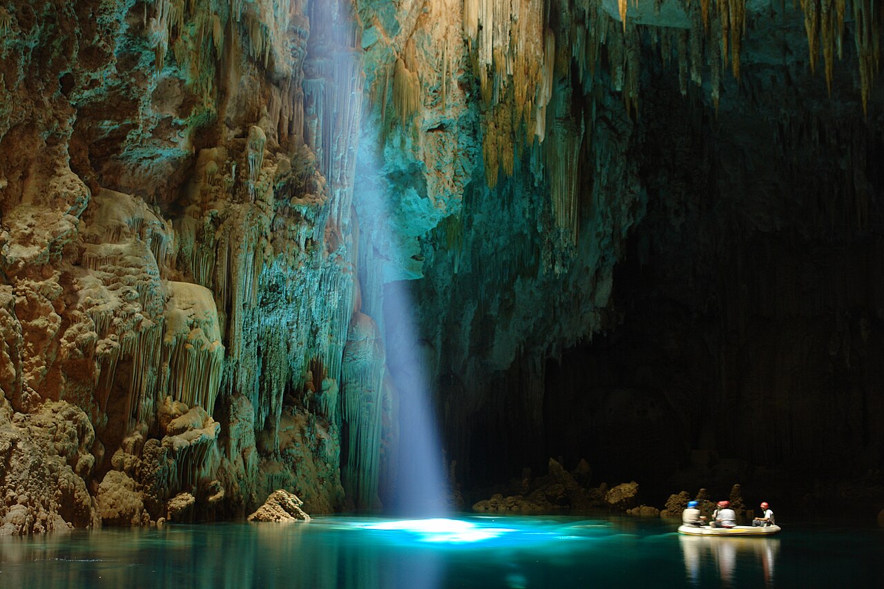
Abismo Anhumas
Operator's figure for the lake; it varies with the seasons. No independent survey was found. Divers are limited to 18 or 20 m (operator pages differ).
A partly flooded limestone cave about 23 km from Bonito, entered only through a 72 m vertical shaft. Its clear lake, which the operator gives as about 80 m deep, holds limestone cones up to about 20 m tall and is visited by snorkellers and scuba divers.
Abismo Anhumas is a limestone cave in the Serra da Bodoquena karst, about 23 km from the town of Bonito in Mato Grosso do Sul. Its only entrance is a narrow opening at the top of a 72 m shaft, roughly the height of a 26-storey building. At the bottom lies a lake of very clear water; the operator puts its depth at about 80 m, varying with the rainy and dry seasons, and its volume at around 24,000 cubic metres.
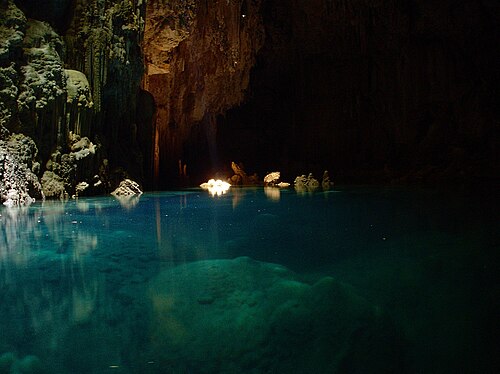
Visitors are lowered and raised by an electric rappel system run by the operator, two people at a time, to a floating deck on the lake. From there they can look at the formations, snorkel, or take one of two scuba options. Under the surface, cones of limestone up to about 20 m high rise from the floor; the operator describes the area as a city of submerged cones and also points divers to the skeleton of an anteater that fell into the cave years ago.
The diving offered is lake diving under the entrance shaft rather than cave penetration: an introductory dive to 8 m for people without certification, and a dive for certified divers. The operator's own pages give 18 m in some places and 20 m in others as the limit for certified divers, so check the current limit when booking.
According to the operator, the cave was found by chance in 1970 after a forest fire on the former Fazenda Anhumas, opened to visitors in 1995 and has been under its present management since 1999. No published survey or scientific study of the lake was found for this record, so depth and formation figures are the operator's.
Geology
The cave is formed in limestone. The submerged cones and the stalactites and stalagmites above water are calcium carbonate deposits; the operator says the cones reach about 20 m in height and claims the cave holds the largest such cone recorded in the literature, a claim not checked against any published study.
Water, flow and flooding
The lake is still water at the foot of the shaft. The operator states that its depth changes with the rainy and dry seasons, reaching about 80 m, that visibility can reach 60 m and that the average water temperature is 18 °C.
Why it matters
Abismo Anhumas is one of the few places in Brazil where non-specialist divers can dive inside a cave lake, and its submerged cones are its main draw. The operator says specialists, including environmental engineers and biologists, inspect the cave every year to check that tourism is not harming it.
Conditions
The operator gives an average water temperature of 18 °C and visibility of up to 60 m; lake depth varies with the rainy and dry seasons. Sunlight reaches the lake only for a short part of the day. A 2021 PADI blog post suggested December to March as the best period; treat all of this as typical, not current, conditions.
Typical ranges from published sources, not current conditions.
Survey and exploration history
| 1970 | The cave was discovered by chance after a forest fire on the former Fazenda Anhumas, according to the operator. [1] |
| 1995 | The cave opened to visitors, according to the operator. [1] |
| 1999 | The current management took over the attraction, according to the operator. [1] |
Entrances and dive sites
One documented entrance: a narrow opening at the top of a 72 m shaft. Access is only by the operator's electric rappel system with the operator's equipment.
Every fact on this page, with its source (18)
| Fact | Status | Source |
|---|---|---|
| The cave is 23 km from the centre of Bonito, reached via highway MS-382. | Verified | [9] [7] |
| The descent into the cave is 72 m (the operator compares it to 26 storeys), made by an electric rappel system that carries two people at a time to a floating deck.Operator's own facility description. | Verified | [4] [6] [9] [7] |
| The lake's depth varies with the rainy and dry seasons and can reach about 80 m.Operator figure, repeated in the press; no published survey found. | Reported | [1] [7] |
| The lake holds approximately 24,000 cubic metres of water.Operator figure. | Reported | [1] |
| Limestone cones in the lake reach up to about 20 m in height.Operator figure. | Reported | [1] [7] |
| The operator claims the cave contains the largest cone recorded in the world literature.Operator claim; no scientific publication supporting it was found. | Reported | [2] |
| Average water temperature is 18 °C.Average figure, not a range. | Reported | [1] [7] |
| Visibility in the lake can reach 60 m.Operator figure (maximum, not typical). | Reported | [1] [3] |
| A 2021 PADI blog guest post named December to March as the best time to visit and said sunlight reaches the lake only briefly each day.Secondary, 2021. | Reported | [8] |
| The cave was discovered in 1970 after a forest fire on the former Fazenda Anhumas, opened to visitors in 1995 and has been under current management since 1999.Operator history; no independent source found. | Reported | [1] |
| The operator says specialists including environmental engineers and biologists inspect the cave annually.Operator statement. | Reported | [1] |
| Tours run in small groups with time slots set by the monitor team the day before, and a check-in session at the operator's office in Bonito the day before is part of the process.Operator rules as published. | Verified | [6] [4] |
| Access is only by the operator's electric rappel with the operator's equipment; outside equipment is not allowed. | Verified | [7] [3] |
| A 2021 PADI blog post said 18 to 25 people per day may descend.Secondary source from 2021; the operator's site does not publish a daily limit. | May be out of date | [8] |
| The introductory (baptism) dive needs no certification, is open from age 12 and goes to a maximum of 8 m. | Verified | [3] [5] |
| The certified dive requires at least Open Water certification; the depth limit is given as 18 m on some operator pages and 20 m on others.s3 and the product title on s5 say 20 m; s2, the body text of s5 and the 2022 press article s7 say 18 m. | Sources conflict | [2] [3] [5] [7] |
| Visitors must tell the operator about medical restrictions in advance; the team assesses each case. | Verified | [4] |
| Sunlight reaches the lake for only a short part of each day.2021 secondary source. | Reported | [8] |
Verified: stated by an official or primary source we opened. Reported: from a secondary source only. Sources conflict: the note gives both versions. May be out of date: the newest source we found is old.
Written in our own words from the sources above. Report a correction