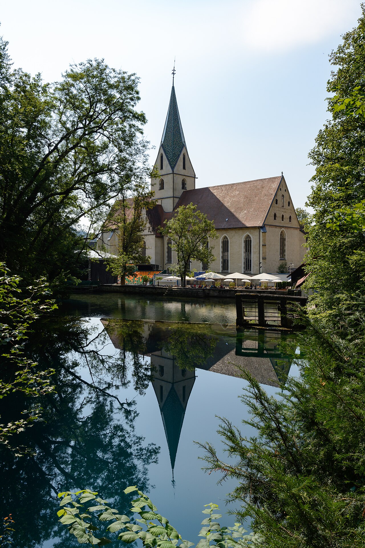
Blauhöhle system (Blautopf)
Total surveyed length published by the ARGE Blautopf website, 'Stand 10/2026'. Its cave page still shows 18,149 m as of October 2024. The spring pool is about 22 m deep. No overall depth figure for the cave system was found.
A cave system behind the Blautopf karst spring in Blaubeuren, surveyed to about 19 km by October 2026, with long flooded sections and large dry halls. Diving is limited to a research group holding a permit since 1997; the cave is closed to visitors.
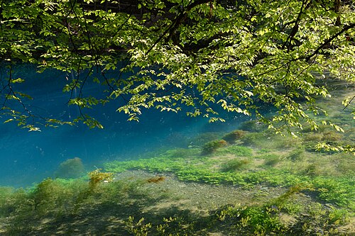
The Blautopf is a funnel-shaped karst spring in the town of Blaubeuren on the Swabian Alb, famous for its intense blue colour. Rainwater sinking into the limestone of a catchment of about 160 km² collects in an underground river system and re-emerges here before flowing about 22 km to the Danube at Ulm.
Divers first reached the bottom of the spring pool, about 22 m down, in 1957. In 1985 Jochen Hasenmayer dived some 1,200 m into the cave to reach a large air-filled hall, the Mörikedom. Since 1997 the Arbeitsgemeinschaft Blautopf (ARGE Blautopf), formed by members of the caving club Höhlenforschungsgruppe Ostalb-Kirchheim, has held a diving permit for research. In 2006 a connection to the Vetterhöhle gave a dry route into the system, and exploration above and below water has continued since.
The Blauhöhle system is now one of the longest cave systems in Germany, with three known levels and a surveyed length of about 19 km. Neighbouring research by the Arbeitsgemeinschaft Blaukarst in the Hessenhauhöhle, the deepest cave of the Swabian Alb at 148 m, reached a large river cave in 2011 that dye tracing in 2012 linked hydraulically to the Blautopf.
The cave system cannot be visited by the public, and the spring area itself has been under renovation since August 2024 while remaining accessible for sightseeing.
Geology
Karst developed in Jurassic limestone of the Swabian Alb, according to the town of Blaubeuren.
Water, flow and flooding
Mean discharge of the Blautopf is about 2,300 litres per second, rising to more than 30,000 litres per second after heavy rain; the catchment is about 160 km². Dye tracing has shown that two underground rivers (Ur-Blau and Nordblau) each supply roughly half of the spring's water.
Why it matters
One of the longest cave systems in Germany and a classic site in the history of European cave diving.
Conditions
The town gives about 9 °C year-round for the spring water. Flow and visibility change strongly with rainfall: discharge can rise more than tenfold after heavy rain.
Typical ranges from published sources, not current conditions.
Survey and exploration history
| 1957 | Divers reach the bottom of the Blautopf at 22 m. [2] |
| 1985 | Jochen Hasenmayer reaches the Mörikedom air chamber about 1,200 m into the cave. [2] |
| 1997 | ARGE Blautopf is formed and receives a diving permit for research. [3] |
| 2006 | A connection between the Blautopfhöhle and the Vetterhöhle provides a dry access route. [2] [4] |
| 2011 | Arbeitsgemeinschaft Blaukarst breaks through from its Hessenhau dig into a large river cave later shown by dye tracing to feed the Blautopf. [5] |
| 2024-05-19 | The surveyed length of the Blauhöhle passes 18 km. [6] |
Entrances and dive sites
Entrances include the Blautopf spring (diving) and the Vetterhöhle (dry route since the 2006 connection). Neither is open to the public.
Every fact on this page, with its source (11)
| Fact | Status | Source |
|---|---|---|
| The surveyed total length of the Blauhöhle system is 19,006 m as of October 2026.The group's cave page still shows 18,149 m (October 2024); the 18 km mark was passed on 2024-05-19. | Verified | [1] |
| The Blautopf spring pool is about 22 m deep; divers first reached its bottom in 1957. | Verified | [2] [8] |
| The spring water is about 9 °C year-round. | Verified | [8] |
| Mean discharge is about 2,300 L/s, exceeding 30,000 L/s after heavy rain, from a catchment of about 160 km². | Verified | [8] |
| Dye tracing showed that two rivers, Ur-Blau and Nordblau, each supply about half of the Blautopf's water.Arge Blaukarst history page; dates of its breakthrough differ between its German (March 2011) and English (May 2011) pages, and a 2012 dye test proved the hydraulic link. | Reported | [5] |
| The Blauhöhle system cannot currently be entered by visitors.Town page, undated, viewed 2026-10-14. | Verified | [2] |
| ARGE Blautopf received a diving permit in 1997 on the basis of its scientific expertise.Issuing authority and conditions not stated. | Reported | [3] |
| The Blautopf grounds have been under comprehensive renovation since August 2024, with access to the Blautopf maintained during the works. | Verified | [7] |
| Jochen Hasenmayer first reached the Mörikedom by diving in 1985, after 1,200 m; the Vetterhöhle connection followed in 2006. | Verified | [2] [4] |
| The Hessenhauhöhle is 148 m deep, the deepest cave of the Swabian Alb.Figure unchanged as of 2016 per the group's German pages. | Reported | [5] |
| Diving in the Blautopf cave is carried out under the research diving permit held by ARGE Blautopf since 1997; the cave cannot be entered by visitors.Permit issuer and conditions not stated. | Verified | [3] [2] |
Verified: stated by an official or primary source we opened. Reported: from a secondary source only. Sources conflict: the note gives both versions. May be out of date: the newest source we found is old.
Written in our own words from the sources above. Report a correction