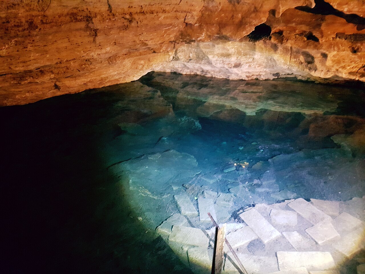
Engelbrecht Cave
CDAA figures: East passage max 8 m, West passage max 12 m, East Extension max 22 m.
A council-owned show cave in central Mount Gambier with two flooded passages, East (Cave-rated, about 70 m) and West (Advanced Cave, about 340 m), plus the Advanced Cave East Extension with more than 400 m of passage.
Engelbrecht Cave sits beneath a doline (a collapse sinkhole) in the middle of Mount Gambier and is named after Carl Engelbrecht, a 19th-century German settler. The City of Mount Gambier owns it and a tour operator runs guided visits of the dry cave and sinkhole for the public, with a café and viewing platforms at the surface.
Two submerged passages lead off in opposite directions. The East passage, reached by a short stairway inside the eastern tourist cave, is a low, silty tunnel of about 70 m to an inner air chamber. The West passage is reached down a long stone stairway to a small pool; after a narrow restriction (a section where passage size limits how divers can move) the first sump runs about 100 m to an air chamber and rock pile, beyond which a second, usually very clear sump continues.
From the East passage air chamber, Advanced Cave divers can climb over the rock pile to the East Extension (EEX), where the CDAA describes more than 400 m of submerged tunnel, several dry squeezes and seasonal water-level changes. The CDAA treats EEX as a sidemount-only site and does not allow training there.
水况、水流与洪水
The CDAA warns that storm water can enter the West passage's first sump after heavy rain, so visibility there swings between very clear and zero; the second sump is usually clear. Water levels in the East Extension's 'Rabbit Hole' vary seasonally from almost dry to fully submerged.
环境条件
Visibility in the West passage first sump depends on recent rain; silty sections can drop to zero visibility if disturbed.
典型范围来自已发表资料,不代表当前实际状况。
入口与潜点
Two dive entrances inside the show cave: East (5L19) and West (5L20). The East Extension is reached on foot through the East passage air chamber. Divers collect keys from the city visitor centre.
仅供方位参考,不可用于导航。空心圆点为大致位置。
本页所有信息及其来源 (8)
| 信息条目 | 状态 | 来源 |
|---|---|---|
| The East Extension features more than 400 m of submerged tunnel with a maximum depth of 22 m. | 已核实 | [3] |
| The East passage extends about 70 m with a maximum depth of 8 m; the West passage extends about 340 m with a maximum depth of 12 m. | 已核实 | [1] [2] |
| A private tour operator manages the site for the City of Mount Gambier; divers collect a key from the Lady Nelson Visitor Centre and may dive between 8 AM and 8 PM daily. | 已核实 | [1] [2] |
| The CDAA rates the East passage Cave and the West passage and East Extension Advanced Cave. | 已核实 | [1] [2] [3] [4] |
| The East Extension is an advanced sidemount-only site, Cave-rated divers must not go beyond the main chamber rock pile, and no training is allowed there. | 已核实 | [3] |
| The West passage first sump can be contaminated by storm water after heavy rain, so visibility ranges from crystal clear to zero. | 已核实 | [2] |
| Coordinates are the mapped cave entrance of the public show cave in Chute Street, Mount Gambier.Public tourist site. | 已核实 | [5] |
| Coordinates are the mapped cave entrance of the public show cave in Chute Street, Mount Gambier.Public tourist site. | 已核实 | [5] |
已核实:来自我们直接查阅的官方或主要来源。已报告:仅来自二手来源。来源存在冲突:注释中列出两种版本。可能已过时:我们找到的最新来源已有一定年代。
由我们根据上述来源以自己的文字整理撰写。 提交更正