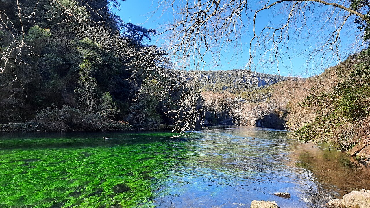
Fontaine de Vaucluse
Floor reached by the robot Modexa on 2 August 1985; the deepest human dive reported on the FFS fiche is Hasenmayer's 205 m in 1983.
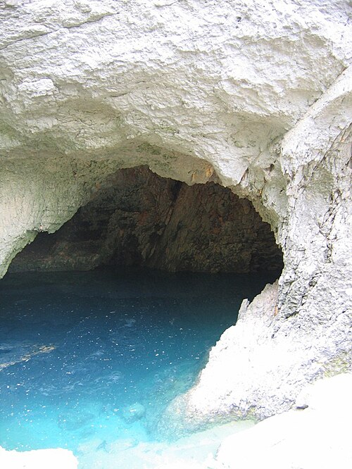
The source of the Sorgue and the largest karst spring in metropolitan France according to its commune. Its flooded shaft has been explored by divers and robots to a sandy floor at 315 m; the municipality banned diving in 1974, and later work has been research-led.
The Fontaine de Vaucluse lies at the foot of a cliff more than 240 m high and drains rain and snowmelt from a catchment of about 1,240 km², including the southern slopes of Mont Ventoux, the Monts de Vaucluse and the Montagne de Lure. In spring and autumn floods the pool overflows spectacularly; at other times the Sorgue is fed by lower secondary springs.
The flooded shaft below the pool has drawn divers since a Marseille helmet diver reached 23 m in 1878. Cousteau and Dumas made the first self-contained dives here in 1946, reaching 46 m. In 1981 Claude Touloumdjian reached 153 m with COMEX support; Jochen Hasenmayer, who had dived to 140 m without authorisation a few days earlier, returned alone in 1983 and reached 205 m. On 2 August 1985 the remotely operated Modexa landed on a sandy floor at 315 m, still the known terminus.
The local caving club, the Société spéléologique de Fontaine de Vaucluse (SSFV), has led most later work, including its own Spélénaute robot (1989-1996) and, from 2001, archaeological prospection that recovered more than 1,600 Roman-era coins and objects under the direction of the State's underwater archaeology service.
The commune states that a 1974 survey dive with an undisclosed commercial aim led the municipality to prohibit all diving. Visitors are asked not to cross the safety barriers at the pool because rocks fall from the cliff with potentially fatal force.
Água, fluxo e inundações
The commune gives an annual discharge of 630 to 700 million cubic metres, flood flows of around 90 m³/s and a near-constant water temperature of 12.5 to 13 °C. Showcaves notes that for much of the year the main shaft does not overflow and water emerges from lower outlets in the riverbed. In August 2022, when flow at the station fell to the regulatory threshold of 4 m³/s for two days, navigation and underwater activities were banned on the Sorgues under a prefectural order of 28 May 2019.
Por que isso importa
A classic site in the history of diving and cave exploration, from early helmet dives to Cousteau's first autonomous dives and record robot descents, and an archaeological site whose submerged Roman coins led to protection measures by the Ministry of Culture.
Condições
Flow varies greatly with season: floods in spring and autumn, low summer flow when the pool may sit below its rim. Rockfall from the cliff is a hazard at the pool.
Faixas típicas de fontes publicadas, não as condições atuais.
Histórico de levantamento topográfico e exploração
| 1878-03 | Helmet diver Nello Ottonelli reaches 23 m. [1] [2] |
| 1946-08-27 | Cousteau and Dumas reach 46 m in the first self-contained dives at the spring. [1] [2] |
| 1974 | After a survey dive to 78 m by divers from Angoulême, the municipality prohibits all diving. [1] [2] |
| 1983-09-09 | Jochen Hasenmayer dives solo to 205 m. [1] |
| 1985-08-02 | The robot Modexa lands on a sandy floor at 315 m. [1] [2] |
| 2003-08 | SSFV divers working with the archaeology service recover about 400 antique pieces; a 2004 campaign brings the total above 1,600. [1] |
| 2005 | Thomas Soulard (SSFV) dives to 125 m to explore the Prado gallery and shows it joins the main shaft. [1] |
Entradas e pontos de mergulho
One entrance, the spring pool at the foot of the cliff, reached by a public footpath from the village.
Cada informação desta página, com sua fonte (10)
| Informação | Status | Fonte |
|---|---|---|
| The commune describes the Fontaine de Vaucluse as the largest exsurgence in metropolitan France, fed by a catchment of 1,240 km². | Verificado | [2] |
| On 2 August 1985 the Modexa robot settled on a sandy floor at 315 m, which remains the known terminus. | Verificado | [1] [2] [3] |
| Jochen Hasenmayer dived alone to 205 m on 9 September 1983. | Verificado | [1] |
| Claude Touloumdjian reached 153 m in September-October 1981 with COMEX gas mixtures. | Verificado | [1] |
| Annual discharge is 630 to 700 million m³, flood flow around 90 m³/s, and water temperature 12.5 to 13 °C. | Verificado | [2] |
| The Sorgue's water temperature is near-constant between 12.5 and 13 °C. | Verificado | [2] |
| A 1974 topography dive with an undisclosed commercial aim led the municipality to prohibit all diving.The commune repeats this on its current site; the text of the 1974 decision was not found. | Verificado | [1] [2] |
| Under a prefectural order of 28 May 2019, navigation and underwater activities on all the Sorgues and the Canal de Vaucluse were banned from 23 August 2022 after flow at Fontaine de Vaucluse stayed at the 4 m³/s threshold for two days.Applies to the rivers below the spring; a seasonal, flow-triggered rule. | Reportado | [4] |
| The commune reports a ban on all diving dating from 1974. | Verificado | [2] |
| SSFV divers found a deposit of antique coins in 2001; excavations in 2003 and 2004 with the Ministry of Culture raised the number of pieces and objects above 1,600, spanning roughly 40 BC to AD 450. | Verificado | [1] |
Verificado: declarado por uma fonte oficial ou primária que consultamos. Relatado: proveniente apenas de uma fonte secundária. Fontes divergem: a nota apresenta as duas versões. Pode estar desatualizado: a fonte mais recente que encontramos é antiga.
Escrito com nossas próprias palavras a partir das fontes acima. Reportar uma correção