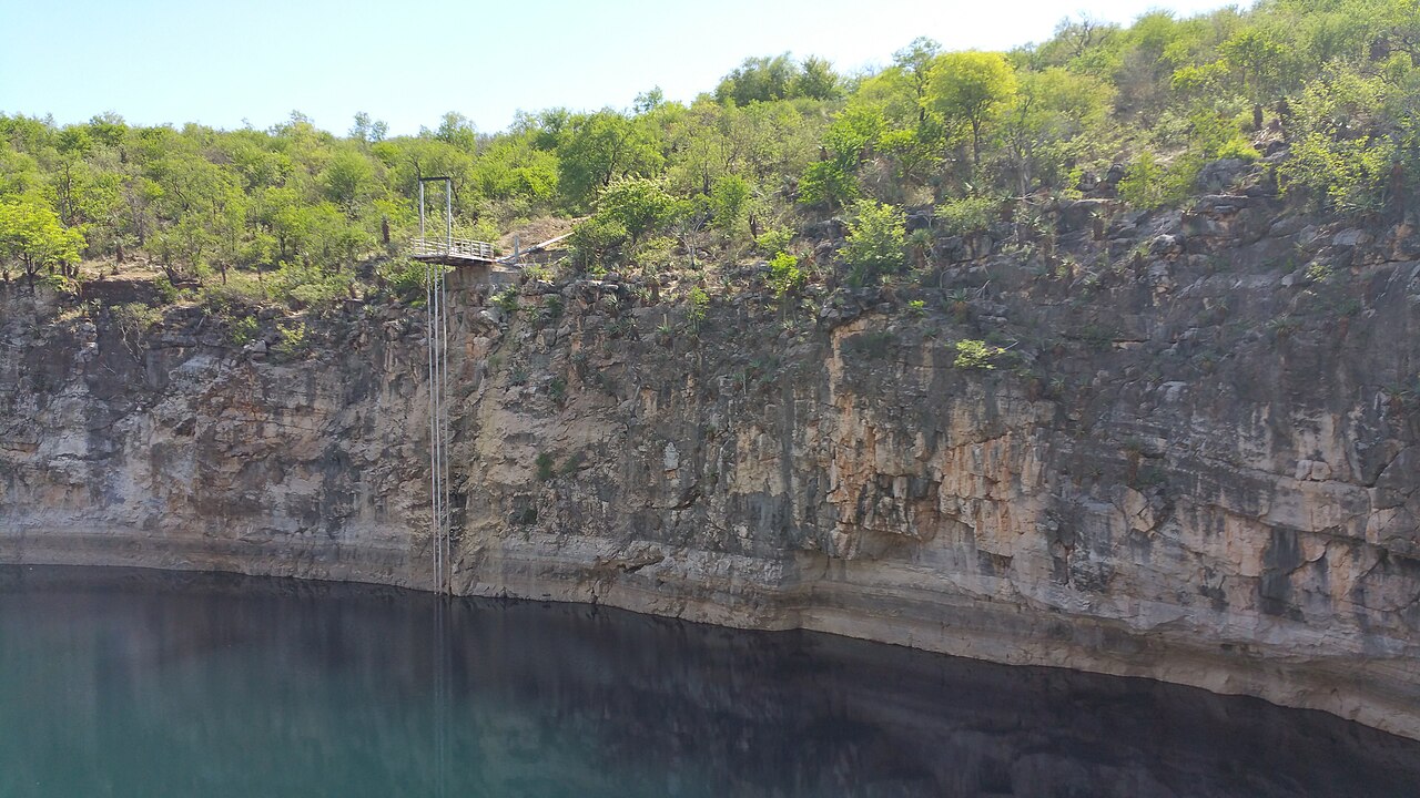
Lake Guinas
Maximum depth from the 2019 SUNFISH survey; the Namibian Sun gives 130 m. Divers reached 132 m in 1988 on the eastern side.
A deep, clear sinkhole lake on private farmland west of Tsumeb, home of the critically endangered Guinas tilapia. A 2019 robotic survey mapped it to 133 m; divers have reached about 130 m.
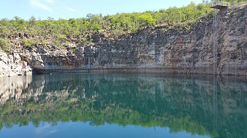
Lake Guinas is a sinkhole lake on private farmland between Otavi and Tsumeb in northern Namibia. At the surface it is a narrow pool about 120 m long and 59 m wide, set about 30 m below the surrounding ground behind vertical walls.
Underwater the lake widens. The 2019 SUNFISH sonar survey described an hourglass shape about 300 m long and 175 m wide near the bottom, with a maximum depth of 133 m. Divers have worked here since at least the 1980s: Boetie Scheun reached 132 m on the eastern side in 1988, Nuno Gomes 123 m in 1999, and in 2024 a German team dived to 113 m with one diver going to 130 m.
The lake is biologically important as the natural home of Tilapia guinasana, a small cichlid fish endemic to Namibia and classed as critically endangered. Divers have also reported living stromatolites (layered mats built by microbes) and old stalactites that formed when the water table stood lower.
Lake Guinas has also seen drownings, with police reporting that bodies have not been recovered because of the complex underwater shape. The lake is on private land and visits depend on the landowner's permission.
Geologi
Guinas is a collapse sinkhole in karst. Stalactites below today's water level show that parts of the cave were once air-filled, when the water table was lower.
Air, arus, dan banjir
A 2008 expedition reported water at about 26 C and described it as clear. The lake is believed by some to be connected with Lake Otjikoto through underground caves, but this has not been proven.
Mengapa ini penting
The lake is the natural home of the critically endangered cichlid Tilapia guinasana, which is endemic to Namibia and was later introduced to Lake Otjikoto. It also contains living stromatolites. It was one of the three sites mapped by the SUNFISH autonomous vehicle in 2019.
Kondisi
About 26 C on a 2008 expedition, with clear water; no recent measurements found.
Rentang tipikal dari sumber yang dipublikasikan, bukan kondisi saat ini.
Sejarah survei dan eksplorasi
| 1988 | Boetie Scheun reached 132 m on the eastern side. [6] |
| 1999 | Nuno Gomes reached 123 m. [6] |
| 2008-06 | Nuno Gomes and Pieter Venter dived to the eastern-side bottom at 105 m for a film expedition. [6] |
| 2019 | The SUNFISH autonomous vehicle mapped the lake to 133 m. [4] [5] |
| 2024-06 | A German cave-diving team dived to 113 m, one diver reaching 130 m. [1] |
Pintu masuk dan lokasi selam
An open-air sinkhole on private farmland; the water is about 30 m below ground behind vertical walls. Not publicly accessible.
Untuk orientasi, bukan navigasi. Titik kosong menunjukkan posisi perkiraan.
Setiap fakta di halaman ini, beserta sumbernya (13)
| Fakta | Status | Sumber |
|---|---|---|
| Lake Guinas lies on private land west of Tsumeb, on a gravel road between Otavi and Tsumeb. | Dilaporkan | [1] [2] |
| Area-level coordinates rounded from the published location; the lake is on private land.Rounded to 0.1 degree on purpose. | Dilaporkan | [3] [2] |
| At the surface the lake is about 120 m long and 59 m wide. | Dilaporkan | [1] [2] |
| The 2019 SUNFISH survey mapped Lake Guinas as an hourglass shape about 300 m long and 175 m wide at the bottom, 133 m deep.Namibian Sun (2024) gives 130 m. | Dilaporkan | [4] [5] |
| The water surface lies about 30 m below ground level, with a vertical drop. | Dilaporkan | [6] |
| Water temperature of 26 C was reported on a 2008 expedition. | Mungkin sudah tidak mutakhir | [6] |
| Boetie Scheun reached 132 m on the eastern side in 1988 and Nuno Gomes reached 123 m in 1999. | Dilaporkan | [6] |
| In 2008 Nuno Gomes and Pieter Venter dived to the eastern-side bottom at 105 m for a film expedition, using a winch set up by Thinus van Wyk and his son. | Dilaporkan | [6] |
| In June 2024 a German team dived to 113 m and one diver went to 130 m. | Dilaporkan | [1] |
| Lake Guinas is the home of the critically endangered endemic Tilapia guinasana. | Dilaporkan | [1] [7] |
| Living stromatolites and stalactites formed when the water table was lower have been reported in the lake. | Dilaporkan | [6] |
| Police records show about three drownings in Lake Guinas with no bodies recovered; police described the submerged topography as difficult. | Dilaporkan | [2] |
| The lake is on private land; visits are possible with the landowner's permission. | Dilaporkan | [1] [3] |
Terverifikasi: dinyatakan oleh sumber resmi atau sumber primer yang kami buka langsung. Dilaporkan: hanya dari sumber sekunder. Sumber berbeda pendapat: catatan menyajikan kedua versi. Mungkin sudah kedaluwarsa: sumber terbaru yang kami temukan sudah lama.
Ditulis dengan kata-kata kami sendiri berdasarkan sumber di atas. Laporkan koreksi