Manatee Springs cave system
Florida State Parks says divers have helped map 'more than 5 miles' of known routes (about 8 km); the page is undated and does not name a survey organisation.
The cave system behind Manatee Springs, a first-magnitude spring on the lower Suwannee River, with more than 5 miles of mapped passage reached from the main spring, the Catfish Hotel and Friedman Sink under daily diver limits.
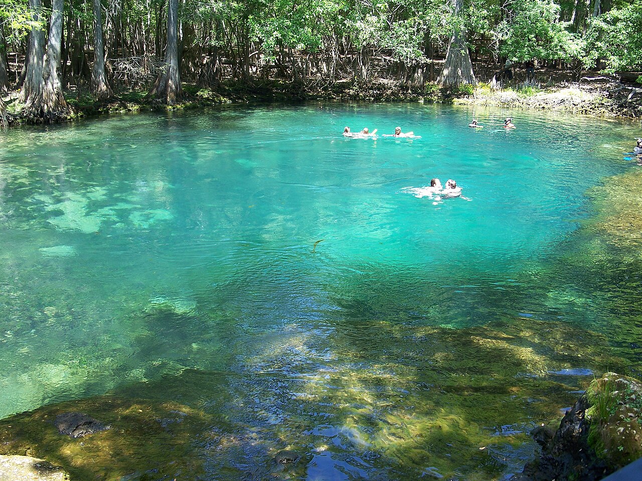
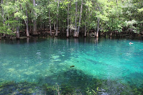
Manatee Springs is one of Florida's first-magnitude springs and the largest single spring flowing into the Suwannee River. It lies in Manatee Springs State Park near Chiefland, where a boardwalk runs through cypress forest beside a quarter-mile spring run. Beneath the spring is an extensive maze of passages that certified cave divers have helped map for more than 5 miles.
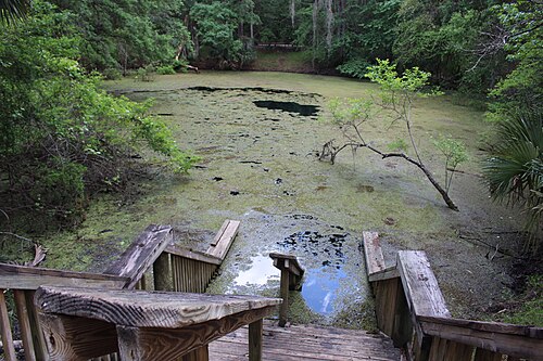
Three entrances are used. The main spring is open to open water divers and to cave divers. The Catfish Hotel, a sinkhole named for the bottom-dwelling fish that gather in it and often covered in duckweed, is the usual starting point for cave dives and is also used for cavern diving. Friedman Sink is reserved for divers with full cave certification.
The park strictly limits numbers: a set count of open water and cavern divers at one time and per day, and separate small limits for cave divers at the Catfish Hotel and Friedman Sink. Diving is first come, first served, with no reservations. The caves are home to the cave crayfish Procambarus lucifugus and Hobbs' cave amphipod, and manatees shelter in the spring in cooler months.
Wasser, Strömung und Überflutung
Florida State Parks gives an average flow of 50 to 150 million gallons a day. When the Suwannee River floods, river water can rise high enough to submerge the boardwalk, and dark tannic river water fills the spring run and greatly reduces visibility. The spring stays at about 72°F (22°C) year-round.
Warum es wichtig ist
Manatee Springs was designated a National Natural Landmark in 1972. Cave divers' mapping has also added to knowledge of how water flows through the spring, according to the park.
Bedingungen
Constant 72°F (22°C). During Suwannee River floods, tannic river water backs into the spring run and visibility drops sharply. Manatees use the spring in winter and divers must keep 50 feet away from them.
Typische Wertebereiche aus veröffentlichten Quellen, keine aktuellen Bedingungen.
Zugänge und Tauchplätze
Three diving entrances are named by the park: the main spring (open water and cave divers), the Catfish Hotel (open water, cavern and cave divers) and Friedman Sink (full cave certification only).
Zur Orientierung, nicht zur Navigation. Hohle Punkte sind ungefähre Angaben.
Weiterführende Literatur
Karst Underwater Research (KUR) ↗
New Madison and Manatee cave maps ↗
Alle Angaben auf dieser Seite mit Quellennachweis (11)
| Angabe | Status | Quelle |
|---|---|---|
| Certified cave divers have helped map more than 5 miles of known routes under Manatee Springs.A minimum figure ('more than'); undated park page. | Verifiziert | [3] |
| Manatee Springs averages a flow of 50 to 150 million gallons per day and is the largest single spring flowing into the Suwannee River.The park's main page says 100 million gallons daily. | Verifiziert | [3] |
| When the Suwannee River floods, the boardwalk can be submerged and dark tannic river water fills the spring run, greatly reducing visibility. | Verifiziert | [3] |
| The spring water remains a constant 72 degrees year-round.About 22°C. | Verifiziert | [3] |
| Manatee Springs was designated a registered National Natural Landmark in 1972. | Verifiziert | [3] |
| Open water diving is allowed in the main spring and the Catfish Hotel; cavern diving in the Catfish Hotel; cave divers may enter at the main spring and the Catfish Hotel; Friedman Sink requires full cave certification. | Verifiziert | [1] |
| Diving capacity is 18 open water and cavern divers at one time and 36 per day for the main spring and Catfish Hotel, and for cave divers eight at Catfish Hotel and four at Friedman Sink at one time, 24 per day.Read 2026-10-14. | Verifiziert | [1] |
| Each diver must register and present a certification card shown on the vehicle dashboard, dive within certification limits, dive with at least two divers, and keep 50 feet from manatees; open water divers may not carry lights. | Verifiziert | [1] |
| Divers must be registered by 3 p.m. and out of the water and checked out one hour before sunset.The Experiences page instead says divers must register three hours before sundown. Both pages read 2026-10-14. | Quellen widersprechen sich | [2] |
| USGS lists Manatee Spring (site 02323566) at latitude 29.4896808, longitude -82.976791. | Verifiziert | [4] |
| USGS lists Manatee Spring at longitude -82.976791. | Verifiziert | [4] |
Verifiziert: von einer offiziellen oder primären Quelle bestätigt, die wir geöffnet haben. Gemeldet: nur aus einer Sekundärquelle. Quellen widersprechen sich: Die Anmerkung enthält beide Versionen. Möglicherweise veraltet: Die neueste von uns gefundene Quelle ist alt.
In eigenen Worten aus den oben genannten Quellen verfasst. Korrektur melden