Sistema Gleda–Camp des Pou
Approximate development of 14,620 m, of which 13,720 m underwater and 900 m above water; total area 142,350 m² (Gràcia et al. 2020). Maximum depth below water level according to the 2020 review.
A coastal cave system in Manacor, Mallorca, with about 14.6 km of passage, 13.7 km of it flooded, linking two collapse entrances. Access is controlled and diving has been limited to permitted research and exploration.
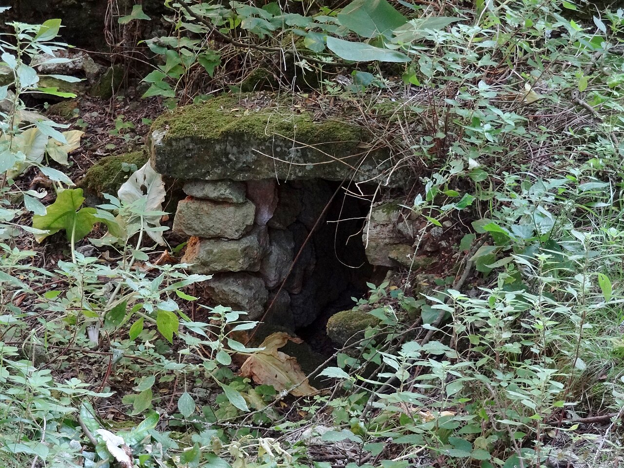
The Gleda–Camp des Pou system is an anchialine cave: a flooded coastal cave in which fresh water floats on denser salt water that reaches it underground from the sea, about 1.7 km away. It opens to the surface through two collapse entrances at opposite ends, the spectacular collapse of the Cova de sa Gleda and the smaller Avenc des Camp des Pou, at about 36 m and 45 m above sea level.
The Societat Espeleològica Balear's 2020 review describes a succession of large chambers and galleries divided into eight sectors, with great volumes, rich speleothems (cave formations) and varied corrosion shapes. The flooded passages are mostly between about 8 and 20 m deep, with a maximum of 24.5 m. Several isolated air chambers have elevated carbon dioxide.
Speleo-divers of the Grup Nord de Mallorca began systematic exploration in 1997; by 2010 they had logged some 400 diving days and more than 2,000 hours underwater, discovered new sectors and connected the Gleda with the Camp des Pou shaft. Work continued under the Societat Espeleològica Balear after a pause caused by permit refusals between late 2015 and 2019.
The cave lies on the Son Josep Nou estate. A metal door closes the passage into the entrance chamber, and a tourism guide states that access has been prohibited since 2014 except for scientific permits.
Geologia
The cave is developed in the Miocene limestone platform of the Marina de Manacor and is speleogenetically related to the nearby Pirata–Pont–Piqueta system, the third-longest cave in the Balearics.
Acqua, corrente e allagamenti
CTD probe profiles show water at about 19.6 °C with a salinity profile in three layers separated by pycnoclines (density boundaries). In early autumn 2020 the entrance lake's surface salinity was below 2‰, rising to about 10‰ at 7 m and 16‰ near 11 m, then sharply to 30‰ and slowly to about 37‰ at depth. The pycnocline level shifts by about 0.8 m between summer and winter. Heavy rain sends torrents and sediment into the entrance chamber.
Perché è importante
One of the longest underwater caves in the Balearic Islands and a research site for cave mineralogy, water chemistry and, since 2019, underwater archaeology.
Condizioni
Layered fresh and salt water with haloclines; heavy rain can wash large amounts of sediment into the entrance chamber, as recorded in 1990 and 2001.
Intervalli tipici da fonti pubblicate, non condizioni attuali.
Storia del rilievo e dell'esplorazione
| 1974 | The Speleo Club Mallorca surveys the Cova de sa Gleda entrance area. [1] |
| 1976 | The Speleo Club Mallorca surveys the Avenc des Camp des Pou. [1] |
| 1997 | The Grup Nord de Mallorca begins systematic diving exploration of the Gleda. [1] |
| 2010 | By this year the survey shows the Gleda connected with the Avenc des Camp des Pou. [1] |
| 2015 | At the end of the year the Conselleria refuses permission to continue work, halting it for more than three years. [1] |
| 2019-05-25 | Work resumes under the Societat Espeleològica Balear. [1] |
Accessi e siti di immersione
Two currently accessible entrances (Cova de sa Gleda and Avenc des Camp des Pou), plus at least two more that were filled in over past centuries. Neither is open for recreational diving.
Ogni informazione in questa pagina, con la relativa fonte (10)
| Informazione | Stato | Fonte |
|---|---|---|
| The system has an approximate development of 14,620 m, of which 13,720 m are underwater and 900 m above water. | Verificato | [1] |
| The figure is from the review published online on 28 December 2020. | Verificato | [1] |
| Maximum depth is 24.5 m below the water.A tourism guide gives a vertical range of 24 m and a length of 13,500 m. | Verificato | [1] |
| Water temperature measured by CTD probe is close to 19.6 °C. | Verificato | [1] |
| Salinity at the entrance lake rose from under 2‰ at the surface to 10‰ at 7 m, 16‰ near 11 m, then 30‰ and about 37‰ at depth (autumn 2020). | Verificato | [1] |
| The Conselleria refused permission to continue work at the end of 2015 because of complaints and disputes, and work resumed on 25 May 2019. | Verificato | [1] |
| Access has been prohibited since 2014, with special permits granted for scientific work. | Segnalato | [2] |
| The cave belongs to the Son Josep Nou estate, and a metal door separates the cave from the outside. | Verificato | [1] |
| Only permitted scientific or exploration activity is described; there is no recreational access. | Segnalato | [1] [2] |
| From 1997 to 2010 the GNM's work amounted to 14 years, 400 days of dives and more than 2,000 hours of diving. | Verificato | [1] |
Verificato: dichiarato da una fonte ufficiale o primaria che abbiamo consultato. Segnalato: da una fonte secondaria soltanto. Le fonti sono in contrasto: la nota riporta entrambe le versioni. Potrebbe essere non aggiornato: la fonte più recente che abbiamo trovato è datata.
Scritto con parole nostre dalle fonti indicate sopra. Segnala una correzione