نظام الكهف
Wakulla-Leon Sinks cave system
236,723 ft (44.8 miles) of surveyed underwater passage after the Chip's Hole connection, per WKPP. Florida State Parks gives approximately 45 miles as of January 2023. No single maximum depth is published in the sources read. Florida State Parks reports more than 22 miles of passage deeper than 190 feet; WKPP describes Turner Sink exploration at about 280 feet and Wakulla tunnels averaging about 285 feet; GUE describes the 2007 traverse as about seven hours at 300 feet.
The longest mapped underwater cave in the United States, about 45 miles (72 km) linking Wakulla Spring to the Leon Sinks area beneath the Woodville Karst Plain; mostly deep, explored by the Woodville Karst Plain Project, with very limited recreational access.
South of Tallahassee, rain and swamp water drain into the flat limestone country of the Woodville Karst Plain through sinkholes and sinking streams, flow through large water-filled tunnels and re-emerge at Wakulla Spring, one of the largest springs in the United States. Divers have mapped those tunnels for decades, and in December 2007 two divers swam from Turner Sink, in the Leon Sinks part of the network, to Wakulla Spring, proving that the two caves form one system.
The Woodville Karst Plain Project (WKPP), a non-profit exploration and research group, reported in 2023 that it had connected Chip's Hole cave to the system, bringing the surveyed total to 236,723 feet (about 44.8 miles, or 72 km). Florida State Parks gives the same order of figure and notes more than 30 known entrances and more than 22 miles of passage deeper than 190 feet (58 metres). Exploration here has depended on mixed breathing gases, underwater scooters and rebreathers, and several world distance records were set in these caves.
Recreational access is narrow. Scuba diving is not allowed in Wakulla Spring itself or its swimming area. Within Edward Ball Wakulla Springs State Park, certified cave divers may dive Emerald Sink and Clearcut Sink, although the park listed Clearcut as closed because of road construction on US Highway 319. In the Leon Sinks Geological Area of the Apalachicola National Forest, the Forest Service prohibits swimming, and WKPP history records that diving access was restricted after the sinks were included in the protected area in 1987.
The system matters well beyond diving. Dye-trace studies show water entering swallets (sinking streams) far upstream reappearing at Wakulla Spring, and WKPP teams collect water samples and radio-locate passages from the surface as part of their mapping work.
الجيولوجيا
The caves lie in the Upper Floridan aquifer, mainly in the Oligocene Suwannee Limestone and the overlying Miocene St. Marks Formation. Inside the Wakulla Spring cave the top of the Suwannee Limestone is met at about 90 feet below the water surface, and the St. Marks Formation is exposed between about 9 and 90 feet. Florida's state geologist designated Edward Ball Wakulla Springs State Park a State Geological Site on 2018-12-20.
المياه والتدفق والفيضانات
Wakulla Spring discharges roughly 300 million gallons a day from a watershed estimated at 975 square miles reaching into south Georgia. Part of that water is young surface water that sinks through large swallets and travels quickly through the conduits; dye traces have confirmed links from four major swallets to the spring. Florida State Parks says Wakulla has one of the largest observed ranges of discharge of any Florida spring.
لماذا يهم ذلك
The longest mapped underwater cave in the United States according to Florida State Parks. Mastodon and other Ice Age mammal bones have been recovered from the spring, including bones found just inside the cave mouth at about 220 feet in the 1950s. The 1987 US Deep Caving Team project tested an early fully closed-circuit rebreather here, and WKPP dives set distance-at-depth records in 2000, 2007 and 2008.
تاريخ المسح والاستكشاف
| 1987 | Bill Stone's US Deep Caving Team mapped 13,100 feet in Wakulla Spring between October and December and tested a prototype closed-circuit rebreather. [4] |
| 1987 | Big Dismal, Little Dismal and nearby sinks became part of the Leon Sinks Geological Area, which restricted diving access. [4] |
| 1994 | WKPP received a Special Use Permit to explore Wakulla Springs. [5] |
| 1996-06 | WKPP divers connected Big Dismal Sink to upstream Cheryl Sink, making Leon Sinks the most extensive underwater cave then known in the US. [5] |
| 2007-12 | Jarrod Jablonski and Casey McKinlay traversed from Turner Sink to Wakulla Spring, proving that the Leon Sinks and Wakulla caves are one system. [6] [7] |
| 2008-06 | WKPP divers reached 25,766 feet from the Wakulla Spring entrance in Q-tunnel. [6] |
| 2023-01 | WKPP divers connected Chip's Hole cave to the system, bringing the surveyed total to 236,723 feet. [3] |
| 2026-08 | WKPP reported a Wakulla Basin Mapping Initiative season with the Sunfish autonomous vehicle, which 3D-mapped 4.63 miles of passage. [8] |
المداخل ومواقع الغوص
Florida State Parks counts more than 30 known entrances (sinkholes and springs). Recreational cave diving is published only for Emerald Sink and Clearcut Sink inside Edward Ball Wakulla Springs State Park (Clearcut listed as closed for road construction). Wakulla Spring is closed to recreational scuba; Leon Sinks entrances are on national forest land where swimming is prohibited; several other entrances are on private land.
Big Dismal Sink
Clearcut Sink
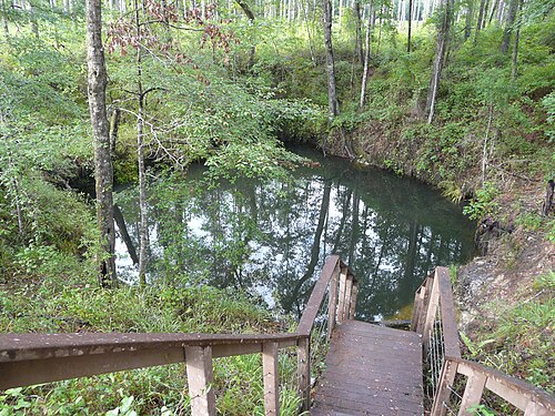
Emerald Sink
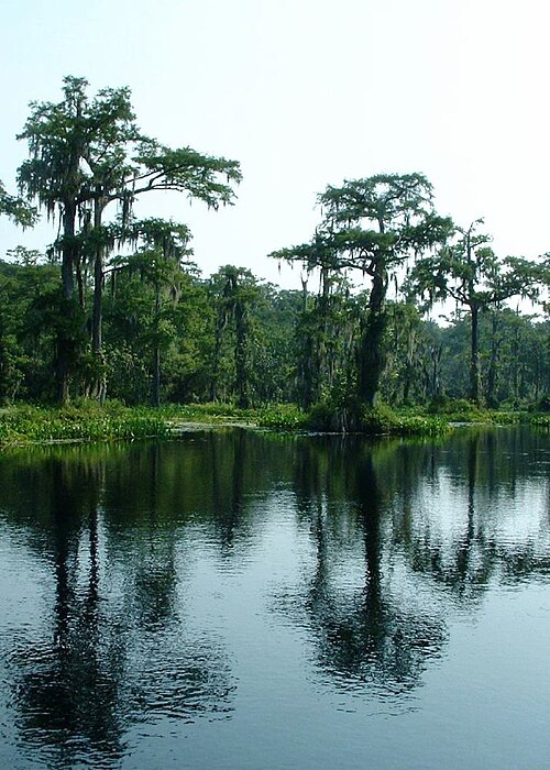
Wakulla Spring
للتوجه العام، لا للملاحة. النقاط المفرغة تحديد تقريبي.
مزيد من القراءة
A short history of underwater cave exploration: dated milestones
Archaeology and palaeontology in underwater caves
Conservation, landowners and responsible access
Groundwater, haloclines and water quality in flooded caves
How underwater caves are surveyed and studied
How underwater caves form: karst, dissolution and drowned passages
Threats to underwater caves today, and how they are protected
The Wakulla Springs Project ↗
U.S. Deep Caving Team ↗
Woodville Karst Plain Project (WKPP) ↗
كل حقيقة في هذه الصفحة مع مصدرها (22)
| حقيقة | الحالة | المصدر |
|---|---|---|
| After the Chip's Hole connection on 2023-01-07, WKPP reported 236,723 feet (44.8 miles) of surveyed underwater cave passage in the Wakulla system.Florida State Parks (s2) independently gives approximately 45 miles as of January 2023. | موثق | [3] |
| As of January 2023 cave divers had explored and mapped approximately 45 miles of passage in the Wakulla Springs cave system, part of the longest mapped underwater cave system in the United States. | موثق | [2] |
| More than 30 entrances to the Wakulla Springs cave system are known, and more than 22 miles of passage exceed 190 feet in depth. | موثق | [2] |
| On 2007-12-15 Jarrod Jablonski and Casey McKinlay traversed from Turner Sink to Wakulla Spring, nearly seven miles, proving the Wakulla and Leon Sinks caves are one system.WKPP gives about 35,000 ft; GUE gives about 36,000 ft. | موثق | [6] [7] |
| The 1987 US Deep Caving Team project mapped 13,100 feet in Wakulla and included a 24-hour test of the Cis-Lunar rebreather prototype. | موثق | [4] |
| In 1987 Big Dismal, Little Dismal and nearby sinks became part of the Leon Sinks Geological Area of the Apalachicola National Forest, which restricted diving access.WKPP history page; no Forest Service rule text found. | موثق | [4] |
| WKPP was granted a Special Use Permit to explore Wakulla Springs in early 1994, and on 1996-06-01 connected Big Dismal Sink to upstream Cheryl Sink. | موثق | [5] |
| On 2008-06-13 WKPP divers reached 25,766 feet from the Wakulla Springs entrance in Q-tunnel. | موثق | [6] |
| WKPP's 2026 mapping update reports 4.63 miles of passage 3D-mapped by the Sunfish autonomous vehicle and new radio-location fixes.Published 2026-08-04. | موثق | [8] |
| WKPP reports Turner Sink penetration at a depth of 280 feet (2002) and Wakulla A-tunnel penetration at an average depth of 285 feet (1994).No overall maximum depth published in sources read. | موثق | [5] [6] |
| In the mid-1950s FSU students found mastodon bones just inside the Wakulla cave mouth in about 220 feet of water. | موثق | [10] |
| Wakulla Spring discharges approximately 300 million gallons per day from a watershed estimated at 975 square miles, and dye traces confirm that water entering four major swallets discharges at the spring. | موثق | [2] |
| The top of the Suwannee Limestone is about 90 feet below the water surface in the Wakulla Spring cave, with the St. Marks Formation exposed between 9 and 90 feet; the park became a State Geological Site on 2018-12-20. | موثق | [2] |
| Recreational scuba diving is not allowed in Wakulla Spring or the swimming area; certified cave divers may cave dive at Emerald Sink or Clearcut Sink, the latter currently closed due to road construction on Highway 319.Park page undated; read 2026-10-14. | موثق | [1] |
| The Forest Service does not allow swimming at the Leon Sinks Geological Area, to preserve the sinkhole walls and for visitor safety.The page does not mention diving. | موثق | [9] |
| WKPP's 2026 update thanks the Wakulla Spring State Park Service and individual landowners for access to certain sinks, and notes one sink is on private property. | موثق | [8] |
| USGS lists Wakulla Spring (site 02327000) at about latitude 30.235, longitude -84.301; rounded here to area precision.Area-level because the spring is closed to recreational diving. | موثق | [11] |
| USGS lists Wakulla Spring at about longitude -84.301.Rounded. | موثق | [11] |
| WKPP is a 501(c)3 non-profit whose stated mission is discovery through exploration and scientific research in the flooded caves of the Woodville Karst Plain. | موثق | [12] |
| WKPP history records trimix use from 1987, the Gavin scooter from 1991 and a semi-closed rebreather in Wakulla from 1997, with several penetration and traverse records set in the system.Records as claimed by WKPP. | موثق | [4] [5] [6] |
| Recreational scuba is not allowed in Wakulla Spring or the swimming area; certified cave divers may cave dive at Emerald Sink or Clearcut Sink, diving participation is limited in each designated area and prior arrangements are recommended. | موثق | [1] |
| Swimming is not allowed at the Leon Sinks Geological Area. | موثق | [9] |
موثق: مُصرَّح به من مصدر رسمي أو أولي فتحناه. مُبلَّغ عنه: من مصدر ثانوي فقط. المصادر متضاربة: تتضمن الملاحظة النسختين. قد يكون قديماً: أحدث مصدر وجدناه قديم.
مكتوب بأسلوبنا الخاص من المصادر أعلاه. الإبلاغ عن تصحيح