다이브 사이트, 시즌, 해양 생물 — 조사하고, 지도에 표시하고, 계획했습니다.
메뉴
목적지 다이브 사이트 해양 생물 난파선 뉴스
여행 계획하기 트립 플래너 다이빙 시기 비용 계산기 비교 해양 생물 캘린더 수온 리브어보드 운영업체 & 리조트 해양공원 고압산소치료 챔버 세계 지도
지역 호주, 뉴질랜드 & 동아시아카리브해 & 서대서양유럽, 대서양 & 지중해인도양 및 동아프리카태평양 제도 & 미크로네시아홍해 & 중동동남아시아 & 코랄 트라이앵글아메리카 & 동태평양 국가
학습 & 도구 전체 가이드 자격증 장비 가이드 영상 데이터에게 묻기 AI 에이전트 API
소개 소개 방법론 면책 조항 문의
내 보기
★ 저장됨

즐겨찾기한 목적지, 다이브 사이트, 생물종 — 이 브라우저에 저장됩니다.

API 게이트웨이

아틀라스의 캐시 데이터에 대한 무료 읽기 전용 JSON 접근.

다크 모드

🧭 가이드 보기
다이빙이 처음이라면 — 수심, 조류, 자격증 레벨이 낯설 수 있습니다. 브라우징하는 동안 모든 용어를 쉽게 설명해 드립니다. 동일한 데이터를, 도움말과 함께 확인하세요.

⚡ 전문가 보기
월 다이빙과 드리프트 다이빙의 차이는 이미 아시죠. 데이터만 — 깔끔하고 빠르게, 간결하게. 기본 보기입니다.

인터페이스 언어

해양보호구역 · Thailand

Mu Ko Similan National Park

설립 1982 140 km² 충분히 검증됨

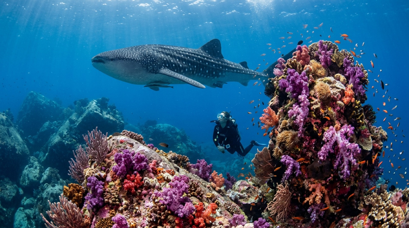
Mu Ko Similan National Park, established in 1982, protects a granite island chain in the Andaman Sea about 60 km off Khao Lak, plus the later additions of Koh Bon and Koh Tachai to the north. The western sides of the islands are all smooth boulders — arches, canyons, and swim-throughs like Elephant Head Rock — while the eastern sides slope in classic hard-coral gardens. Leopard sharks rest on the sand, mantas and whale sharks pass Koh Bon and Koh Tachai, and turtles nest on beaches such as Donald Duck Bay. Famous Richelieu Rock lies farther north inside neighboring Mu Ko Surin National Park, sharing the same seasonal regime; liveaboards thread both parks.

다이버에게 적용되는 규칙

The park closes annually for the southwest monsoon — roughly mid-May to mid-October — and all diving happens in the open season, mostly by liveaboard and speedboat day trips under park-registered operators. Visitors pay national park entrance fees plus per-dive fees, collected by operators. Koh Tachai's beach was closed to tourism in 2016 for recovery, and specific dive sites open or close by park order. Fishing, collecting, and anchoring on coral are prohibited — boats use park moorings — and overnight island stays have been curtailed in recent years, with day-use rules on the beaches.

요금 및 허가: Park entrance fee (foreigner rate higher) plus diving fees per day, collected by operators; fees and camping rules change by park order.
다이브 경로

출처: Government of Thailand ↗Wikipedia ↗ · 위 출처를 기준으로 검증된 정보입니다. 근거가 없는 항목은 '아직 미검증'으로 표시됩니다.

호주, 뉴질랜드 & 동아시아

Cairns & the Ribbon ReefsNingaloo ReefCoral Sea & Osprey ReefOkinawa & the Kerama IslandsPoor Knights IslandsTownsville & the YongalaGreen IslandIzu Peninsula

카리브해 & 서대서양

BonaireCozumelRiviera Maya & the CenotesBelize Barrier ReefGrand CaymanIsla Mujeres & CancúnRoatánTiger Beach & Grand Bahama

유럽, 대서양 & 지중해

Malta & GozoSilfra & IcelandThe AzoresCanary IslandsLarnaca & the ZenobiaScapa FlowArctic NorwayMadeira

인도양 및 동아프리카

North & South Malé AtollsAri AtollBaa Atoll & Hanifaru BayAliwal Shoal & UmkomaasMafia IslandMauritiusSeychellesSodwana Bay

태평양 제도 & 미크로네시아

PalauChuuk (Truk) LagoonFakaravaKona, HawaiʻiRangiroaTaveuni & Rainbow ReefBeqa Lagoon & Pacific HarbourEspiritu Santo

홍해 & 중동

Sharm El Sheikh & Ras MohammedBrothers, Daedalus & St John'sDahabHurghada & El GounaMarsa Alam & the Deep SouthAqabaDaymaniyat IslandsMusandam Peninsula

동남아시아 & 코랄 트라이앵글

Bali & Nusa PenidaKomodoRaja AmpatSipadan & MabulAnilaoCoronKoh TaoLembeh Strait

아메리카 & 동태평양

Galápagos IslandsCocos IslandFlorida KeysSea of Cortez & Cabo PulmoSocorro & the RevillagigedosBritish ColumbiaCalifornia Channel IslandsCosta Rica Pacific Coast