Tauchplätze, Saisons und Meereslebewesen – recherchiert, kartiert, geplant.
Menü
Reiseziele Tauchplätze Meeresleben Wracks News
Eine Reise planen Tauchtrip-Planer Wann tauchen Kostenrechner Vergleiche Meereslebewesen-Kalender Wassertemperatur Liveaboards Tauchbetriebe & Resorts Meeresschutzgebiete Druckkammern Weltkarte
Regionen Australien, Neuseeland & OstasienKaribik & WestatlantikEuropa, Atlantik & MittelmeerIndischer Ozean & OstafrikaPazifikinseln & MikronesienRotes Meer & Naher OstenSüdostasien & Korallen-DreieckAmerika & Östlicher Pazifik Länder
Lernen & Tools Alle Guides Zertifizierungen Ausrüstungsratgeber Videos Daten abfragen KI-Agenten API
Über uns Über uns Methodik Haftungsausschluss Kontakt
Deine Ansicht
★ Gespeichert

Deine gespeicherten Reiseziele, Tauchplätze und Tierarten — im Browser gespeichert.

API-GATEWAY

Kostenloser, schreibgeschützter JSON-Zugriff auf die gecachten Daten des Atlas.

Dunkelmodus

🧭 Geführte Ansicht
Neu beim Tauchen — Tiefen, Strömungen, Zertifizierungsstufen? Wir erklären jeden Begriff beim Stöbern in verständlicher Sprache. Dieselben Daten, mit integrierter Hilfe.

⚡ Expertenansicht
Du kennst den Unterschied zwischen einem Wall und einem Drift Dive. Nur die Daten – klar, schnell und kompakt. Das ist die Standardansicht.

Oberflächensprache
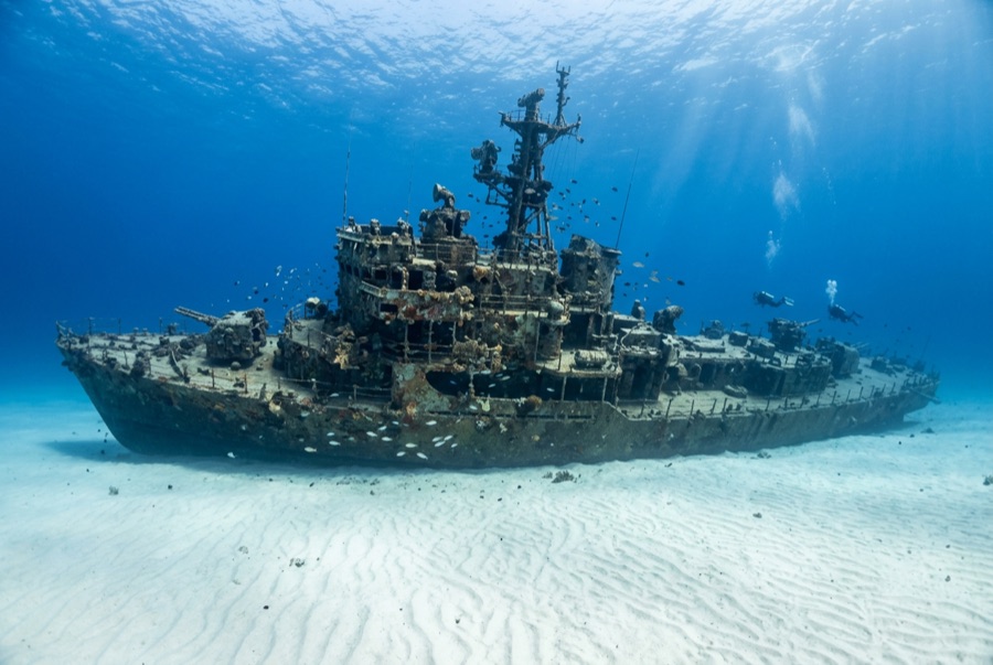
El Aguila — illustrative image

El Aguila

Coastal cargo freighter Gesunken 1997 20–33 m Roatán
KI-generierte Illustration
Hier wurden Leben verlorenNone (planned scuttling). Lokale Tauchbetriebe bitten darum, das Wrack mit dem entsprechenden Respekt zu tauchen.
Dokumentiert
Tiefe zum Wrackdeck
20 m / 66 ft
Maximale Tiefe
33 m / 108 ft
Gebaut / versenkt
? / 1997
Länge
70 m
Orientierung
Upright Bow; Midships And Stern Broken Into Sections
Level
Intermediate
Beste Monate
Mar–Sep

Die Geschichte dahinter

'The Eagle' had already sunk once before divers ever saw her. The roughly 70-meter freighter went down at Utila while hauling cargo, was raised, and sat rusting in a Roatán harbor until the island's dive community bought the hull, cleaned it, and scuttled it in 1997 on the sand at about 33 meters outside the Sandy Bay reef line. A year later Hurricane Mitch — the storm that devastated Honduras — rolled across the site and snapped the ship into three sections, scattering the midships and leaving her looking far more like a genuine casualty than a placed attraction. Divers generally count that an improvement: the break opened the holds to light, created canyons of plating to weave through, and gave the wreck the pleasing chaos of a debris field anchored by an intact, upright bow. Her most famous residents are morays of unusual size and boldness — thick green morays that free-swim across the sand — along with garden eels, big amiable grouper and midnight parrotfish that follow divers from the nearby reef. She pairs naturally with the shallower reef wall for a two-level profile.

Wie sie sank: Deliberately scuttled as an artificial reef off Sandy Bay, 1997.

Heute dort tauchen

Bedingung: In three sections since Hurricane Mitch (1998); bow intact and upright, remainder broken but coherent

Wrackinnenraum-Tauchen: Limited. Hurricane damage opened the structure; short, bright pass-throughs exist in the bow and holds, with nothing enclosed enough for long penetration. Das Betreten von Überkopf-Umgebungen erfordert eine spezifische Ausbildung – mindestens ein Wrack-Zertifikat, für die vollständige Penetration eine technische Wrack-Ausbildung.

Empfohlene Zertifizierung: Advanced Open Water

Strömung: Mild · Sichtweite: 15–30 m

Meeresleben: Oversized green morays hunt openly, garden eels ring the wreck, grouper and midnight parrotfish tag along, and eagle rays cross the sand flat.

Gefahren: Depth on the sand, sharp broken plating, and the usual temptation to overstay at 30 meters

Schutz & Recht

Lies off Sandy Bay within Roatán's managed marine-reserve waters — park fees fund patrols and moorings

Ansehen

Aus den offiziellen Kanälen

Alle Videos →

Videos sind eingebettete Links zu den Kanälen der jeweiligen Ersteller – wir hosten nichts und geben für alles die Quelle an.

Quellen: Roatán Marine Park ↗ · Fakten wurden anhand der oben genannten Quellen verifiziert; Felder ohne Quellenbeleg sind als noch nicht verifiziert gekennzeichnet.

Australien, Neuseeland & Ostasien

Cairns & the Ribbon ReefsNingaloo ReefCoral Sea & Osprey ReefOkinawa & the Kerama IslandsPoor Knights IslandsTownsville & the YongalaGreen IslandIzu Peninsula

Karibik & Westatlantik

BonaireCozumelRiviera Maya & the CenotesBelize Barrier ReefGrand CaymanIsla Mujeres & CancúnRoatánTiger Beach & Grand Bahama

Europa, Atlantik & Mittelmeer

Malta & GozoSilfra & IcelandThe AzoresCanary IslandsLarnaca & the ZenobiaScapa FlowArctic NorwayMadeira

Indischer Ozean & Ostafrika

North & South Malé AtollsAri AtollBaa Atoll & Hanifaru BayAliwal Shoal & UmkomaasMafia IslandMauritiusSeychellesSodwana Bay

Pazifikinseln & Mikronesien

PalauChuuk (Truk) LagoonFakaravaKona, HawaiʻiRangiroaTaveuni & Rainbow ReefBeqa Lagoon & Pacific HarbourEspiritu Santo

Rotes Meer & Naher Osten

Sharm El Sheikh & Ras MohammedBrothers, Daedalus & St John'sDahabHurghada & El GounaMarsa Alam & the Deep SouthAqabaDaymaniyat IslandsMusandam Peninsula

Südostasien & Korallen-Dreieck

Bali & Nusa PenidaKomodoRaja AmpatSipadan & MabulAnilaoCoronKoh TaoLembeh Strait

Amerika & Östlicher Pazifik

Galápagos IslandsCocos IslandFlorida KeysSea of Cortez & Cabo PulmoSocorro & the RevillagigedosBritish ColumbiaCalifornia Channel IslandsCosta Rica Pacific Coast