Dive sites, seasons and marine life — researched, mapped, planned.
Menu
Destinations Dive Sites Marine Life Wrecks News
Plan a trip Trip planner When to dive Cost calculator Comparisons Marine-life calendar Water temperature Liveaboards Operators & resorts Marine parks Hyperbaric chambers World map
Regions Australia, New Zealand & East AsiaCaribbean & Western AtlanticEurope, Atlantic & MediterraneanIndian Ocean & East AfricaPacific Islands & MicronesiaRed Sea & Middle EastSoutheast Asia & Coral TriangleThe Americas & Eastern Pacific Countries
Learn & Tools All guides Certifications Gear guides Videos Ask the Data AI Agents API
About About us Methodology Disclaimer Contact
Your view
★ Saved

Your starred destinations, sites and species — stored in this browser.

API GATEWAY

Free read-only JSON access to the atlas's cached data.

Dark mode

🧭 Guided View
New to diving — depths, currents, certification levels? We explain every term as you browse, in plain English. Same data, with the help built in.

⚡ Expert View
You already know the difference between a wall and a drift. Just the data — clean, fast and compact. This is the default view.

Interface language
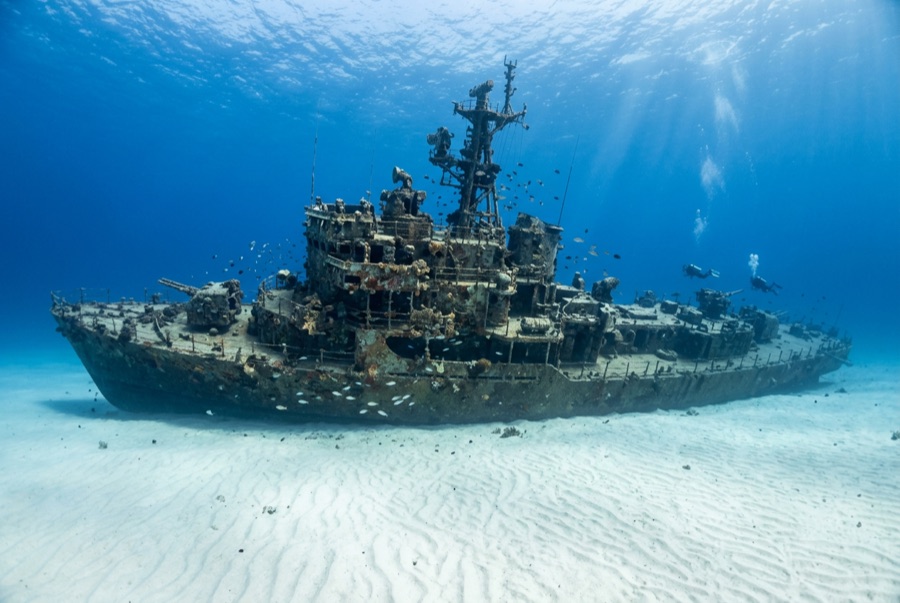
El Aguila — illustrative image

El Aguila

Coastal cargo freighter Sunk 1997 20–33 m Roatán
AI-generated illustration
Lives were lost hereNone (planned scuttling). Local operators ask that the wreck be dived with corresponding respect.
Documented
Depth to deck
20 m / 66 ft
Maximum depth
33 m / 108 ft
Built / sunk
? / 1997
Length
70 m
Orientation
Upright Bow; Midships And Stern Broken Into Sections
Level
Intermediate
Best months
Mar–Sep

The story

'The Eagle' had already sunk once before divers ever saw her. The roughly 70-meter freighter went down at Utila while hauling cargo, was raised, and sat rusting in a Roatán harbor until the island's dive community bought the hull, cleaned it, and scuttled it in 1997 on the sand at about 33 meters outside the Sandy Bay reef line. A year later Hurricane Mitch — the storm that devastated Honduras — rolled across the site and snapped the ship into three sections, scattering the midships and leaving her looking far more like a genuine casualty than a placed attraction. Divers generally count that an improvement: the break opened the holds to light, created canyons of plating to weave through, and gave the wreck the pleasing chaos of a debris field anchored by an intact, upright bow. Her most famous residents are morays of unusual size and boldness — thick green morays that free-swim across the sand — along with garden eels, big amiable grouper and midnight parrotfish that follow divers from the nearby reef. She pairs naturally with the shallower reef wall for a two-level profile.

How she sank: Deliberately scuttled as an artificial reef off Sandy Bay, 1997.

Diving her today

Condition: In three sections since Hurricane Mitch (1998); bow intact and upright, remainder broken but coherent

Penetration: Limited. Hurricane damage opened the structure; short, bright pass-throughs exist in the bow and holds, with nothing enclosed enough for long penetration. Entering any overhead environment requires specific training — a wreck certification at minimum, technical wreck training for full penetration.

Recommended certification: Advanced Open Water

Current: Mild · Visibility: 15–30 m

Marine life: Oversized green morays hunt openly, garden eels ring the wreck, grouper and midnight parrotfish tag along, and eagle rays cross the sand flat.

Hazards: Depth on the sand, sharp broken plating, and the usual temptation to overstay at 30 meters

Protection & law

Lies off Sandy Bay within Roatán's managed marine-reserve waters — park fees fund patrols and moorings

Watch

From the official channels

All videos →

Videos are embedded links to their creators' own channels — we host nothing and credit everything.

Sources: Roatán Marine Park ↗ · Facts verified against the sources above; fields without support are labeled not yet verified.

Australia, New Zealand & East Asia

Cairns & the Ribbon ReefsNingaloo ReefCoral Sea & Osprey ReefOkinawa & the Kerama IslandsPoor Knights IslandsTownsville & the YongalaGreen IslandIzu Peninsula

Caribbean & Western Atlantic

BonaireCozumelRiviera Maya & the CenotesBelize Barrier ReefGrand CaymanIsla Mujeres & CancúnRoatánTiger Beach & Grand Bahama

Europe, Atlantic & Mediterranean

Malta & GozoSilfra & IcelandThe AzoresCanary IslandsLarnaca & the ZenobiaScapa FlowArctic NorwayMadeira

Indian Ocean & East Africa

North & South Malé AtollsAri AtollBaa Atoll & Hanifaru BayAliwal Shoal & UmkomaasMafia IslandMauritiusSeychellesSodwana Bay

Pacific Islands & Micronesia

PalauChuuk (Truk) LagoonFakaravaKona, HawaiʻiRangiroaTaveuni & Rainbow ReefBeqa Lagoon & Pacific HarbourEspiritu Santo

Red Sea & Middle East

Sharm El Sheikh & Ras MohammedBrothers, Daedalus & St John'sDahabHurghada & El GounaMarsa Alam & the Deep SouthAqabaDaymaniyat IslandsMusandam Peninsula

Southeast Asia & Coral Triangle

Bali & Nusa PenidaKomodoRaja AmpatSipadan & MabulAnilaoCoronKoh TaoLembeh Strait

The Americas & Eastern Pacific

Galápagos IslandsCocos IslandFlorida KeysSea of Cortez & Cabo PulmoSocorro & the RevillagigedosBritish ColumbiaCalifornia Channel IslandsCosta Rica Pacific Coast