Situs selam, musim, dan kehidupan laut — diteliti, dipetakan, direncanakan.
Menu
Destinasi Lokasi Selam Kehidupan Laut Bangkai kapal Berita
Rencanakan perjalanan Perencana trip Kapan waktu terbaik menyelam Kalkulator biaya Perbandingan Kalender kehidupan laut Suhu air Liveaboard Operator & resor Taman laut Ruang hiperbarik Peta dunia
Wilayah Australia, Selandia Baru & Asia TimurKaribia & Atlantik BaratEropa, Atlantik & MediteraniaSamudra Hindia & Afrika TimurKepulauan Pasifik & MikronesiaLaut Merah & Timur TengahAsia Tenggara & Segitiga Terumbu KarangAmerika & Pasifik Timur Negara
Pelajari & Alat Semua panduan Sertifikasi Panduan perlengkapan Video Tanya Data Agen AI API
Tentang Tentang kami Metodologi Penafian Kontak
Tampilan kamu
★ Tersimpan

Destinasi, lokasi selam, dan spesies favorit yang kamu bintangi — tersimpan di browser ini.

API GATEWAY

Akses JSON gratis hanya-baca ke data cache atlas.

Mode gelap

🧭 Tampilan Terpandu
Baru mengenal menyelam — kedalaman, arus, level sertifikasi? Kami menjelaskan setiap istilah saat kamu menjelajah, dalam bahasa yang mudah dipahami. Data yang sama, lengkap dengan panduan bawaan.

⚡ Tampilan Ahli
Kamu sudah tahu perbedaan antara wall dive dan drift dive. Cukup datanya — bersih, cepat, dan ringkas. Ini adalah tampilan default.

Bahasa antarmuka
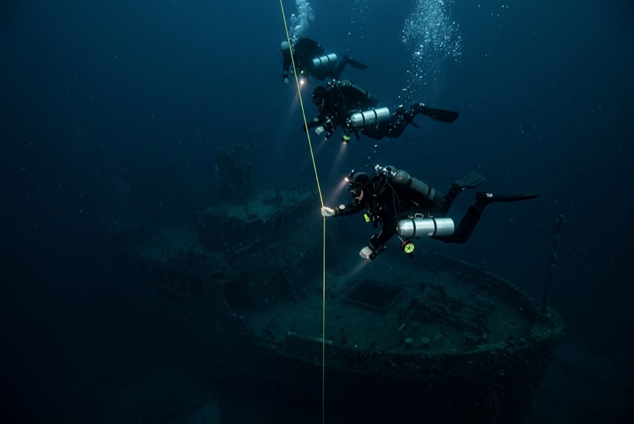
HIJMS Nagato — illustrative image

HIJMS Nagato

Japanese Nagato-class battleship Ditenggelamkan 1946 33–51 m Bikini Atoll
Ilustrasi hasil AI
Ada nyawa yang melayang di siniNone in the sinking — she was unmanned at Bikini. Operator lokal meminta agar bangkai kapal ini diselami dengan rasa hormat yang sepadan.
Terdokumentasi dengan baik
Kedalaman ke dek
33 m / 108 ft
Kedalaman maksimum
51 m / 167 ft
Dibangun / ditenggelamkan
1920 / 1946
Panjang
224 m
Orientasi
Capsized
Level
Technical
Bulan-bulan terbaik
May–Oct

Kisahnya

When she commissioned in 1920, Nagato was the first battleship in the world to mount 16-inch guns, and for two decades she was the pride of the Combined Fleet. It was from her flagship radio room, at anchor in home waters, that the coded order confirming the Pearl Harbor attack went out in December 1941. She survived Leyte Gulf and finished the war as Japan's last operational battleship, battered at Yokosuka. The Americans took her to Bikini for Operation Crossroads, moored her close to the bomb, and she absorbed both blasts; after Baker she settled slowly for five days and rolled over unobserved during the night of 29–30 July 1946. She rests upside down, her four great screws at technical-diving depth and her 16-inch guns beneath the overturned hull. For wreck divers she is a pilgrimage: the physical remainder of the fleet that began the Pacific war, reachable only by expedition, in a lagoon whose nuclear history is briefed alongside the dive plan.

Bagaimana kapal ini tenggelam: Damaged by the Baker atomic test and sank at night on 29–30 July 1946.

Menyelaminya hari ini

Kondisi: Structurally sound but inverted; the superstructure is crushed beneath the hull. Residual radioactivity at diver depths is low on modern surveys — a briefing point, not a barrier.

Penetrasi: Limited. Passages beneath and inside the inverted hull are for experienced technical teams; the casing spaces silt heavily and exits are unobvious. Memasuki area overhead apa pun memerlukan pelatihan khusus — minimal sertifikasi wreck, dan pelatihan wreck teknis untuk penetrasi penuh.

Sertifikasi yang disarankan: Technical/trimix certification

Arus: Mild · Visibilitas: 20–35 m

Kehidupan laut: Trevally and grey reef sharks patrol the hull's shadowed flanks; growth is modest under the dark overhangs, richer along the propellers.

Bahaya: Depth from the first minute of the dive, overhead environment, remoteness from medical care, and wartime munitions still aboard.

Perlindungan & hukum

Part of the Bikini Atoll UNESCO World Heritage Site; access only through authorized expeditions with Bikinian and Marshallese approval.

Every object aboard is heritage of two nations — removal is prohibited.

Tonton

Dari saluran resmi

Semua video →

Video adalah tautan sematan ke kanal milik kreatornya sendiri — kami tidak meng-host apa pun dan selalu mencantumkan kredit.

Sumber: UNESCO World Heritage Centre ↗Wikipedia ↗ · Fakta diverifikasi terhadap sumber-sumber di atas; kolom yang belum didukung data diberi label belum diverifikasi.

Australia, Selandia Baru & Asia Timur

Cairns & the Ribbon ReefsNingaloo ReefCoral Sea & Osprey ReefOkinawa & the Kerama IslandsPoor Knights IslandsTownsville & the YongalaGreen IslandIzu Peninsula

Karibia & Atlantik Barat

BonaireCozumelRiviera Maya & the CenotesBelize Barrier ReefGrand CaymanIsla Mujeres & CancúnRoatánTiger Beach & Grand Bahama

Eropa, Atlantik & Mediterania

Malta & GozoSilfra & IcelandThe AzoresCanary IslandsLarnaca & the ZenobiaScapa FlowArctic NorwayMadeira

Samudra Hindia & Afrika Timur

North & South Malé AtollsAri AtollBaa Atoll & Hanifaru BayAliwal Shoal & UmkomaasMafia IslandMauritiusSeychellesSodwana Bay

Kepulauan Pasifik & Mikronesia

PalauChuuk (Truk) LagoonFakaravaKona, HawaiʻiRangiroaTaveuni & Rainbow ReefBeqa Lagoon & Pacific HarbourEspiritu Santo

Laut Merah & Timur Tengah

Sharm El Sheikh & Ras MohammedBrothers, Daedalus & St John'sDahabHurghada & El GounaMarsa Alam & the Deep SouthAqabaDaymaniyat IslandsMusandam Peninsula

Asia Tenggara & Segitiga Terumbu Karang

Bali & Nusa PenidaKomodoRaja AmpatSipadan & MabulAnilaoCoronKoh TaoLembeh Strait

Amerika & Pasifik Timur

Galápagos IslandsCocos IslandFlorida KeysSea of Cortez & Cabo PulmoSocorro & the RevillagigedosBritish ColumbiaCalifornia Channel IslandsCosta Rica Pacific Coast