Pontos de mergulho, épocas e vida marinha — pesquisados, mapeados, planeados.
Menu
Destinos Pontos de Mergulho Vida Marinha Naufrágios Notícias
Planejar uma viagem Planejador de viagem Quando mergulhar Calculadora de custos Comparações Calendário de vida marinha Temperatura da água Liveaboards Operadores & resorts Parques marinhos Câmaras hiperbáricas Mapa mundial
Regiões Austrália, Nova Zelândia e Ásia OrientalCaribe e Atlântico OcidentalEuropa, Atlântico & MediterrâneoOceano Índico e África OrientalIlhas do Pacífico & MicronésiaMar Vermelho & Médio OrienteSudeste Asiático e Triângulo de CoralAs Américas e o Pacífico Oriental Países
Aprender e Ferramentas Todos os guias Certificações Guias de equipamento Vídeos Consulte os Dados Agentes de IA API
Sobre Sobre nós Metodologia Aviso legal Contato
A sua vista
★ Guardado

Os seus destinos, sítios de mergulho e espécies favoritos — guardados neste browser.

API GATEWAY

Acesso JSON gratuito e só de leitura aos dados em cache do atlas.

Modo escuro

🧭 Vista Guiada
Novo no mergulho — profundidades, correntes, níveis de certificação? Explicamos cada termo enquanto navega, em linguagem simples. Os mesmos dados, com a ajuda integrada.

⚡ Vista de Especialista
Já sabe a diferença entre uma parede e um drift dive. Apenas os dados — claros, rápidos e compactos. Esta é a vista predefinida.

Idioma da interface
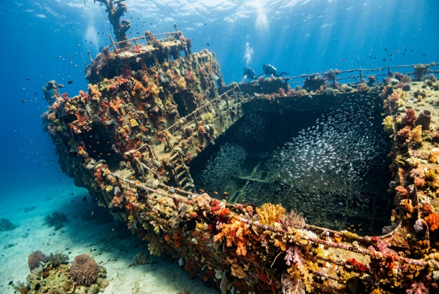
Mary Celestia — illustrative image

Mary Celestia

Iron-hulled sidewheel paddle steamer, Civil War blockade runner Afundado 1864 ~17 m Bermuda
Ilustração gerada por IA
Houve vidas perdidas aquiOne crew member, the ship's cook, drowned. Os operadores locais pedem que o naufrágio seja mergulhado com o respeito correspondente.
Bem documentado
Profundidade máxima
17 m / 56 ft
Construído / afundado
1864 / 1864
Comprimento
67 m
Orientação
Upright Remains On Sand; Hull Largely Gone Around The Machinery
Nível
Beginner
Melhores meses
May–Oct

A história

Built in Liverpool in 1864 for one purpose — outrunning the Union blockade — the Mary Celestia lasted barely a season. Long, low and fast, she shuttled between Bermuda and Wilmington, North Carolina, carrying munitions and supplies for the Confederacy on a route that made the island rich. On 6 September 1864, departing with a local pilot aboard who reportedly waved off warnings, she struck a reef just off the south shore and went down in minutes; the cook, returning below for belongings, was the only death. She settled on flat sand at about 17 meters, where her iconic remains read like a diagram of Victorian engineering: one paddle wheel standing upright and nearly whole, its twin collapsed, with boilers, engine, anchor and bow structure arranged around them. The wreck made headlines again when archaeologists excavating the bow found an unopened case of wine and bottles of perfume; the scent was analyzed and recreated in 2015. She is shallow, historic and often calm — a gentle dive with an outsized story — and, like all Bermuda wrecks, legally protected down to the last rivet.

Como afundou: Struck a reef off Bermuda's south shore and sank within minutes, 6 September 1864.

A mergulhar nela hoje

Condição: Machinery and one paddle wheel remarkably intact; hull plating mostly dissolved into the sand

Penetração: None.

Certificação recomendada: Open Water

Corrente: Mild · Visibilidade: 15–30 m

Vida marinha: Sergeant majors and bream cloud the paddle wheel, hogfish root in the sand, and hard corals and hydroids trim the frames.

Perigos: Surge near the reef line on all but calm days

Proteção & legislação

Protected historic wreck of Bermuda, actively studied by archaeologists — disturb nothing

Artifact recovery is illegal without a Bermuda government license.

The 2011 bow excavation was carried out under permit; anything divers find stays where it lies.

Assista

Dos canais oficiais

Todos os vídeos →

Os vídeos são links incorporados dos próprios canais dos criadores — não hospedamos nada e creditamos tudo.

Fontes: Bermuda Tourism Authority ↗National Museum of Bermuda ↗ · Factos verificados em relação às fontes acima; os campos sem suporte estão assinalados como não verificado ainda.

Austrália, Nova Zelândia e Ásia Oriental

Cairns & the Ribbon ReefsNingaloo ReefCoral Sea & Osprey ReefOkinawa & the Kerama IslandsPoor Knights IslandsTownsville & the YongalaGreen IslandIzu Peninsula

Caribe e Atlântico Ocidental

BonaireCozumelRiviera Maya & the CenotesBelize Barrier ReefGrand CaymanIsla Mujeres & CancúnRoatánTiger Beach & Grand Bahama

Europa, Atlântico & Mediterrâneo

Malta & GozoSilfra & IcelandThe AzoresCanary IslandsLarnaca & the ZenobiaScapa FlowArctic NorwayMadeira

Oceano Índico e África Oriental

North & South Malé AtollsAri AtollBaa Atoll & Hanifaru BayAliwal Shoal & UmkomaasMafia IslandMauritiusSeychellesSodwana Bay

Ilhas do Pacífico & Micronésia

PalauChuuk (Truk) LagoonFakaravaKona, HawaiʻiRangiroaTaveuni & Rainbow ReefBeqa Lagoon & Pacific HarbourEspiritu Santo

Mar Vermelho & Médio Oriente

Sharm El Sheikh & Ras MohammedBrothers, Daedalus & St John'sDahabHurghada & El GounaMarsa Alam & the Deep SouthAqabaDaymaniyat IslandsMusandam Peninsula

Sudeste Asiático e Triângulo de Coral

Bali & Nusa PenidaKomodoRaja AmpatSipadan & MabulAnilaoCoronKoh TaoLembeh Strait

As Américas e o Pacífico Oriental

Galápagos IslandsCocos IslandFlorida KeysSea of Cortez & Cabo PulmoSocorro & the RevillagigedosBritish ColumbiaCalifornia Channel IslandsCosta Rica Pacific Coast