Siti di immersione, stagioni e fauna marina — ricercati, mappati, pianificati.
Menu
Destinazioni Siti di immersione Vita marina Relitti Notizie
Pianifica un viaggio Pianificatore di viaggi Quando immergersi Calcolatore dei costi Confronti Calendario della fauna marina Temperatura dell'acqua Liveaboard Operatori & resort Parchi marini Camere iperbariche Mappa del mondo
Regioni Australia, Nuova Zelanda e Asia OrientaleCaraibi e Atlantico occidentaleEuropa, Atlantico e MediterraneoOceano Indiano e Africa OrientaleIsole del Pacifico & MicronesiaMar Rosso & Medio OrienteAsia meridionale e Triangolo dei CoralliLe Americhe e il Pacifico orientale Paesi
Impara e strumenti Tutte le guide Brevetti Guide all'attrezzatura Video Interroga i dati AI Agent API
Informazioni Chi siamo Metodologia Disclaimer Contatti
La tua vista
★ Salvato

Le tue destinazioni, siti e specie preferiti — salvati in questo browser.

API GATEWAY

Accesso JSON gratuito in sola lettura ai dati in cache dell'atlante.

Modalità scura

🧭 Visualizzazione Guidata
Sei nuovo alle immersioni — profondità, correnti, livelli di brevetto? Spieghiamo ogni termine mentre navighi, in modo semplice e chiaro. Gli stessi dati, con il supporto integrato.

⚡ Visualizzazione Esperta
Conosci già la differenza tra una parete e una drift dive. Solo i dati — chiari, rapidi e compatti. Questa è la visualizzazione predefinita.

Lingua dell'interfaccia
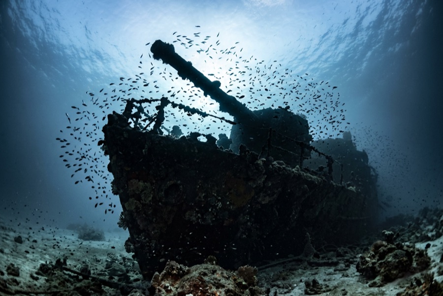
Numidia — illustrative image

Numidia

British cargo steamer Affondata 1901 8–80 m Brothers, Daedalus & St John's
Illustrazione generata dall'AI
Qui si sono perse delle viteNo lives were lost. Gli operatori locali chiedono che il relitto venga visitato con il dovuto rispetto.
Documentato
Profondità al ponte
8 m / 26 ft
Profondità massima
80 m / 262 ft
Costruito / affondato
1901 / 1901
Lunghezza
137 m
Stazza
6,399 GRT
Orientamento
Lying Down The Reef Slope, Bow Shallow, Stern Far Below
Livello
Advanced
Mesi migliori
Mar, Apr, May, Jun, Sep, Oct, Nov

La storia

Numidia was almost new when she died. Completed on the Clyde in 1901 for the Anchor Line, she was weeks into only her second voyage, London for Calcutta, when in the early hours of 20 July 1901 she steamed straight onto the north point of Big Brother — a mile-long island with a lighthouse that was lit and working. The crew got off without loss, and salvors spent weeks stripping what they could reach while the hull ground on the reef. Then she slipped, and gravity arranged one of the most dramatic wrecks in the Red Sea: a ship draped bow-up down a near-vertical wall, upper works beginning within ten meters of the surface and the stern fading past the edge of sport-diving depth. Pairs of railway wheels from her cargo still lie stacked near the island. A century of soft coral has upholstered every surviving beam.

Come è affondata: Ran onto the northern point of Big Brother Island, 20 July 1901.

Immersioni su di essa oggi

Condizione: The shallow section is broken and coral-fused; the deeper hull holds its shape, becoming more intact the farther down the wall it goes.

Penetrazione: Limited. Short pass-throughs in the forward section suit trained divers; anything deep inside the down-slope hull becomes a technical dive quickly. Entrare in qualsiasi ambiente overhead richiede una formazione specifica — come minimo una certificazione wreck, e una formazione tecnica wreck per la penetrazione completa.

Certificazione consigliata: Advanced Open Water with deep experience; technical training below 40 m

Corrente: Strong · Visibilità: 20–40 m

Vita marina: Soft corals in full riot, anthias in their thousands, and grey reef sharks — with oceanic whitetips and hammerheads possible off the wall in season.

Pericoli: Strong, shifting currents around the island, exposed offshore position, and a wreck that invites divers deeper than they planned — watch depth and gas.

Tutela & normativa

Lies within Egypt's offshore marine-park islands; liveaboard permits and park fees apply.

Guarda

Dai canali ufficiali

Tutti i video →

I video sono link incorporati ai canali dei rispettivi autori — non ospitiamo nulla e diamo sempre credito a tutti.

Fonti: Divernet ↗ · Dati verificati rispetto alle fonti indicate; i campi privi di riscontro sono contrassegnati come non ancora verificati.

Australia, Nuova Zelanda e Asia Orientale

Cairns & the Ribbon ReefsNingaloo ReefCoral Sea & Osprey ReefOkinawa & the Kerama IslandsPoor Knights IslandsTownsville & the YongalaGreen IslandIzu Peninsula

Caraibi e Atlantico occidentale

BonaireCozumelRiviera Maya & the CenotesBelize Barrier ReefGrand CaymanIsla Mujeres & CancúnRoatánTiger Beach & Grand Bahama

Europa, Atlantico e Mediterraneo

Malta & GozoSilfra & IcelandThe AzoresCanary IslandsLarnaca & the ZenobiaScapa FlowArctic NorwayMadeira

Oceano Indiano e Africa Orientale

North & South Malé AtollsAri AtollBaa Atoll & Hanifaru BayAliwal Shoal & UmkomaasMafia IslandMauritiusSeychellesSodwana Bay

Isole del Pacifico & Micronesia

PalauChuuk (Truk) LagoonFakaravaKona, HawaiʻiRangiroaTaveuni & Rainbow ReefBeqa Lagoon & Pacific HarbourEspiritu Santo

Mar Rosso & Medio Oriente

Sharm El Sheikh & Ras MohammedBrothers, Daedalus & St John'sDahabHurghada & El GounaMarsa Alam & the Deep SouthAqabaDaymaniyat IslandsMusandam Peninsula

Asia meridionale e Triangolo dei Coralli

Bali & Nusa PenidaKomodoRaja AmpatSipadan & MabulAnilaoCoronKoh TaoLembeh Strait

Le Americhe e il Pacifico orientale

Galápagos IslandsCocos IslandFlorida KeysSea of Cortez & Cabo PulmoSocorro & the RevillagigedosBritish ColumbiaCalifornia Channel IslandsCosta Rica Pacific Coast