Scopri dove immergerti, quando andare e cosa potresti vedere.

Scopri dove immergerti, quando andare e cosa potresti vedere.
★
Menu
Destinazioni Siti di immersione Vita marina Relitti Notizie
Pianifica un viaggio Pianificatore di viaggi Quando immergersi Calcolatore dei costi Confronti Calendario della fauna marina Temperatura dell'acqua Liveaboard Operatori & resort Parchi marini Camere iperbariche Mappa del mondo
Immersioni in grotta Tutta la speleologia subacquea Destinazioni e siti di immersione Sistemi di grotte e mappe Formazione e qualifiche Diving center e guide Attrezzatura e tecnologia Sicurezza e ricerca sugli incidenti Scienza, storia e conservazione Risorse e aggiornamenti
Regioni Australia, Nuova Zelanda e Asia OrientaleCaraibi e Atlantico occidentaleEuropa, Atlantico e MediterraneoOceano Indiano e Africa OrientaleIsole del Pacifico & MicronesiaMar Rosso & Medio OrienteAsia meridionale e Triangolo dei CoralliLe Americhe e il Pacifico orientale Paesi
Impara e strumenti Tutte le guide Brevetti Guide all'attrezzatura Video Interroga i dati AI Agent API
Informazioni Chi siamo Metodologia Disclaimer Contatti
La tua vista
★ Salvato

Le tue destinazioni, siti e specie preferiti, salvati in questo browser.

API GATEWAY

Accesso JSON gratuito in sola lettura ai dati in cache dell'atlante.

Modalità scura

Visualizzazione Guidata
Sei alle prime armi con le immersioni? Profondità, correnti, livelli di certificazione? Spieghiamo ogni termine mentre navighi, in modo semplice e chiaro. Gli stessi dati, con tutto il supporto integrato.

Visualizzazione Esperta
Conosci già la differenza tra una parete e una drift dive. Solo i dati: chiari, rapidi e sintetici. Questa è la visualizzazione predefinita.

Lingua dell'interfaccia
Ray of Hope

Ray of Hope

Coastal freighter Affondata 2003 ~15 m Nassau & New Providence
Illustrazione generata dall'AI
Nessuna vittima in questo luogoNone (planned scuttling).
Documentato
Profondità massima
15 m / 49 ft
Costruito / affondato
? / 2003
Lunghezza
60 m
Orientamento
Upright
Livello
Beginner
Mesi migliori
Nov–May

La storia

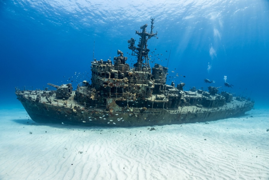
The Ray of Hope is a working ship turned film set turned shark theater. A roughly 60-meter freighter of the kind that shuttles freight through the Bahamas, she was acquired, cleaned and scuttled in 2003 on the sand flats along southwest New Providence's drop-off, joining a cluster of wrecks placed over the years for divers and for Hollywood. This stretch of coast has doubled for open ocean in Bond films and countless productions. She landed upright, bow toward the wall, and would be a pleasant if unremarkable reef dive except for her neighbors: the site sits beside one of the Caribbean's longest-running shark feeds, and Caribbean reef sharks treat the wreck as part of their patrol route. Even on unbaited dives it is normal to descend through a loose spiral of sharks and find more resting in the sand lee of the hull. The holds are open and bright, grouper and horse-eye jacks crowd the superstructure, and the short swim to the wall lets one dive combine wreck, reef edge and big animals.

Come è affondata: Deliberately scuttled as an artificial reef off southwest New Providence, 2003.

Immersioni su di essa oggi

Condizione: Upright and intact, colonization young but spreading; structure sound

Penetrazione: Limited. Cargo holds and the wheelhouse are open with multiple exits; genuine enclosed penetration is limited and should stay with trained divers. L'ingresso in qualsiasi ambiente overhead richiede una formazione specifica: almeno un brevetto per wreck diving, e una formazione tecnica per wreck diving per la penetrazione completa.

Certificazione consigliata: Open Water

Corrente: Mild · Visibilità: 15–30 m

Vita marina: Caribbean reef sharks are the constant (circling, resting on sand, shadowing divers), joined by grouper, horse-eye jacks, southern stingrays and a resident green moray.

Pericoli: Sharks conditioned by nearby feeds approach closely; keep hands in and follow briefings

Guarda

Dai canali ufficiali

Tutti i video →

I video sono link incorporati ai canali dei rispettivi autori. Non ospitiamo nulla e accreditiamo tutto.

Fonti: Stuart Cove's Dive Bahamas ↗Bahamas Ministry of Tourism ↗ · Dati verificati rispetto alle fonti indicate; i campi privi di riscontro sono contrassegnati come non ancora verificati.

Australia, Nuova Zelanda e Asia Orientale

Cairns & the Ribbon ReefsNingaloo ReefCoral Sea & Osprey ReefOkinawa & the Kerama IslandsPoor Knights IslandsTownsville & the YongalaGreen IslandIzu Peninsula

Caraibi e Atlantico occidentale

BonaireCozumelRiviera Maya & the CenotesBelize Barrier ReefGrand CaymanIsla Mujeres & CancúnRoatánTiger Beach & Grand Bahama

Europa, Atlantico e Mediterraneo

Malta & GozoSilfra & IcelandThe AzoresCanary IslandsLarnaca & the ZenobiaScapa FlowArctic NorwayMadeira

Oceano Indiano e Africa Orientale

North & South Malé AtollsAri AtollBaa Atoll & Hanifaru BayAliwal Shoal & UmkomaasMafia IslandMauritiusSeychellesSodwana Bay

Isole del Pacifico & Micronesia

PalauChuuk (Truk) LagoonFakaravaKona, HawaiʻiRangiroaTaveuni & Rainbow ReefBeqa Lagoon & Pacific HarbourEspiritu Santo

Mar Rosso & Medio Oriente

Sharm El Sheikh & Ras MohammedBrothers, Daedalus & St John'sDahabHurghada & El GounaMarsa Alam & the Deep SouthAqabaDaymaniyat IslandsMusandam Peninsula

Asia meridionale e Triangolo dei Coralli

Bali & Nusa PenidaKomodoRaja AmpatSipadan & MabulAnilaoCoronKoh TaoLembeh Strait

Le Americhe e il Pacifico orientale

Galápagos IslandsCocos IslandFlorida KeysSea of Cortez & Cabo PulmoSocorro & the RevillagigedosBritish ColumbiaCalifornia Channel IslandsCosta Rica Pacific Coast