Dive sites, seasons and marine life — researched, mapped, planned.
Menu
Destinations Dive Sites Marine Life Wrecks News
Plan a trip Trip planner When to dive Cost calculator Comparisons Marine-life calendar Water temperature Liveaboards Operators & resorts Marine parks Hyperbaric chambers World map
Regions Australia, New Zealand & East AsiaCaribbean & Western AtlanticEurope, Atlantic & MediterraneanIndian Ocean & East AfricaPacific Islands & MicronesiaRed Sea & Middle EastSoutheast Asia & Coral TriangleThe Americas & Eastern Pacific Countries
Learn & Tools All guides Certifications Gear guides Videos Ask the Data AI Agents API
About About us Methodology Disclaimer Contact
Your view
★ Saved

Your starred destinations, sites and species — stored in this browser.

API GATEWAY

Free read-only JSON access to the atlas's cached data.

Dark mode

🧭 Guided View
New to diving — depths, currents, certification levels? We explain every term as you browse, in plain English. Same data, with the help built in.

⚡ Expert View
You already know the difference between a wall and a drift. Just the data — clean, fast and compact. This is the default view.

Interface language
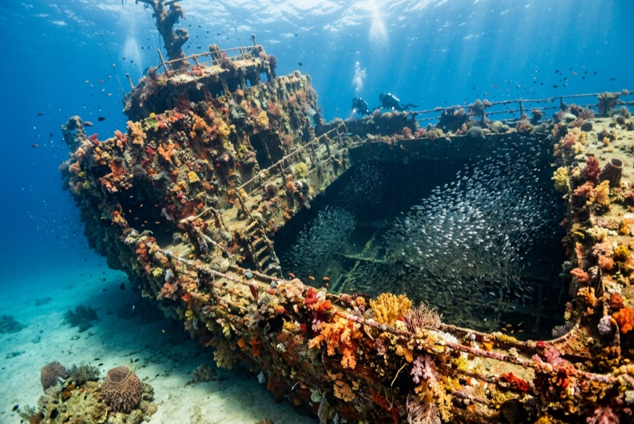
SS Yongala — illustrative image

SS Yongala

Australian coastal passenger and cargo steamer Sunk 1911 14–28 m Townsville & the Yongala
AI-generated illustration
Lives were lost hereAll 122 aboard died. Local operators ask that the wreck be dived with corresponding respect.
Well documented
Depth to deck
14 m / 46 ft
Maximum depth
28 m / 92 ft
Built / sunk
1903 / 1911
Length
110 m
Tonnage
3,664 GRT
Orientation
On Her Starboard Side
Level
Advanced
Best months
Aug–Dec

The story

The Yongala was a crack coastal liner, English-built in 1903 and running the Adelaide–Cairns route for the Adelaide Steamship Company. On 23 March 1911 she steamed north past the Dent Island lighthouse into a cyclone; wireless had been invented but her set had not yet been fitted, so the storm warning could not reach her. She vanished with all 122 people aboard — passengers, crew, and a racehorse named Moonshine whose body coming ashore was among the first evidence of the loss. For decades her fate stayed one of Australia's sea mysteries; a wartime sonar contact was finally confirmed as the Yongala in 1958. She lies on her starboard side on open sand miles from any reef, and that isolation made her an oasis: half a century of larvae drifting past had nowhere else to settle, and she is now routinely called the most life-dense wreck dive on earth. She is also a mass grave, protected by law, dived outside only.

How she sank: Lost with all hands in a cyclone off Cape Bowling Green, 23 March 1911.

Diving her today

Condition: Protected since 1981 under Australia's Historic Shipwrecks Act 1976, now the Underwater Cultural Heritage Act 2018: the hull is intact but softening, and divers are barred from entering or touching it. Moorings are mandatory; anchoring is banned.

Penetration: None. Entry is prohibited by law under her protected-zone status — and unnecessary: everything that makes this dive extraordinary lives on the outside.

Recommended certification: Advanced Open Water

Current: Strong · Visibility: 8–20 m

Marine life: Giant Queensland groupers, marble rays stacked under the bow, olive sea snakes, turtles, eagle rays, barracuda, snapper in walls, and trevally storms — with bull sharks passing in the cooler months.

Hazards: Open-ocean current that can run hard the full dive, exposed sea conditions on the crossing, and no sheltering reef; this is a strong-skills dive.

Protection & law

Commonwealth protected zone under the Underwater Cultural Heritage Act 2018; access via permitted operators and fixed moorings only.

She is the grave of 122 people; penetration, artifact disturbance, and anchoring are offenses.

Nothing may be touched or taken — the law and the dead both say so.

Watch

From the official channels

All videos →

Videos are embedded links to their creators' own channels — we host nothing and credit everything.

Sources: Queensland Museum Network ↗Wikipedia ↗ · Facts verified against the sources above; fields without support are labeled not yet verified.

Australia, New Zealand & East Asia

Cairns & the Ribbon ReefsNingaloo ReefCoral Sea & Osprey ReefOkinawa & the Kerama IslandsPoor Knights IslandsTownsville & the YongalaGreen IslandIzu Peninsula

Caribbean & Western Atlantic

BonaireCozumelRiviera Maya & the CenotesBelize Barrier ReefGrand CaymanIsla Mujeres & CancúnRoatánTiger Beach & Grand Bahama

Europe, Atlantic & Mediterranean

Malta & GozoSilfra & IcelandThe AzoresCanary IslandsLarnaca & the ZenobiaScapa FlowArctic NorwayMadeira

Indian Ocean & East Africa

North & South Malé AtollsAri AtollBaa Atoll & Hanifaru BayAliwal Shoal & UmkomaasMafia IslandMauritiusSeychellesSodwana Bay

Pacific Islands & Micronesia

PalauChuuk (Truk) LagoonFakaravaKona, HawaiʻiRangiroaTaveuni & Rainbow ReefBeqa Lagoon & Pacific HarbourEspiritu Santo

Red Sea & Middle East

Sharm El Sheikh & Ras MohammedBrothers, Daedalus & St John'sDahabHurghada & El GounaMarsa Alam & the Deep SouthAqabaDaymaniyat IslandsMusandam Peninsula

Southeast Asia & Coral Triangle

Bali & Nusa PenidaKomodoRaja AmpatSipadan & MabulAnilaoCoronKoh TaoLembeh Strait

The Americas & Eastern Pacific

Galápagos IslandsCocos IslandFlorida KeysSea of Cortez & Cabo PulmoSocorro & the RevillagigedosBritish ColumbiaCalifornia Channel IslandsCosta Rica Pacific Coast