Puntos de buceo, temporadas y vida marina — investigados, cartografiados, planificados.
Menú
Destinos Puntos de buceo Vida marina Pecios Noticias
Planifica un viaje Planificador de viajes Cuándo bucear Calculadora de costes Comparativas Calendario de fauna marina Temperatura del agua Liveaboards Operadores y resorts Parques marinos Cámaras hiperbáricas Mapa mundial
Regiones Australia, Nueva Zelanda y Asia OrientalCaribe y Atlántico occidentalEuropa, Atlántico y MediterráneoOcéano Índico y África OrientalIslas del Pacífico y MicronesiaMar Rojo y Oriente MedioSudeste Asiático y el Triángulo del CoralLas Américas y el Pacífico Oriental Países
Aprender y herramientas Todas las guías Certificaciones Guías de equipo Vídeos Consulta los datos Agentes de IA API
Acerca de Quiénes somos Metodología Aviso legal Contacto
Tu vista
★ Guardado

Tus destinos, sitios y especies favoritos — guardados en este navegador.

API GATEWAY

Acceso JSON gratuito de solo lectura a los datos en caché del atlas.

Modo oscuro

🧭 Vista guiada
¿Nuevo en el buceo? ¿Profundidades, corrientes, niveles de certificación? Explicamos cada término mientras navegas, en un lenguaje claro. Los mismos datos, con la ayuda integrada.

⚡ Vista experta
Ya conoces la diferencia entre una pared y un drift dive. Solo los datos — claros, rápidos y concisos. Esta es la vista predeterminada.

Idioma de la interfaz
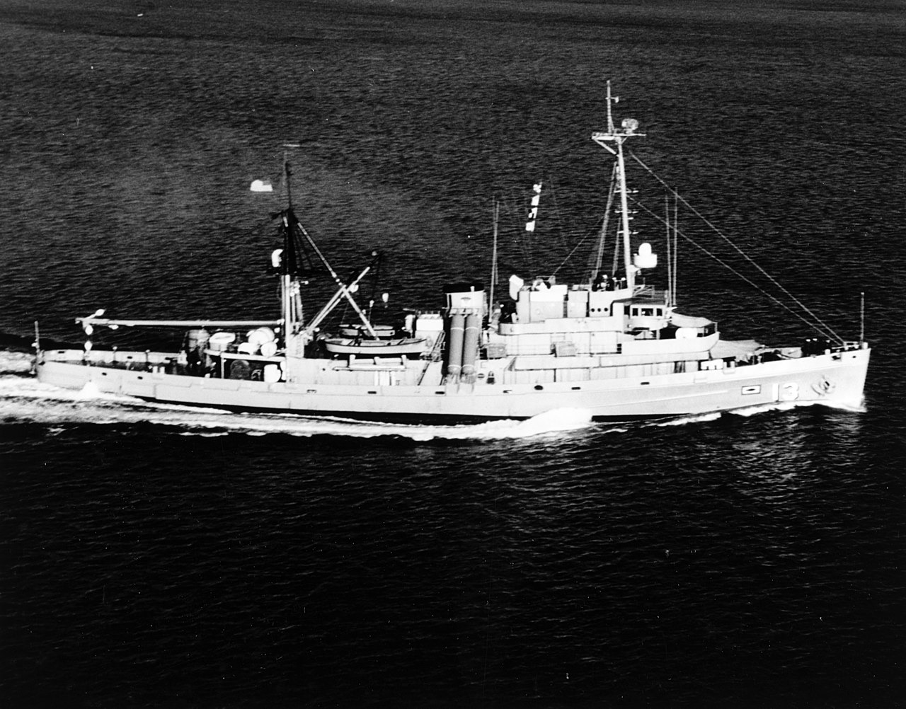
USS Kittiwake — illustrative image

USS Kittiwake

Chanticleer-class submarine rescue vessel (ASR-13) Hundido 2011 5–19 m Grand Cayman
Ilustración generada por IA
Aquí se perdieron vidasNone (planned scuttling). Los operadores locales piden que el pecio se bucee con el respeto correspondiente.
Bien documentado
Profundidad hasta cubierta
5 m / 16 ft
Profundidad máxima
19 m / 62 ft
Construido / hundido
1945 / 2011
Longitud
76 m
Orientación
Port Side (Upright Until 2017 Storm Swells)
Nivel
Beginner
Mejores meses
Nov–May

La historia

For almost fifty years the Kittiwake tended US Navy submarines, her divers and recompression chambers standing by for crews in trouble; her boats also recovered the data recorder from the Challenger space shuttle wreckage in 1986. Decommissioned in 1994, she spent years in the mothball fleet before the Cayman Islands bought her for a purpose she was oddly suited to: teaching divers. Stripped of fuel, wiring and hazards, with hatches removed and hull openings cut, she was sent down in clear sand off the north end of Seven Mile Beach in January 2011 and has been colonizing ever since. She originally sat upright and so shallow that snorkelers could study her deck; heavy storm swells in 2017 rolled her onto her port side, where she remains, largely intact. Five decks — mess hall, recompression chamber, mirrors still on bulkheads — make her one of the world's most accessible true ship interiors, while the surrounding sand flat keeps navigation simple. A small fee, collected through operators, funds her upkeep as a managed dive attraction.

Cómo se hundió: Deliberately scuttled as an artificial reef off Seven Mile Beach, 5 January 2011.

Buceando aquí hoy

Condición: Intact and clean; lying on her port side since 2017 with structure sound and interior spaces open

Penetración: Full With Training. Prepared for diver access with cut openings and removed hatches; upper compartments are bright and simple, but full interior tours still call for wreck training and a guide who knows the new sideways geometry. Acceder a cualquier entorno de penetración exige formación específica — como mínimo una certificación en pecios, y formación técnica en pecios para penetración completa.

Certificación recomendada: Open Water

Corriente: Mild · Visibilidad: 20–30 m

Vida marina: Horse-eye jacks school over the hull, garden eels ring the sand, hawksbill turtles graze the sponges, and barracuda, goatfish and the occasional spotted eagle ray pass along the reef line.

Riesgos: Light surge in winter swells; inside, the rotated orientation disorients divers who knew her upright

Protección y legislación

Managed wreck site under Cayman marine-park rules — a small dive fee applies through licensed operators and nothing may be taken

Ver

Desde los canales oficiales

Todos los vídeos →

Los vídeos son enlaces incrustados a los canales propios de sus creadores — no alojamos nada y acreditamos todo.

Fuentes: Cayman Islands Government ↗Wikipedia ↗ · Datos verificados frente a las fuentes anteriores; los campos sin respaldo se marcan como aún no verificados.

Australia, Nueva Zelanda y Asia Oriental

Cairns & the Ribbon ReefsNingaloo ReefCoral Sea & Osprey ReefOkinawa & the Kerama IslandsPoor Knights IslandsTownsville & the YongalaGreen IslandIzu Peninsula

Caribe y Atlántico occidental

BonaireCozumelRiviera Maya & the CenotesBelize Barrier ReefGrand CaymanIsla Mujeres & CancúnRoatánTiger Beach & Grand Bahama

Europa, Atlántico y Mediterráneo

Malta & GozoSilfra & IcelandThe AzoresCanary IslandsLarnaca & the ZenobiaScapa FlowArctic NorwayMadeira

Océano Índico y África Oriental

North & South Malé AtollsAri AtollBaa Atoll & Hanifaru BayAliwal Shoal & UmkomaasMafia IslandMauritiusSeychellesSodwana Bay

Islas del Pacífico y Micronesia

PalauChuuk (Truk) LagoonFakaravaKona, HawaiʻiRangiroaTaveuni & Rainbow ReefBeqa Lagoon & Pacific HarbourEspiritu Santo

Mar Rojo y Oriente Medio

Sharm El Sheikh & Ras MohammedBrothers, Daedalus & St John'sDahabHurghada & El GounaMarsa Alam & the Deep SouthAqabaDaymaniyat IslandsMusandam Peninsula

Sudeste Asiático y el Triángulo del Coral

Bali & Nusa PenidaKomodoRaja AmpatSipadan & MabulAnilaoCoronKoh TaoLembeh Strait

Las Américas y el Pacífico Oriental

Galápagos IslandsCocos IslandFlorida KeysSea of Cortez & Cabo PulmoSocorro & the RevillagigedosBritish ColumbiaCalifornia Channel IslandsCosta Rica Pacific Coast