Sites de plongée, saisons et vie marine — recherchés, cartographiés, planifiés.
Menu
Destinations Sites de plongée Vie marine Épaves Actualités
Planifier un voyage Planificateur de séjour Quand plonger Calculateur de coût Comparaisons Calendrier de la faune marine Température de l'eau Liveaboards Opérateurs & resorts Parcs marins Caissons hyperbares Carte du monde
Régions Australie, Nouvelle-Zélande & Asie de l'EstCaraïbes & Atlantique occidentalEurope, Atlantique & MéditerranéeOcéan Indien & Afrique de l'EstÎles du Pacifique & MicronésieMer Rouge & Moyen-OrientAsie du Sud-Est et Triangle de CorailLes Amériques et Pacifique Est Pays
Apprendre & Outils Tous les guides Certifications Guides d'équipement Vidéos Interroger les données Agents IA API
À propos À propos de nous Méthodologie Avertissement Contact
Votre vue
★ Enregistré

Vos destinations, sites et espèces favoris — enregistrés dans ce navigateur.

API GATEWAY

Accès JSON gratuit en lecture seule aux données en cache de l'atlas.

Mode sombre

🧭 Vue Guidée
Nouveau dans la plongée — profondeurs, courants, niveaux de certification ? Nous expliquons chaque terme au fil de votre navigation, en langage clair. Les mêmes données, avec l'aide intégrée.

⚡ Vue Expert
Vous connaissez déjà la différence entre un tombant et un drift. Juste les données — claires, rapides et compactes. C'est la vue par défaut.

Langue de l'interface
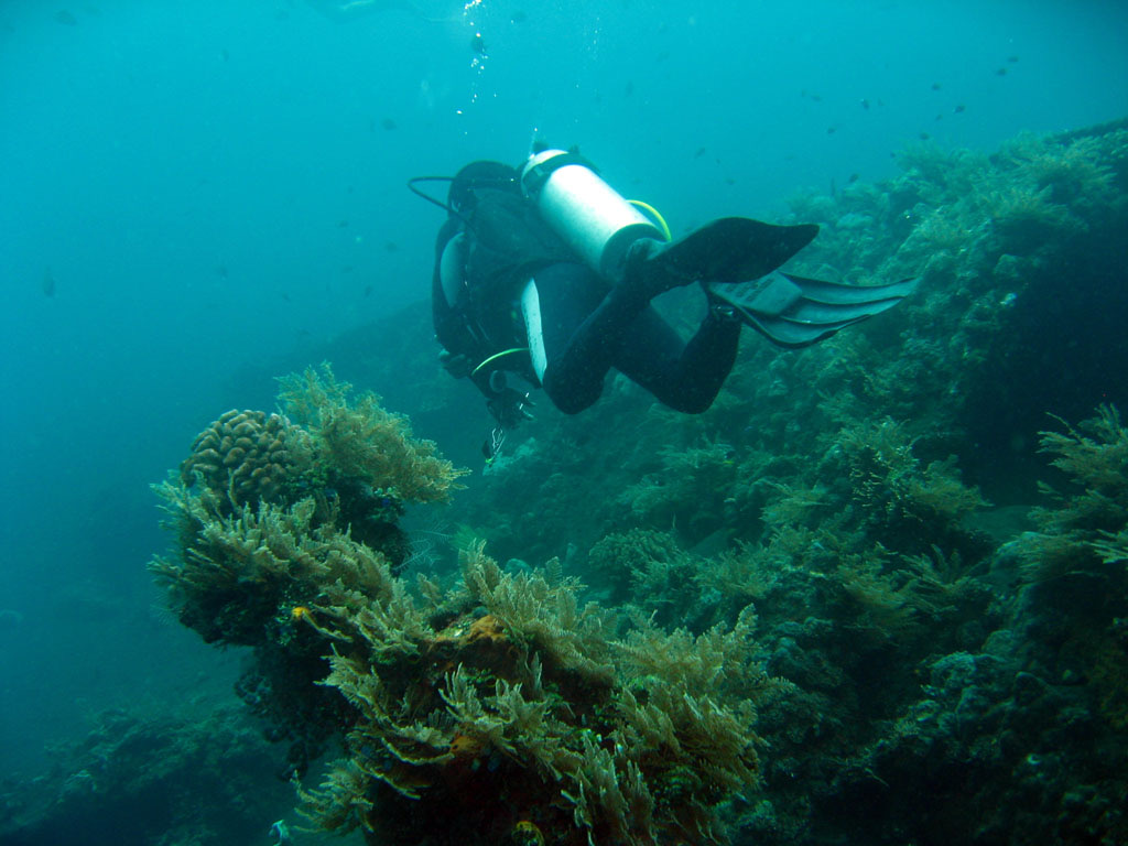
USAT Liberty — illustrative image

USAT Liberty

US Army transport ship (First World War-era cargo steamer) Coulé 1963 5–30 m Bali & Nusa Penida
Illustration générée par IA
Des vies ont été perdues iciNone — the crew survived the 1942 attack. Les opérateurs locaux demandent que l'épave soit plongée avec le respect qui s'impose.
Bien documenté
Profondeur jusqu'au pont
5 m / 16 ft
Profondeur maximale
30 m / 98 ft
Construit / coulé
1918 / 1963
Longueur
120 m
Orientation
On Her Side Along The Slope, Heavily Collapsed
Niveau
Beginner
Meilleurs mois
Apr–Nov

L'histoire

The Liberty is the world's most visited shipwreck largely because you can walk to her. Built in 1918 as a US wartime freighter, she was crossing the Lombok Strait in January 1942 with railway parts and rubber when the Japanese submarine I-166 torpedoed her. Two Allied destroyers took the flooding ship in tow, but she could not make Singaraja and was run ashore at Tulamben on Bali's northeast coast, where she was stripped and left rusting on the black sand for twenty years. In 1963 the catastrophic eruption of Mount Agung — whose cone rises directly behind the beach — shook her off the shore, and she slid to rest on the sand slope a stone's throw out, from snorkel depth to thirty meters. Six decades of warm, nutrient-rich water have done the rest: the broken hull is now Bali's densest reef, circled at dawn by a famous school of bumphead parrotfish. Guides, porters, and warungs in Tulamben village all live on her patronage.

Comment elle a coulé: Torpedoed by Japanese submarine I-166 on 11 January 1942 and beached at Tulamben; tremors from the 1963 eruption of Mount Agung slid the hull below the waterline.

Plongée sur ce site aujourd'hui

Condition: A ruin in the best sense — structural collapse has opened her to light and growth, and coral now holds much of her shape together.

Pénétration: Limited. Openings in the collapsed hull allow short daylight swim-throughs; there is no deep interior left to penetrate. Toute pénétration en environnement semi-fermé exige une formation spécifique — au minimum une certification épave, et une formation technique épave pour une pénétration complète.

Certification recommandée: Open Water

Courant: Mild · Visibilité: 10–25 m

Vie marine: Bumphead parrotfish at first light, resident great barracuda, garden eels on the slope, pygmy seahorses on the gorgonians, and clouds of anthias over every surface.

Dangers: Crowds at peak hours, surge on the shallow section in season, and stonefish and scorpionfish on the entry rocks.

Protection & réglementation

The village community manages the site; fees and porter customs support local stewardship.

Nothing has been left to take — and nothing on the reef may be.

Regarder

Depuis les canaux officiels

Toutes les vidéos →

Les vidéos sont des liens intégrés vers les chaînes de leurs créateurs — nous n'hébergeons rien et créditons tout.

Sources: Wikipedia ↗ · Informations vérifiées par rapport aux sources ci-dessus ; les champs sans référence sont marqués non encore vérifiés.

Australie, Nouvelle-Zélande & Asie de l'Est

Cairns & the Ribbon ReefsNingaloo ReefCoral Sea & Osprey ReefOkinawa & the Kerama IslandsPoor Knights IslandsTownsville & the YongalaGreen IslandIzu Peninsula

Caraïbes & Atlantique occidental

BonaireCozumelRiviera Maya & the CenotesBelize Barrier ReefGrand CaymanIsla Mujeres & CancúnRoatánTiger Beach & Grand Bahama

Europe, Atlantique & Méditerranée

Malta & GozoSilfra & IcelandThe AzoresCanary IslandsLarnaca & the ZenobiaScapa FlowArctic NorwayMadeira

Océan Indien & Afrique de l'Est

North & South Malé AtollsAri AtollBaa Atoll & Hanifaru BayAliwal Shoal & UmkomaasMafia IslandMauritiusSeychellesSodwana Bay

Îles du Pacifique & Micronésie

PalauChuuk (Truk) LagoonFakaravaKona, HawaiʻiRangiroaTaveuni & Rainbow ReefBeqa Lagoon & Pacific HarbourEspiritu Santo

Mer Rouge & Moyen-Orient

Sharm El Sheikh & Ras MohammedBrothers, Daedalus & St John'sDahabHurghada & El GounaMarsa Alam & the Deep SouthAqabaDaymaniyat IslandsMusandam Peninsula

Asie du Sud-Est et Triangle de Corail

Bali & Nusa PenidaKomodoRaja AmpatSipadan & MabulAnilaoCoronKoh TaoLembeh Strait

Les Amériques et Pacifique Est

Galápagos IslandsCocos IslandFlorida KeysSea of Cortez & Cabo PulmoSocorro & the RevillagigedosBritish ColumbiaCalifornia Channel IslandsCosta Rica Pacific Coast