Discover where to dive, when to go, and what you could see.

Discover where to dive, when to go, and what you could see.
★
Menu
Destinations Dive Sites Marine Life Wrecks News
Plan a trip Trip planner When to dive Cost calculator Comparisons Marine-life calendar Water temperature Liveaboards Operators & resorts Marine parks Hyperbaric chambers World map
Cave Diving All cave diving Destinations & Dive Sites Cave Systems & Maps Training & Qualifications Dive Centers & Guides Equipment & Technology Safety & Incident Research Science, History & Conservation Resources & Updates
Regions Australia, New Zealand & East AsiaCaribbean & Western AtlanticEurope, Atlantic & MediterraneanIndian Ocean & East AfricaPacific Islands & MicronesiaRed Sea & Middle EastSoutheast Asia & Coral TriangleThe Americas & Eastern Pacific Countries
Learn & Tools All guides Certifications Gear guides Videos Ask the Data AI Agents API
About About us Methodology Disclaimer Contact
Your view
★ Saved

Your starred destinations, sites and species, stored in this browser.

API GATEWAY

Free read-only JSON access to the atlas's cached data.

Dark mode

Guided View
New to diving? Depths, currents, certification levels? We explain every term as you browse, in plain English. Same data, with the help built in.

Expert View
You already know the difference between a wall and a drift. Just the data: clean, fast and compact. This is the default view.

Interface language
Dean's Blue Hole

Dean's Blue Hole

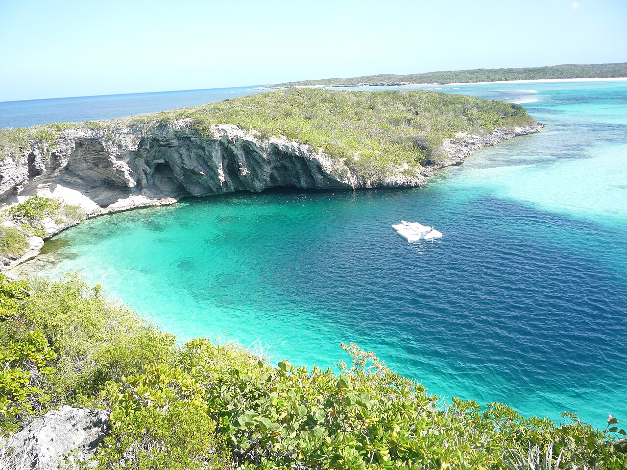
Photo: Ton Engwirda · CC BY-SA 3.0 nl
Access status not verified · as published 2026-10-14 Reached from the beach by a rocky path. No permits, fees or diving rules are published. Access rules change: confirm with the landowner or managing authority before you travel.
Documented Also known as: Deans Blue Hole, Dean's Hole
Entrance depth
Not published
Commonly dived areas
Not published
Maximum depth here
202 m (663 ft)
Published category
None published
Visibility
10–50 m

A beach-side blue hole on Long Island, about 202 m deep, with a narrow neck opening into a vast chamber. It is used mainly for freediving and snorkelling.

The hole is entered from a sandy beach in a sheltered bay. Its rim ledges and the coral-covered sides of the entrance hold reef fish, and a school of tarpon is reported to hang at about 20 m. Below the neck, the walls open out into a very large chamber.

The site is the venue of the Vertical Blue freediving competition. No land-manager rules for scuba or cave diving are published.

The environment

Open, sheltered blue hole: surface opening about 45 x 55 m, ledges at 10-15 m, then a chamber at least 100 m across descending to about 202 m.

Conditions

The freediving organiser reports no current or waves inside the hole and visibility of about 10 to 50 m (typical).

Typical ranges from published sources, not current conditions.

Dean's Blue Hole Satellite: NASA Blue Marble

For orientation, not navigation. Hollow dots are approximate.

Sources: [1] The Islands of The Bahamas (Bahamas Ministry of Tourism) ↗[2] Vertical Blue ↗[3] GeoNames ↗ · checked 2026-10-14
Every fact on this page, with its source (6)
FactStatusSource
The hole is about 663 ft (202 m) deep.Vertical Blue gives 203 m. Reported [1] [2]
The opening is about 45 x 55 m, narrowing to about 25 x 35 m with ledges at 10-15 m, above a cavern at least 100 m across. Reported [2]
A resident school of tarpon is found at about 20 m. Reported [2]
Visibility is about 10 to 50 m.Typical, not current. Reported [2]
The hole is reached by a rocky pathway from the surrounding beach. Verified [1]
Coordinates are for Clarence Town (GeoNames), the settlement where the hole is located.Area-level. Reported [3]

Verified: stated by an official or primary source we opened. Reported: from a secondary source only. Sources conflict: the note gives both versions. May be out of date: the newest source we found is old.

Written in our own words from the sources above. Report a correction

Australia, New Zealand & East Asia

Cairns & the Ribbon ReefsNingaloo ReefCoral Sea & Osprey ReefOkinawa & the Kerama IslandsPoor Knights IslandsTownsville & the YongalaGreen IslandIzu Peninsula

Caribbean & Western Atlantic

BonaireCozumelRiviera Maya & the CenotesBelize Barrier ReefGrand CaymanIsla Mujeres & CancúnRoatánTiger Beach & Grand Bahama

Europe, Atlantic & Mediterranean

Malta & GozoSilfra & IcelandThe AzoresCanary IslandsLarnaca & the ZenobiaScapa FlowArctic NorwayMadeira

Indian Ocean & East Africa

North & South Malé AtollsAri AtollBaa Atoll & Hanifaru BayAliwal Shoal & UmkomaasMafia IslandMauritiusSeychellesSodwana Bay

Pacific Islands & Micronesia

PalauChuuk (Truk) LagoonFakaravaKona, HawaiʻiRangiroaTaveuni & Rainbow ReefBeqa Lagoon & Pacific HarbourEspiritu Santo

Red Sea & Middle East

Sharm El Sheikh & Ras MohammedBrothers, Daedalus & St John'sDahabHurghada & El GounaMarsa Alam & the Deep SouthAqabaDaymaniyat IslandsMusandam Peninsula

Southeast Asia & Coral Triangle

Bali & Nusa PenidaKomodoRaja AmpatSipadan & MabulAnilaoCoronKoh TaoLembeh Strait

The Americas & Eastern Pacific

Galápagos IslandsCocos IslandFlorida KeysSea of Cortez & Cabo PulmoSocorro & the RevillagigedosBritish ColumbiaCalifornia Channel IslandsCosta Rica Pacific Coast