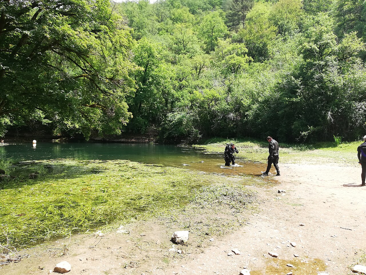
Résurgence de Cabouy
The main entrance to the flooded Ouysse river, a pool 20 to 25 m across in the Alzou valley about 3 km from Rocamadour, where the Ouysse begins its surface course.
Cabouy is reached by the small road that follows the Alzou valley from Rocamadour, over the col de Magès and past a house and the commune's pumping station. The resurgence pool is 20 to 25 m in diameter, with vegetation covering the bottom down to about 6 m.
A slope of debris leads to about 15 m at the gallery entrance and the conduit reaches 31 m at its porch. Divernet describes following a rope through near-zero visibility to the entrance, after which visibility improves and the passage opens into a large gallery. From the low point the floor rises to about 12 m some 275 m in and stays between 14 and 18 m to the 325 m mark, continuing towards Pou Meyssen.
Since 2012 a rope tied to a tree above the entrance links the surface to an anchor at -9 m, where the guideline laid in 2011-2014 starts; the line carries distance tags from Cabouy every 50 m.
Die Umgebung
A large spring pool with weed in the shallows, a silty approach and a big river gallery beyond; seasonal floods.
Bedingungen
Typical only. Divernet describes near-zero visibility on the approach to the entrance improving inside; seasonal floods damage the guideline.
Typische Wertebereiche aus veröffentlichten Quellen, keine aktuellen Bedingungen.
Weitere Eingänge zu Réseau de l'Ouysse (Cabouy – Pou Meyssen)
Zur Orientierung, nicht zur Navigation. Hohle Punkte sind ungefähre Angaben.
Alle Angaben auf dieser Seite mit Quellennachweis (10)
| Angabe | Status | Quelle |
|---|---|---|
| The resurgence basin is 20 to 25 m in diameter and vegetation covers the bottom to about 6 m. | Verifiziert | [1] |
| The debris slope reaches about 15 m at the gallery entrance; beyond the low point the passage lies between about 12 and 18 m for the first few hundred metres. | Verifiziert | [1] |
| The conduit reaches 31 m at its entrance porch, the low point near Cabouy.Subaqua gives about 30 m. | Verifiziert | [1] [2] |
| A rope from a tree above the entrance runs to an anchor at -9 m where the new guideline starts, with distance tags every 50 m.Installed 2012-2014; condition today not verified. | Verifiziert | [2] |
| Divernet gives about 14 °C as the average water temperature in Lot caves.Regional average. | Gemeldet | [3] |
| A rope is followed through zero visibility to the entrance, after which visibility improves greatly. | Gemeldet | [3] |
| The approach passes a house and the pumping station the commune of Rocamadour built for its water supply; no access rules are stated. | Gemeldet | [1] |
| Published at N 44°47'26" E 1°35'03". | Verifiziert | [1] [4] |
| Published at N 44°47'26" E 1°35'03". | Verifiziert | [1] [4] |
| The sources consulted publish no qualification, permit or registration requirement set by a land manager or access body for this site.Absence of a published rule, not confirmation that none exists. | Gemeldet | [1] |
Verifiziert: von einer offiziellen oder primären Quelle bestätigt, die wir geöffnet haben. Gemeldet: nur aus einer Sekundärquelle. Quellen widersprechen sich: Die Anmerkung enthält beide Versionen. Möglicherweise veraltet: Die neueste von uns gefundene Quelle ist alt.
In eigenen Worten aus den oben genannten Quellen verfasst. Korrektur melden