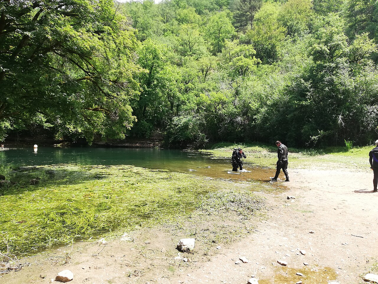
Résurgence de Cabouy
The main entrance to the flooded Ouysse river, a pool 20 to 25 m across in the Alzou valley about 3 km from Rocamadour, where the Ouysse begins its surface course.
Cabouy is reached by the small road that follows the Alzou valley from Rocamadour, over the col de Magès and past a house and the commune's pumping station. The resurgence pool is 20 to 25 m in diameter, with vegetation covering the bottom down to about 6 m.
A slope of debris leads to about 15 m at the gallery entrance and the conduit reaches 31 m at its porch. Divernet describes following a rope through near-zero visibility to the entrance, after which visibility improves and the passage opens into a large gallery. From the low point the floor rises to about 12 m some 275 m in and stays between 14 and 18 m to the 325 m mark, continuing towards Pou Meyssen.
Since 2012 a rope tied to a tree above the entrance links the surface to an anchor at -9 m, where the guideline laid in 2011-2014 starts; the line carries distance tags from Cabouy every 50 m.
環境
A large spring pool with weed in the shallows, a silty approach and a big river gallery beyond; seasonal floods.
コンディション
Typical only. Divernet describes near-zero visibility on the approach to the entrance improving inside; seasonal floods damage the guideline.
公表資料からの一般的な範囲であり、現在のコンディションではありません。
他のエントランス({n}) Réseau de l'Ouysse (Cabouy – Pou Meyssen)
方向確認用であり、ナビゲーション用ではありません。白抜きのドットはおおよその位置を示しています。
このページのすべての情報とその出典 (10)
| 情報 | ステータス | 出典 |
|---|---|---|
| The resurgence basin is 20 to 25 m in diameter and vegetation covers the bottom to about 6 m. | 確認済み | [1] |
| The debris slope reaches about 15 m at the gallery entrance; beyond the low point the passage lies between about 12 and 18 m for the first few hundred metres. | 確認済み | [1] |
| The conduit reaches 31 m at its entrance porch, the low point near Cabouy.Subaqua gives about 30 m. | 確認済み | [1] [2] |
| A rope from a tree above the entrance runs to an anchor at -9 m where the new guideline starts, with distance tags every 50 m.Installed 2012-2014; condition today not verified. | 確認済み | [2] |
| Divernet gives about 14 °C as the average water temperature in Lot caves.Regional average. | 報告済み | [3] |
| A rope is followed through zero visibility to the entrance, after which visibility improves greatly. | 報告済み | [3] |
| The approach passes a house and the pumping station the commune of Rocamadour built for its water supply; no access rules are stated. | 報告済み | [1] |
| Published at N 44°47'26" E 1°35'03". | 確認済み | [1] [4] |
| Published at N 44°47'26" E 1°35'03". | 確認済み | [1] [4] |
| The sources consulted publish no qualification, permit or registration requirement set by a land manager or access body for this site.Absence of a published rule, not confirmation that none exists. | 報告済み | [1] |
確認済み:直接開いた公式または一次情報源による記載。報告ベース:二次情報源のみによるもの。情報が競合:注釈に両方のバージョンを記載。最新情報でない可能性あり:確認できた最新の情報源が古い。
上記のソースをもとに、独自の言葉でまとめています。 修正を報告する