湧出口
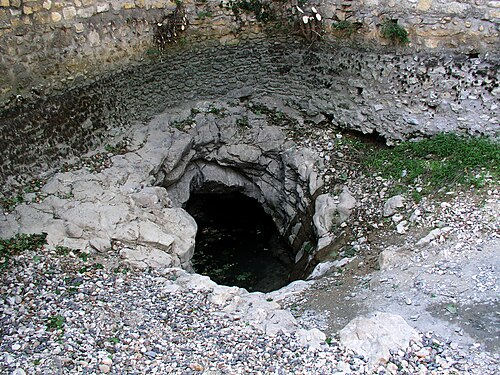
Goul de la Tannerie
The smaller of the two Gouls de Tourne in Bourg-Saint-Andéol: a long, low gallery that turns into a series of deep shafts, explored to 240 m depth in 2014.
The Tannerie entrance leads into a low gallery about 80 cm high and 3 m wide for the first 100 m, up to a canyon topped by an air bell, then a passage about 1 m high and 5 m wide to around 500 m. Beyond, the section becomes rounder until a shaft at about 700 m descends in vertical steps, looping completely in plan.
After about 926 m a further shaft plunges vertically, then at 60 degrees, and vertically again past 165 m and 200 m. The FFS fiche records successive pushes from 1972 onwards; Subaqua reported the 2014 extension to 240 m at nearly 1.5 km from the entrance.
環境
Initially a low, wide bedding-plane gallery with air bells; deeper, a fracture-guided network of shafts and steep slopes.
他のエントランス({n}) Gouls de Tourne
方向確認用であり、ナビゲーション用ではありません。白抜きのドットはおおよその位置を示しています。
このページのすべての情報とその出典 (6)
| 情報 | ステータス | 出典 |
|---|---|---|
| The main gallery is about 0.8 m high and 3 m wide for 0-100 m, about 1 m high and 5 m wide for 100-500 m, and a shaft begins at about 700 m. | 確認済み | [1] |
| Xavier Méniscus reached 240 m at nearly 1.5 km from the entrance on 8 June 2014. | 確認済み | [2] |
| Bollards close the valley; the mairie or technical services can open them with notice.Fiche undated. | 確認済み | [1] |
| Dives are to be reported to the gendarmerie before and after, by prefectural recommendation and at the commune's request.Fiche undated. | 確認済み | [1] |
| Published at N 44°22'11" E 4°38'31". | 確認済み | [1] |
| Published at N 44°22'11" E 4°38'31". | 確認済み | [1] |
確認済み:直接開いた公式または一次情報源による記載。報告ベース:二次情報源のみによるもの。情報が競合:注釈に両方のバージョンを記載。最新情報でない可能性あり:確認できた最新の情報源が古い。
上記のソースをもとに、独自の言葉でまとめています。 修正を報告する