용천
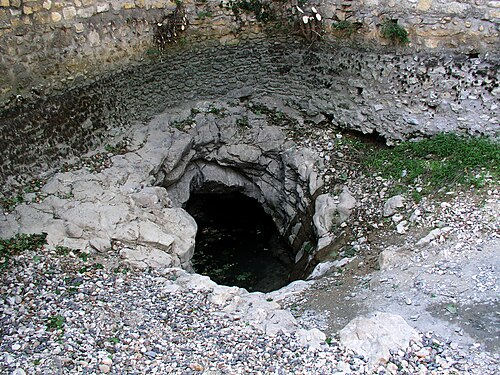
Goul de la Tannerie
The smaller of the two Gouls de Tourne in Bourg-Saint-Andéol: a long, low gallery that turns into a series of deep shafts, explored to 240 m depth in 2014.
The Tannerie entrance leads into a low gallery about 80 cm high and 3 m wide for the first 100 m, up to a canyon topped by an air bell, then a passage about 1 m high and 5 m wide to around 500 m. Beyond, the section becomes rounder until a shaft at about 700 m descends in vertical steps, looping completely in plan.
After about 926 m a further shaft plunges vertically, then at 60 degrees, and vertically again past 165 m and 200 m. The FFS fiche records successive pushes from 1972 onwards; Subaqua reported the 2014 extension to 240 m at nearly 1.5 km from the entrance.
환경
Initially a low, wide bedding-plane gallery with air bells; deeper, a fracture-guided network of shafts and steep slopes.
다른 입구: Gouls de Tourne
방향 파악용이며 내비게이션용이 아닙니다. 빈 점은 대략적인 위치입니다.
이 페이지의 모든 정보와 출처 (6)
| 정보 항목 | 상태 | 출처 |
|---|---|---|
| The main gallery is about 0.8 m high and 3 m wide for 0-100 m, about 1 m high and 5 m wide for 100-500 m, and a shaft begins at about 700 m. | 확인됨 | [1] |
| Xavier Méniscus reached 240 m at nearly 1.5 km from the entrance on 8 June 2014. | 확인됨 | [2] |
| Bollards close the valley; the mairie or technical services can open them with notice.Fiche undated. | 확인됨 | [1] |
| Dives are to be reported to the gendarmerie before and after, by prefectural recommendation and at the commune's request.Fiche undated. | 확인됨 | [1] |
| Published at N 44°22'11" E 4°38'31". | 확인됨 | [1] |
| Published at N 44°22'11" E 4°38'31". | 확인됨 | [1] |
확인됨: 직접 열람한 공식 또는 1차 출처에서 명시된 정보입니다. 보고됨: 2차 출처에서만 확인된 정보입니다. 출처 간 상충: 비고에 두 가지 내용이 모두 기재되어 있습니다. 최신 정보가 아닐 수 있음: 확인된 가장 최근 출처가 오래된 경우입니다.
위의 출처를 바탕으로 자체적으로 작성했습니다. 수정 사항 제보