どこで潜るか、いつ行くか、そして何に出会えるかを見つけよう。

どこで潜るか、いつ行くか、そして何に出会えるかを見つけよう。
★
メニュー
目的地 ダイブサイト マリンライフ 沈船 ニュース
トリップを計画する トリッププランナー ダイビングの時期 費用計算ツール 比較一覧 マリンライフカレンダー 水温 リブアボード オペレーター&リゾート 海洋公園 高気圧酸素治療施設 世界地図
ケーブダイビング 洞窟ダイビングすべて 目的地&ダイブサイト 洞窟システムとマップ トレーニングと資格 ダイビングセンター&ガイド 器材とテクノロジー 安全・インシデントリサーチ 科学・歴史・保全 リソースとアップデート
地域一覧 オーストラリア、ニュージーランド&東アジアカリブ海&西大西洋ヨーロッパ・大西洋・地中海インド洋・東アフリカ太平洋諸島&ミクロネシア紅海&中東東南アジア・コーラルトライアングル南北アメリカ・東太平洋 国・地域
学習&ツール 全ガイド ライセンス・資格 器材ガイド 動画 データに聞く AIエージェント API
このサイトについて 私たちについて 調査方法 免責事項 お問い合わせ
表示形式
★ 保存済み

スターをつけたダイビングエリア、スポット、マリンライフをこのブラウザに保存しています。

APIゲートウェイ

アトラスのキャッシュデータへの無料・読み取り専用JSONアクセス。

ダークモード

ガイドビュー
ダイビングを始めたばかりで、水深・流れ・ライセンスレベルについて知りたいですか?閲覧しながらすべての用語をわかりやすく解説しています。同じデータを、サポート付きでご覧いただけます。

エキスパートビュー
ウォールとドリフトダイブの違いはご存じのはず。データだけをシンプルに、速く、コンパクトに。これがデフォルト表示です。

インターフェース言語
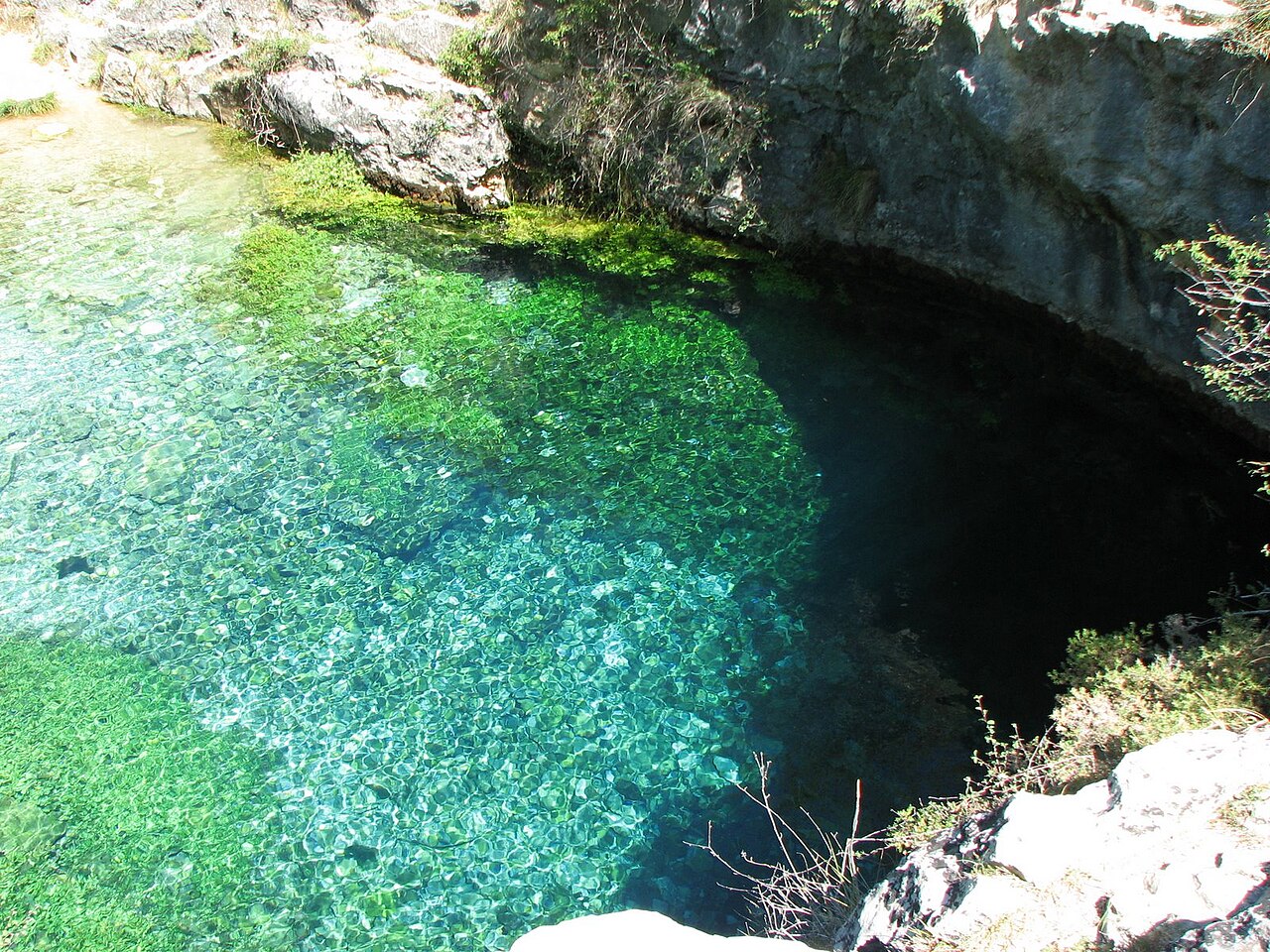
Pozo Azul at Covanera

Pozo Azul (spring pool)

泉〜 21 mPozo AzulSpain
写真: Dhoca73 · Public domain
アクセス状況は未確認 · 公開情報のとおり 2022 Listed by Showcaves as open without restriction and free to visit (2022 data); no published rules for diving were found. アクセスルールは変わることがあります。出発前に土地所有者または管理機関に必ず確認してください。
ドキュメント済み 別名: Pozo Azul de Covanera, Pozo Azul Burgos
入口の深度
未公開
よく潜られるエリア
未公開
このサイトの最大水深
21 m (69 ft)
公開カテゴリ
未公開
水温
11 °C

A small blue spring pool about 9 m across, a short walk from Covanera in the Rudrón valley, that is the entrance to the long Pozo Azul sump system.

Showcaves describes the spring as about 9 m in diameter and reached by a 300 m walk up a side valley from a small car park in Covanera; when that fills, larger car parks across the river add about 400 m of walking. It is not signposted.

Divers going into the cave follow the first sump, about 700 m long and around 21 m deep, before reaching air-filled passage.

環境

A clear spring pool leading into a flooded gallery; cold water.

設備

Small car park; larger car parks in the village across the river.

Pozo Azul (spring pool) 衛星画像:NASA Blue Marble

方向確認用であり、ナビゲーション用ではありません。白抜きのドットはおおよその位置を示しています。

情報源: [1] Showcaves.com ↗[2] Pegasus Caving Club ↗ · 確認済み 2026-10-14
このページのすべての情報とその出典 (8)
情報ステータス出典
Sump 1 is listed as 700 m long and 21 m deep. 報告済み [1]
Sump 1 is 700 m long followed by a 300 m deep-water canal. 確認済み [2]
Water temperature is listed as 11 °C. 報告済み [1]
Open with no restrictions and free (2022 data); the spring is not signposted and the small car park fills up. 報告済み [1]
A small car park lies 300 m from the pool; larger ones are across the river. 報告済み [1]
Listed at 42.735772, -3.795994. 報告済み [1]
The sources consulted publish no qualification, permit or registration requirement set by a land manager or access body for this site.Absence of a published rule, not confirmation that none exists. 報告済み [1]

確認済み:直接開いた公式または一次情報源による記載。報告ベース:二次情報源のみによるもの。情報が競合:注釈に両方のバージョンを記載。最新情報でない可能性あり:確認できた最新の情報源が古い。

上記のソースをもとに、独自の言葉でまとめています。 修正を報告する

オーストラリア、ニュージーランド&東アジア

Cairns & the Ribbon ReefsNingaloo ReefCoral Sea & Osprey ReefOkinawa & the Kerama IslandsPoor Knights IslandsTownsville & the YongalaGreen IslandIzu Peninsula

カリブ海&西大西洋

BonaireCozumelRiviera Maya & the CenotesBelize Barrier ReefGrand CaymanIsla Mujeres & CancúnRoatánTiger Beach & Grand Bahama

ヨーロッパ・大西洋・地中海

Malta & GozoSilfra & IcelandThe AzoresCanary IslandsLarnaca & the ZenobiaScapa FlowArctic NorwayMadeira

インド洋・東アフリカ

North & South Malé AtollsAri AtollBaa Atoll & Hanifaru BayAliwal Shoal & UmkomaasMafia IslandMauritiusSeychellesSodwana Bay

太平洋諸島&ミクロネシア

PalauChuuk (Truk) LagoonFakaravaKona, HawaiʻiRangiroaTaveuni & Rainbow ReefBeqa Lagoon & Pacific HarbourEspiritu Santo

紅海&中東

Sharm El Sheikh & Ras MohammedBrothers, Daedalus & St John'sDahabHurghada & El GounaMarsa Alam & the Deep SouthAqabaDaymaniyat IslandsMusandam Peninsula

東南アジア・コーラルトライアングル

Bali & Nusa PenidaKomodoRaja AmpatSipadan & MabulAnilaoCoronKoh TaoLembeh Strait

南北アメリカ・東太平洋

Galápagos IslandsCocos IslandFlorida KeysSea of Cortez & Cabo PulmoSocorro & the RevillagigedosBritish ColumbiaCalifornia Channel IslandsCosta Rica Pacific Coast