Blue Hole (Dahab)
The bowl is given as just over 100 m (Wikipedia) or 120 m (Circle Divers); the Arch's top is at about 52-55 m. No single maximum is given here.
A reef-rimmed marine sinkhole north of Dahab on the Gulf of Aqaba, over 100 m deep, linked to the open sea by a shallow saddle and by a deep tunnel called the Arch whose top lies at about 52-55 m.
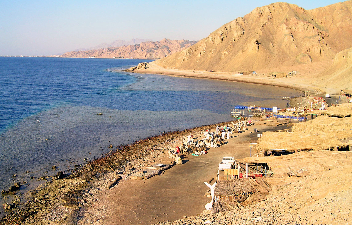
The Blue Hole is a submarine sinkhole in the reef about 10 km north of Dahab, on the Sinai coast of the Gulf of Aqaba. Its bowl drops to somewhere between 100 m and 120 m depending on the source. A shallow saddle at about 6-7 m connects it to the outer reef, and divers often enter via the Bells, a narrow chimney a short distance to the north.
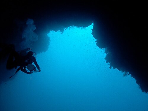
At depth a tunnel called the Arch, about 26 m long, links the hole to the open sea; its top lies at roughly 52-55 m and the floor falls away on the seaward side. Although the overhead section is short, its depth puts it outside recreational limits, and the site has a long history of fatal accidents among divers attempting it without the right training or gas.
A Dahab dive centre describes the Arch as a technical dive only, to be done by certified technical divers on a planned decompression dive with mixed gases and redundant equipment.
The Blue Hole lies in the Abu Galum Protected Area and draws more than 110,000 visitors a year. In 2026 Egypt's Ministry of Local Development and Environment reviewed a plan to reorganise the site, regulate marine activities and cap visitor numbers; no implementation timetable had been published.
Warum es wichtig ist
One of the Red Sea's best-known dive sites and the main documented overhead dive in Egypt. Its Arch is a short tunnel whose hazard comes chiefly from its depth.
Zugänge und Tauchplätze
Open-water entries from the shore over the saddle (about 6-7 m) or via the Bells chimney; the Arch is a deep tunnel to the open sea.
Zur Orientierung, nicht zur Navigation. Hohle Punkte sind ungefähre Angaben.
Alle Angaben auf dieser Seite mit Quellennachweis (8)
| Angabe | Status | Quelle |
|---|---|---|
| The Blue Hole lies about 10 km north of Dahab on the Gulf of Aqaba coast, in the Abu Galum Protected Area. | Gemeldet | [1] [2] |
| Area-level coordinates rounded from the published position of the Blue Hole north of Dahab. | Gemeldet | [3] [1] |
| The Blue Hole is described as just over 100 m deep by one source and 120 m deep by another. | Quellen widersprechen sich | [3] [1] |
| The Arch is a tunnel about 26 m long linking the hole to the open sea, with its top at roughly 52-55 m.Circle Divers gives the top as about 52 m and the depth as about 55 m; Wikipedia gives a 55 m ceiling. | Quellen widersprechen sich | [1] [3] |
| A shallow saddle at about 6-7 m connects the hole to the reef outside. | Gemeldet | [1] [3] |
| A Dahab dive centre states that the Arch is out of bounds for recreational divers and should only be attempted by certified technical divers on a planned decompression dive with a qualified technical centre.Provider statement; no official rule text found. | Gemeldet | [1] |
| The site receives more than 110,000 visitors a year for scuba diving, freediving and snorkelling. | Gemeldet | [2] |
| A 2026 plan reviewed by Egypt's Ministry of Local Development and Environment proposes regulating marine activities, upgrading facilities and capping visitor numbers according to carrying capacity; no timetable was published. | Gemeldet | [2] |
Verifiziert: von einer offiziellen oder primären Quelle bestätigt, die wir geöffnet haben. Gemeldet: nur aus einer Sekundärquelle. Quellen widersprechen sich: Die Anmerkung enthält beide Versionen. Möglicherweise veraltet: Die neueste von uns gefundene Quelle ist alt.
In eigenen Worten aus den oben genannten Quellen verfasst. Korrektur melden