Узнайте, где нырять, когда ехать и что вы можете увидеть.

Узнайте, где нырять, когда ехать и что вы можете увидеть.
★
Меню
Направления Места для дайвинга Морская жизнь Рэки Новости
Спланировать поездку Планировщик поездок Когда нырять Калькулятор стоимости Сравнения Календарь морской жизни Температура воды Liveaboard Операторы и курорты Морские парки Барокамеры Карта мира
Пещерный дайвинг Весь кейв-дайвинг Направления и дайв-сайты Пещерные системы и карты Обучение и квалификации Дайв-центры и гиды Снаряжение и технологии Безопасность и анализ инцидентов Наука, история и охрана природы Ресурсы и обновления
Регионы Австралия, Новая Зеландия и Восточная АзияКарибское море и Западная АтлантикаЕвропа, Атлантика и СредиземноморьеИндийский океан и Восточная АфрикаОстрова Тихого океана и МикронезияКрасное море и Ближний ВостокЮго-Восточная Азия и Коралловый треугольникАмерика и восточная часть Тихого океана Страны
Обучение и инструменты Все гиды Сертификации Гиды по снаряжению Видео Спросить данные ИИ-агенты API
О нас О нас Методология Отказ от ответственности Контакты
Ваш вид
★ Сохранено

Ваши избранные направления, дайв-сайты и виды, сохранённые в этом браузере.

API GATEWAY

Бесплатный доступ только для чтения к кешированным данным атласа в формате JSON.

Тёмный режим

Режим для новичков
Только начинаете нырять? Глубины, течения, уровни сертификации? Мы объясняем каждый термин прямо в процессе просмотра, простым языком. Те же данные, со встроенной помощью.

Экспертный режим
Вы и так знаете разницу между стенкой и дрейф-дайвом. Только данные: чисто, быстро и компактно. Это вид по умолчанию.

Язык интерфейса
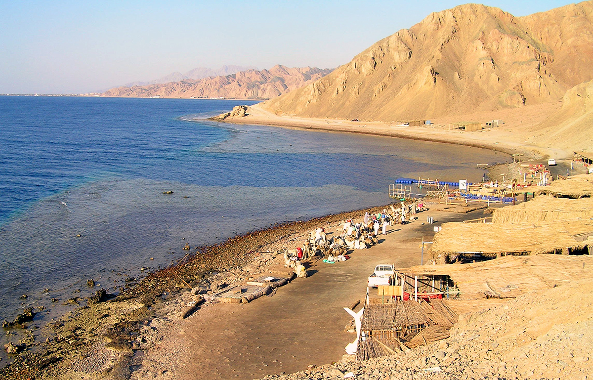
The Blue Hole at Dahab from the shore

Blue Hole (Dahab)

Голубая дыраEgypt, South Sinai
Фото: Ggerdel - Fotografía tomada por: Gustavo Gerdel · CC BY-SA 4.0
Открыто для сертифицированных дайверов, с ограничениями · согласно публикации 2026 Inside the Abu Galum Protected Area; dives are arranged through Dahab dive centres, which describe the Arch as technical-only. A 2026 government plan proposes regulating marine activities and capping visitor numbers. Правила доступа меняются: уточняйте у владельца территории или управляющего органа перед поездкой.
Задокументировано Также известен как: Dahab Blue Hole, Blue Hole Dahab, Blue Hole (Red Sea), The Arch, Blue Hole Arch
Задокументированная протяжённость
Не опубликовано
Задокументированная глубина
Не опубликовано
Входов в списке
1

The bowl is given as just over 100 m (Wikipedia) or 120 m (Circle Divers); the Arch's top is at about 52-55 m. No single maximum is given here.

A reef-rimmed marine sinkhole north of Dahab on the Gulf of Aqaba, over 100 m deep, linked to the open sea by a shallow saddle and by a deep tunnel called the Arch whose top lies at about 52-55 m.

The Blue Hole is a submarine sinkhole in the reef about 10 km north of Dahab, on the Sinai coast of the Gulf of Aqaba. Its bowl drops to somewhere between 100 m and 120 m depending on the source. A shallow saddle at about 6-7 m connects it to the outer reef, and divers often enter via the Bells, a narrow chimney a short distance to the north.

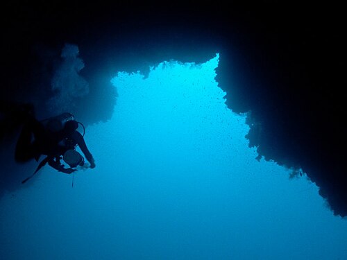
At depth a tunnel called the Arch, about 26 m long, links the hole to the open sea; its top lies at roughly 52-55 m and the floor falls away on the seaward side. Although the overhead section is short, its depth puts it outside recreational limits, and the site has a long history of fatal accidents among divers attempting it without the right training or gas.

A Dahab dive centre describes the Arch as a technical dive only, to be done by certified technical divers on a planned decompression dive with mixed gases and redundant equipment.

The Blue Hole lies in the Abu Galum Protected Area and draws more than 110,000 visitors a year. In 2026 Egypt's Ministry of Local Development and Environment reviewed a plan to reorganise the site, regulate marine activities and cap visitor numbers; no implementation timetable had been published.

Почему это важно

One of the Red Sea's best-known dive sites and the main documented overhead dive in Egypt. Its Arch is a short tunnel whose hazard comes chiefly from its depth.

Входы и дайв-сайты

Open-water entries from the shore over the saddle (about 6-7 m) or via the Bells chimney; the Arch is a deep tunnel to the open sea.
Blue Hole (Dahab)Blue Hole and the Arch, Dahab Спутник: NASA Blue Marble

Для общей ориентации, не для навигации. Незакрашенные точки обозначают приблизительное положение.

Источники: [1] Circle Divers ↗[2] Zawya ↗[3] Wikipedia ↗ · проверено 2026-10-14
Каждый факт на этой странице с указанием источника (8)
ФактСтатусИсточник
The Blue Hole lies about 10 km north of Dahab on the Gulf of Aqaba coast, in the Abu Galum Protected Area. Сообщалось [1] [2]
Area-level coordinates rounded from the published position of the Blue Hole north of Dahab. Сообщалось [3] [1]
The Blue Hole is described as just over 100 m deep by one source and 120 m deep by another. Источники расходятся [3] [1]
The Arch is a tunnel about 26 m long linking the hole to the open sea, with its top at roughly 52-55 m.Circle Divers gives the top as about 52 m and the depth as about 55 m; Wikipedia gives a 55 m ceiling. Источники расходятся [1] [3]
A shallow saddle at about 6-7 m connects the hole to the reef outside. Сообщалось [1] [3]
A Dahab dive centre states that the Arch is out of bounds for recreational divers and should only be attempted by certified technical divers on a planned decompression dive with a qualified technical centre.Provider statement; no official rule text found. Сообщалось [1]
The site receives more than 110,000 visitors a year for scuba diving, freediving and snorkelling. Сообщалось [2]
A 2026 plan reviewed by Egypt's Ministry of Local Development and Environment proposes regulating marine activities, upgrading facilities and capping visitor numbers according to carrying capacity; no timetable was published. Сообщалось [2]

Подтверждено: указано официальным или первичным источником, который мы открывали. Сообщается: только из вторичного источника. Источники расходятся: в примечании приведены обе версии. Может устареть: самый свежий найденный нами источник датирован давно.

Написано нашими словами на основе приведённых выше источников. Сообщить об ошибке

Австралия, Новая Зеландия и Восточная Азия

Cairns & the Ribbon ReefsNingaloo ReefCoral Sea & Osprey ReefOkinawa & the Kerama IslandsPoor Knights IslandsTownsville & the YongalaGreen IslandIzu Peninsula

Карибское море и Западная Атлантика

BonaireCozumelRiviera Maya & the CenotesBelize Barrier ReefGrand CaymanIsla Mujeres & CancúnRoatánTiger Beach & Grand Bahama

Европа, Атлантика и Средиземноморье

Malta & GozoSilfra & IcelandThe AzoresCanary IslandsLarnaca & the ZenobiaScapa FlowArctic NorwayMadeira

Индийский океан и Восточная Африка

North & South Malé AtollsAri AtollBaa Atoll & Hanifaru BayAliwal Shoal & UmkomaasMafia IslandMauritiusSeychellesSodwana Bay

Острова Тихого океана и Микронезия

PalauChuuk (Truk) LagoonFakaravaKona, HawaiʻiRangiroaTaveuni & Rainbow ReefBeqa Lagoon & Pacific HarbourEspiritu Santo

Красное море и Ближний Восток

Sharm El Sheikh & Ras MohammedBrothers, Daedalus & St John'sDahabHurghada & El GounaMarsa Alam & the Deep SouthAqabaDaymaniyat IslandsMusandam Peninsula

Юго-Восточная Азия и Коралловый треугольник

Bali & Nusa PenidaKomodoRaja AmpatSipadan & MabulAnilaoCoronKoh TaoLembeh Strait

Америка и восточная часть Тихого океана

Galápagos IslandsCocos IslandFlorida KeysSea of Cortez & Cabo PulmoSocorro & the RevillagigedosBritish ColumbiaCalifornia Channel IslandsCosta Rica Pacific Coast