Temukan tempat menyelam, waktu terbaik untuk pergi, dan apa yang bisa Anda lihat.

Temukan tempat menyelam, waktu terbaik untuk pergi, dan apa yang bisa Anda lihat.
★
Menu
Destinasi Lokasi Selam Kehidupan Laut Bangkai kapal Berita
Rencanakan perjalanan Perencana trip Kapan waktu terbaik menyelam Kalkulator biaya Perbandingan Kalender kehidupan laut Suhu air Liveaboard Operator & resor Taman laut Ruang hiperbarik Peta dunia
Selam gua Semua cave diving Destinasi & Lokasi Selam Sistem Cave & Peta Pelatihan & Kualifikasi Pusat Selam & Pemandu Peralatan & Teknologi Riset Keselamatan & Insiden Sains, Sejarah & Konservasi Sumber Daya & Pembaruan
Wilayah Australia, Selandia Baru & Asia TimurKaribia & Atlantik BaratEropa, Atlantik & MediteraniaSamudra Hindia & Afrika TimurKepulauan Pasifik & MikronesiaLaut Merah & Timur TengahAsia Tenggara & Segitiga Terumbu KarangAmerika & Pasifik Timur Negara
Pelajari & Alat Semua panduan Sertifikasi Panduan perlengkapan Video Tanya Data Agen AI API
Tentang Tentang kami Metodologi Penafian Kontak
Tampilan kamu
★ Tersimpan

Destinasi, situs, dan spesies yang kamu tandai bintang, tersimpan di browser ini.

API GATEWAY

Akses JSON gratis hanya-baca ke data cache atlas.

Mode gelap

Tampilan Terpandu
Baru menyelam? Kedalaman, arus, level sertifikasi? Kami menjelaskan setiap istilah saat kamu menjelajah, dalam bahasa yang mudah dipahami. Data yang sama, dengan bantuan yang sudah terintegrasi.

Tampilan Ahli
Kamu sudah tahu perbedaan antara wall dan drift dive. Cukup datanya: bersih, cepat, dan ringkas. Ini adalah tampilan default.

Bahasa antarmuka
Dean's Blue Hole

Dean's Blue Hole

Blue hole202 m dalamThe Bahamas, Long Island
Foto: Oceanwave77 · CC BY-SA 4.0
Status akses belum terverifikasi · sesuai yang dipublikasikan 2026-10-14 A beach-side blue hole reached on foot by a rocky path; the tourism ministry lists the Long Island Tourist Office as contact. No permit or diving rules are published. Aturan akses bisa berubah: konfirmasikan dengan pemilik lahan atau otoritas pengelola sebelum Anda berangkat.
Terdokumentasi Juga dikenal sebagai: Deans Blue Hole, Dean's Hole
Panjang yang telah disurvei
Tidak diterbitkan
Kedalaman terdokumentasi
202 m (663 ft)
Pintu masuk yang tercantum
1
Visibilitas
10–50 m

Not a linear cave; the published dimensions are the surface opening (about 45 x 55 m) and the chamber (at least 100 m across). The tourism ministry and the Grand Bahama Museum give 663 ft (about 202 m); Vertical Blue gives 203 m.

A coastal blue hole near Clarence Town on Long Island, about 200 m deep, that opens below a narrow neck into a cavern at least 100 m across. It is best known as the venue of the Vertical Blue freediving competition.

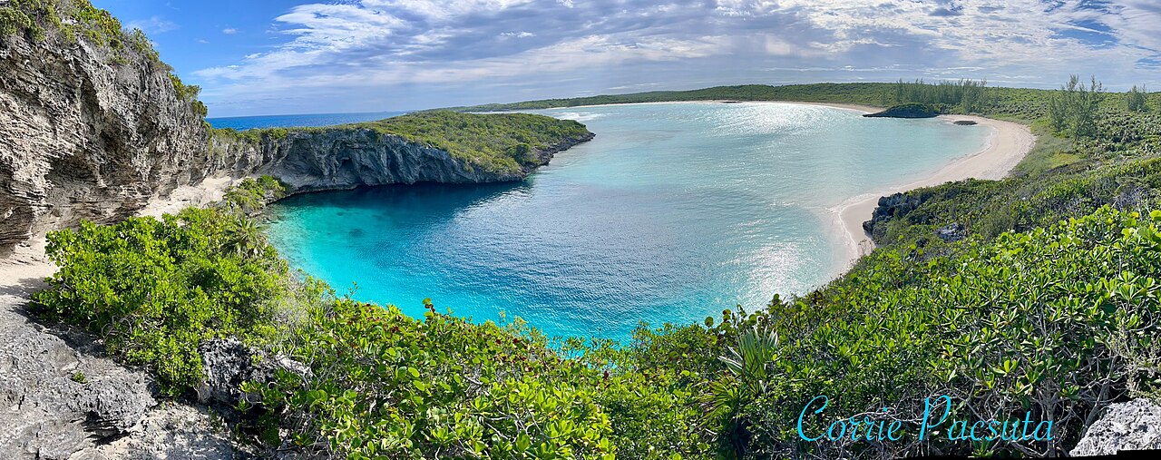
Dean's Blue Hole sits in a sheltered bay next to a beach on Long Island, ringed on three sides by rock walls. At the surface it measures roughly 45 by 55 m, narrows to a series of ledges at 10 to 15 m, and then opens into a huge chamber that the freediving organiser Vertical Blue describes as at least 100 m in diameter.

With a depth usually given as about 202-203 m, it is among the deepest known blue holes; the Grand Bahama Museum and Vertical Blue call it the second deepest blue hole in the world, while the Bahamas tourism ministry says third deepest. How it formed is still debated, since it is much deeper than most Caribbean blue holes.

The site is used mainly for freediving and snorkelling. It hosts the annual Vertical Blue freediving competition, and the water is sheltered from swell and current. No cave penetration route or land-manager diving rules are published.

Geologi

Vertical Blue notes that the origin of the hole is unresolved; one hypothesis is that a much deeper cave migrated upward as its ceiling collapsed over time.

Kondisi

Vertical Blue describes no current or waves inside the hole and visibility of roughly 10 to 50 m. Tarpon, turtles and reef fish visit the entrance area.

Rentang tipikal dari sumber yang dipublikasikan, bukan kondisi saat ini.

Pintu masuk dan lokasi selam

One open entrance from a public beach and lagoon.
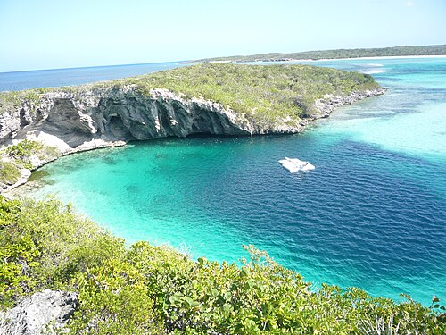
Dean's Blue HoleDean's Blue Hole Satelit: NASA Blue Marble

Untuk orientasi, bukan navigasi. Titik kosong menunjukkan posisi perkiraan.

Sumber: [1] The Islands of The Bahamas (Bahamas Ministry of Tourism) ↗[2] Vertical Blue ↗[3] Grand Bahama Museum ↗[4] GeoNames ↗ · telah diperiksa 2026-10-14
Setiap fakta di halaman ini, beserta sumbernya (7)
FaktaStatusSumber
Dean's Blue Hole is about 663 ft (202 m) deep.Vertical Blue gives 203 m. Ranking conflicts: Vertical Blue and the Grand Bahama Museum say second deepest; the tourism ministry says third. Dilaporkan [1] [3] [2]
The hole measures about 45 x 55 m at the surface, narrows to about 25 x 35 m with ledges at 10-15 m, then opens into a cavern at least 100 m in diameter.Freediving organiser's description. Dilaporkan [2]
Visibility is about 10 to 50 m.Freediving organiser's figure; typical, not current. Dilaporkan [2]
The annual Vertical Blue freediving competition is held at the hole. Terverifikasi [1] [2]
Visitors reach the hole by a rocky path from the beach; contact is the Long Island Tourist Office.No permit or diving rules listed. Terverifikasi [1]
The formation of the hole is not fully understood; one hypothesis is upward migration of a deeper cave by roof collapse. Dilaporkan [2]
Area coordinates are those of Clarence Town in the GeoNames gazetteer; the Grand Bahama Museum places the hole in Clarence Town.Settlement-level; the hole lies close to the town. Dilaporkan [4] [3]

Terverifikasi: dinyatakan oleh sumber resmi atau sumber primer yang kami buka langsung. Dilaporkan: hanya dari sumber sekunder. Sumber berbeda pendapat: catatan menyajikan kedua versi. Mungkin sudah kedaluwarsa: sumber terbaru yang kami temukan sudah lama.

Ditulis dengan kata-kata kami sendiri berdasarkan sumber di atas. Laporkan koreksi

Australia, Selandia Baru & Asia Timur

Cairns & the Ribbon ReefsNingaloo ReefCoral Sea & Osprey ReefOkinawa & the Kerama IslandsPoor Knights IslandsTownsville & the YongalaGreen IslandIzu Peninsula

Karibia & Atlantik Barat

BonaireCozumelRiviera Maya & the CenotesBelize Barrier ReefGrand CaymanIsla Mujeres & CancúnRoatánTiger Beach & Grand Bahama

Eropa, Atlantik & Mediterania

Malta & GozoSilfra & IcelandThe AzoresCanary IslandsLarnaca & the ZenobiaScapa FlowArctic NorwayMadeira

Samudra Hindia & Afrika Timur

North & South Malé AtollsAri AtollBaa Atoll & Hanifaru BayAliwal Shoal & UmkomaasMafia IslandMauritiusSeychellesSodwana Bay

Kepulauan Pasifik & Mikronesia

PalauChuuk (Truk) LagoonFakaravaKona, HawaiʻiRangiroaTaveuni & Rainbow ReefBeqa Lagoon & Pacific HarbourEspiritu Santo

Laut Merah & Timur Tengah

Sharm El Sheikh & Ras MohammedBrothers, Daedalus & St John'sDahabHurghada & El GounaMarsa Alam & the Deep SouthAqabaDaymaniyat IslandsMusandam Peninsula

Asia Tenggara & Segitiga Terumbu Karang

Bali & Nusa PenidaKomodoRaja AmpatSipadan & MabulAnilaoCoronKoh TaoLembeh Strait

Amerika & Pasifik Timur

Galápagos IslandsCocos IslandFlorida KeysSea of Cortez & Cabo PulmoSocorro & the RevillagigedosBritish ColumbiaCalifornia Channel IslandsCosta Rica Pacific Coast