Dean's Blue Hole
Not a linear cave; the published dimensions are the surface opening (about 45 x 55 m) and the chamber (at least 100 m across). The tourism ministry and the Grand Bahama Museum give 663 ft (about 202 m); Vertical Blue gives 203 m.
A coastal blue hole near Clarence Town on Long Island, about 200 m deep, that opens below a narrow neck into a cavern at least 100 m across. It is best known as the venue of the Vertical Blue freediving competition.
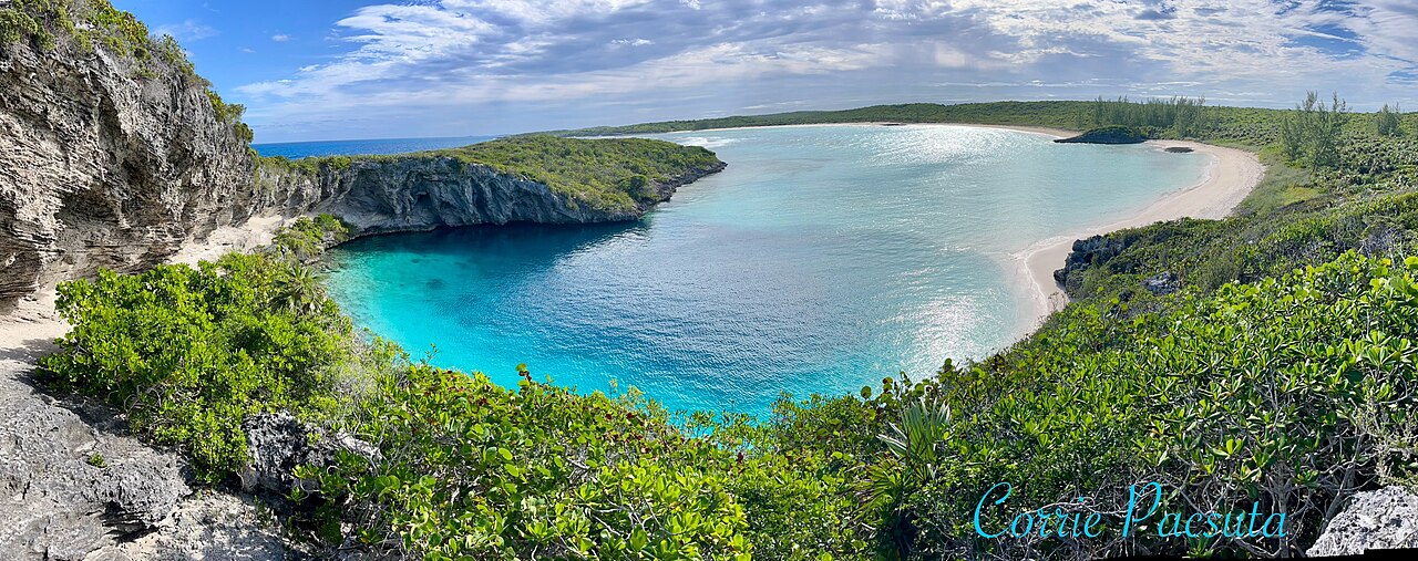
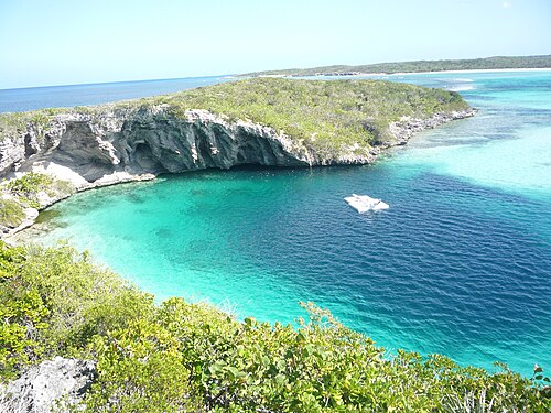
Dean's Blue Hole sits in a sheltered bay next to a beach on Long Island, ringed on three sides by rock walls. At the surface it measures roughly 45 by 55 m, narrows to a series of ledges at 10 to 15 m, and then opens into a huge chamber that the freediving organiser Vertical Blue describes as at least 100 m in diameter.
With a depth usually given as about 202-203 m, it is among the deepest known blue holes; the Grand Bahama Museum and Vertical Blue call it the second deepest blue hole in the world, while the Bahamas tourism ministry says third deepest. How it formed is still debated, since it is much deeper than most Caribbean blue holes.
The site is used mainly for freediving and snorkelling. It hosts the annual Vertical Blue freediving competition, and the water is sheltered from swell and current. No cave penetration route or land-manager diving rules are published.
地質学
Vertical Blue notes that the origin of the hole is unresolved; one hypothesis is that a much deeper cave migrated upward as its ceiling collapsed over time.
コンディション
Vertical Blue describes no current or waves inside the hole and visibility of roughly 10 to 50 m. Tarpon, turtles and reef fish visit the entrance area.
公表資料からの一般的な範囲であり、現在のコンディションではありません。
入口とダイブサイト
One open entrance from a public beach and lagoon.
方向確認用であり、ナビゲーション用ではありません。白抜きのドットはおおよその位置を示しています。
このページのすべての情報とその出典 (7)
| 情報 | ステータス | 出典 |
|---|---|---|
| Dean's Blue Hole is about 663 ft (202 m) deep.Vertical Blue gives 203 m. Ranking conflicts: Vertical Blue and the Grand Bahama Museum say second deepest; the tourism ministry says third. | 報告済み | [1] [3] [2] |
| The hole measures about 45 x 55 m at the surface, narrows to about 25 x 35 m with ledges at 10-15 m, then opens into a cavern at least 100 m in diameter.Freediving organiser's description. | 報告済み | [2] |
| Visibility is about 10 to 50 m.Freediving organiser's figure; typical, not current. | 報告済み | [2] |
| The annual Vertical Blue freediving competition is held at the hole. | 確認済み | [1] [2] |
| Visitors reach the hole by a rocky path from the beach; contact is the Long Island Tourist Office.No permit or diving rules listed. | 確認済み | [1] |
| The formation of the hole is not fully understood; one hypothesis is upward migration of a deeper cave by roof collapse. | 報告済み | [2] |
| Area coordinates are those of Clarence Town in the GeoNames gazetteer; the Grand Bahama Museum places the hole in Clarence Town.Settlement-level; the hole lies close to the town. | 報告済み | [4] [3] |
確認済み:直接開いた公式または一次情報源による記載。報告ベース:二次情報源のみによるもの。情報が競合:注釈に両方のバージョンを記載。最新情報でない可能性あり:確認できた最新の情報源が古い。
上記のソースをもとに、独自の言葉でまとめています。 修正を報告する