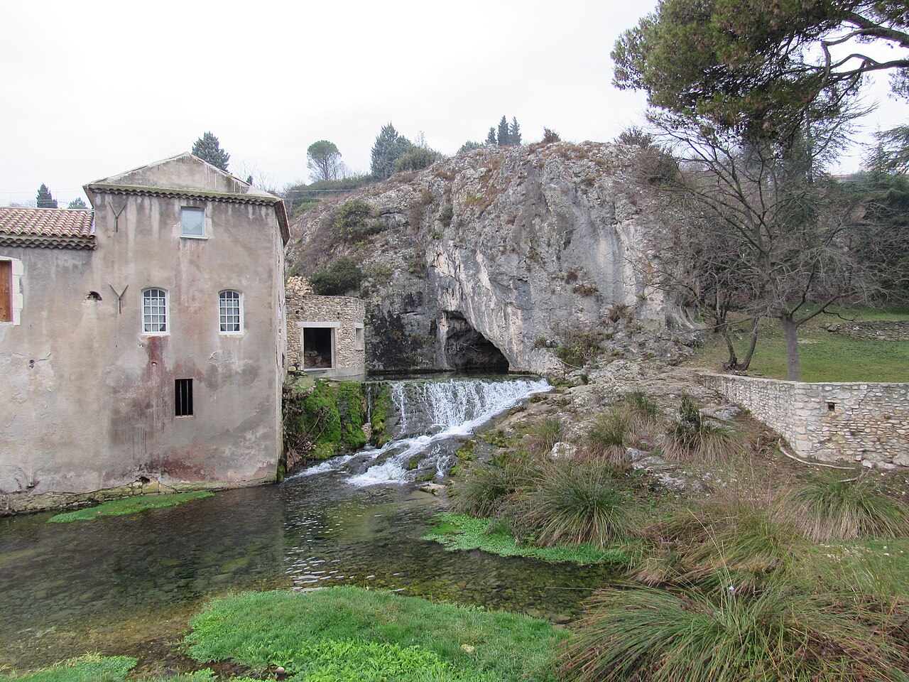
Gouls de Tourne
240 m in the Goul de la Tannerie (Xavier Méniscus, 8 June 2014, per Subaqua n°257). The Goul du Pont reaches 185 m (2006).
Two deep resurgences about 50 m apart in the Tourne quarter of Bourg-Saint-Andéol, draining the Saint-Remèze plateau. The Goul de la Tannerie has been explored to 240 m depth about 1.5 km in, and the Goul du Pont to 185 m.
The Gouls de Tourne are two springs, the Goul du Pont and the Goul de la Tannerie, that emerge beside an ancient wash-house (lavoir antique) signposted together with a carving of the god Mithras in Bourg-Saint-Andéol. Both drain the limestone plateau of Saint-Remèze, and a dye trace from the Pascaloune cave 7.5 km away showed a direct link to both.
The Goul de la Tannerie opens with a long, low gallery, under 1 m high for its first 100 m and wider beyond, before a shaft at about 700 m drops in steps and the conduit continues to a series of deep pits. Swiss, French and British divers progressively extended it from the 1970s; Rick Stanton reached 220 m in 2008, and in June 2014 Xavier Méniscus added 60 m of line to reach 240 m at nearly 1.5 km from the entrance on a 10.5-hour dive.
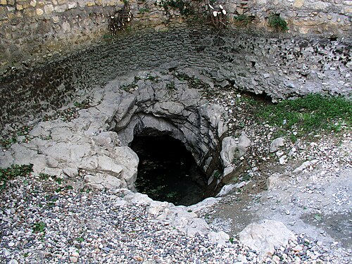
The Goul du Pont has a pool that slopes down to a restriction at 12 m, then a gallery to a vertical shaft and a succession of steps and pits. After its entrance was blocked by cobbles for more than 15 years, a team cleared it in 2002, and divers later reached 185 m about 575 m from the entrance.
The gouls are places for highly experienced deep cave divers. The commune controls vehicle access to the small valley with bollards, and the prefecture and commune ask that every dive be reported to the gendarmerie before and after.
Geologia
The conduits follow the dominant fracture directions of the area; the FFS fiche notes the strong influence of major faults on the layout of the flooded network.
Água, fluxo e inundações
Both springs share the same catchment, the Saint-Remèze plateau, confirmed by a dye trace from the Pascaloune cave 7.5 km to the north-west.
Por que isso importa
Among the deepest explored resurgences in France, used for record-depth exploration dives since the 1980s.
Histórico de levantamento topográfico e exploração
| 1972 | The GEPS (Marseille) reaches 40 m depth 730 m into the Goul de la Tannerie. [1] |
| 1982 | Bertrand Léger reaches 113 m at 1,020 m in the Tannerie in solo trimix dives. [1] |
| 1996 | Olivier Isler and a Franco-Swiss team reach 165 m in the Tannerie. [1] |
| 2002-05 | The Fils d'Ariane team clears the blocked entrance of the Goul du Pont. [2] |
| 2006-04 | Xavier Méniscus reaches 185 m in the Goul du Pont. [2] |
| 2008-05 | Rick Stanton, supported by John Volanthen, reaches 220 m in the Tannerie. [1] |
| 2014-06-08 | Xavier Méniscus extends the Tannerie to 240 m, nearly 1.5 km from the entrance. [3] |
Entradas e pontos de mergulho
Two entrances, the Goul de la Tannerie and the Goul du Pont, about 50 m apart.
Para orientação, não para navegação. Pontos vazados marcam posições aproximadas.
Cada informação desta página, com sua fonte (8)
| Informação | Status | Fonte |
|---|---|---|
| On 8 June 2014 Xavier Méniscus laid 60 m of extra line beyond Rick Stanton's -220 m terminus in the Goul de la Tannerie, reaching 240 m about 1.5 km from the entrance. | Verificado | [3] |
| Rick Stanton, assisted by John Volanthen, reached -220 m in the Tannerie in May 2008. | Verificado | [1] |
| In the Goul du Pont, Xavier Méniscus reached -185 m in April 2006; the fiche also gives a stop at -185 m 575 m from the entrance. | Verificado | [2] |
| The two gouls share the Saint-Remèze plateau catchment, and a dye trace from the Pascaloune cave 7.5 km away showed a direct link. | Verificado | [1] [2] |
| Valley access is closed by bollards that the mairie or technical services can release with reasonable notice; the key is not handed out directly.Fiche undated. | Verificado | [1] |
| Dives must be reported to the Bourg-Saint-Andéol gendarmerie before and after immersion, by prefectural recommendation and at the commune's request.Fiche undated; check current practice locally. | Verificado | [1] |
| Both gouls are published at N 44°22'11" E 4°38'31". | Verificado | [1] [2] |
| Both gouls are published at N 44°22'11" E 4°38'31". | Verificado | [1] [2] |
Verificado: declarado por uma fonte oficial ou primária que consultamos. Relatado: proveniente apenas de uma fonte secundária. Fontes divergem: a nota apresenta as duas versões. Pode estar desatualizado: a fonte mais recente que encontramos é antiga.
Escrito com nossas próprias palavras a partir das fontes acima. Reportar uma correção