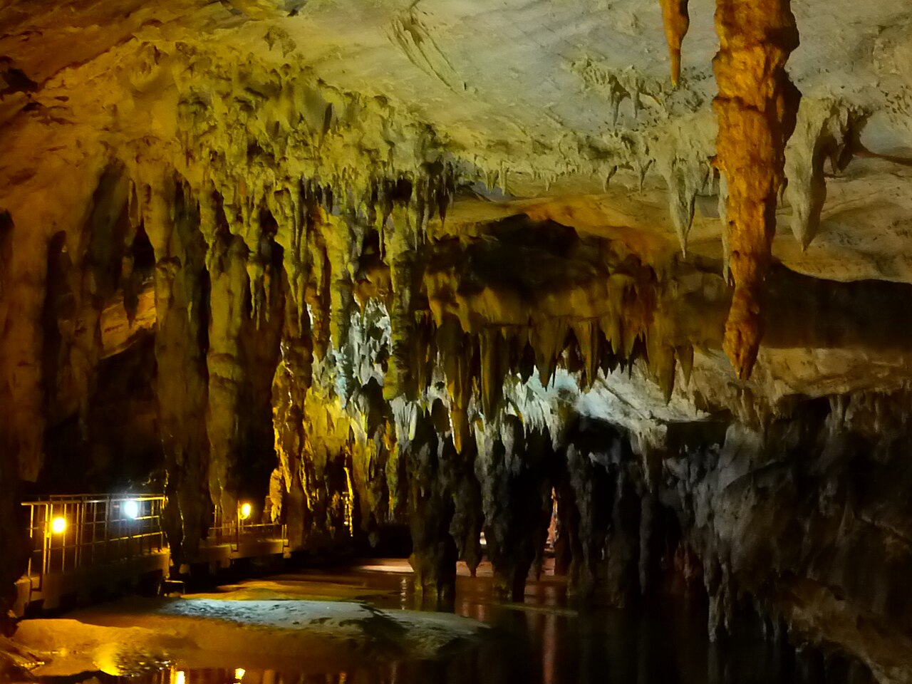
Maaras resurgence (Aggitis Cave)
Development after the August 2010 expedition per Pascal Reilé; earlier totals were 8,544 m (1997), 10,040 m and 10,550 m (2008). Deepest point reached in the S4 bis side sump in 2010 (low passage at -68 m about 1,000 m into the sump).
A large river resurgence at the foot of the Falakro massif in Drama, northern Greece, partly developed as a show cave. Franco-Greek teams have followed its river through a series of sumps; the cave measured 11,800 m after the 2010 expedition.
The Maaras resurgence emerges from marble of the Falakro massif on the edge of the Drama plain. A fluorescein trace injected in the Great Katavothre (swallow hole) at Ohiron reached the spring after 26 h 40 min, over a distance of 9,000 m and a drop of 376 m.
French cavers led by hydrogeologist Pascal Reilé began diving here in 1978 with Greek partners, passing a short first sump into dry passage. The authorities of the prefecture later drove an access tunnel that bypasses the entrance sump, and a road tunnel built in 1983 exposed a palaeontological deposit in an old fossil outlet of the cave. By 1983 the explorers had found 4,280 m of passage.
Local authorities opened part of the cave to visitors in 1992. In 1997 the team obtained a limited exploration permit in a dossier that involved archaeology, the university and the Ministry of Culture, and passed further sumps to a confluence about 5,871 m in, where a warm and a cold tributary meet. Later expeditions in 2000-2008 extended the terminal sumps, and in August 2010 Luigi Casati dived a side sump 3,000 m from the entrance for 1,130 m to 68 m depth, bringing the cave to 11,800 m.
The sumps lie deep inside the cave beyond long carries and are reached only by expedition teams working under permit.
Geologie
The cave is developed in marbles on the south-western flank of the Falakro anticline, between grabens that formed the Drama and Serres plains.
Water, stroming en overstromingen
Gauging by the regional agriculture and irrigation office in 1985-1986 gave a mean discharge of about 10 m³/s, a maximum flood flow of 31 m³/s and a minimum of 0.3 m³/s. The two tributaries at the confluence differ in temperature (about 16.5 °C and 12 °C). In August 2010 the side sump dived carried about 1 m³/s, roughly double previous years.
Waarom het belangrijk is
One of the longest explored river caves in Greece, with palaeontological and archaeological deposits and a show-cave section.
Omstandigheden
Temperatures measured in the tributaries in 1997-2010; flow varies widely with season and floods.
Gebruikelijke ranges uit gepubliceerde bronnen, geen actuele omstandigheden.
Survey- en verkenningsgeschiedenis
| 1978 | Pascal Reilé and Vincent Cordier pass the 8 m first sump and survey 300 m of dry passage beyond. [2] |
| 1983 | Sump 4 is passed; 4,280 m of passage is known. [2] |
| 1992 | Local authorities develop part of the cave for public visits. [3] |
| 1997 | Under a limited permit the team reaches a confluence at 5,871 m and surveys 8,544 m. [3] |
| 2010-08 | Luigi Casati dives the S4 bis side sump for 1,130 m to -63 m with a low point at -68 m; the cave reaches 11,800 m. [1] |
Ingangen en duiklocaties
One natural entrance (the resurgence) plus an artificial access tunnel; the first part is a show cave.
Er zijn nog geen afzonderlijke ingangen vermeld voor dit systeem.
Elk gegeven op deze pagina, met zijn bron (9)
| Gegeven | Status | Bron |
|---|---|---|
| The Maaras cave (Aggitis Cave) now develops 11,800 m after the 2010 expedition. | Geverifieerd | [1] |
| The 11,800 m figure follows the August 2010 dives. | Geverifieerd | [1] |
| The S4 bis side sump was dived for 1,130 m to -63 m with a low passage at -68 m about 1,000 m in. | Geverifieerd | [1] |
| Gaugings in 1985-1986 gave a mean discharge of 10 m³/s, a flood maximum of 31 m³/s and a low-water minimum of 0.3 m³/s. | Geverifieerd | [3] |
| The warm and cold tributaries measured about 16.5 °C and 12 °C; the 2010 side sump was 12 °C. | Geverifieerd | [1] [3] |
| By 1983, 4,280 m had been discovered; in 1997 the team surveyed 8,544 m to a confluence at 5,871 m. | Geverifieerd | [2] [3] |
| Local authorities developed part of the cave for visits in 1992; exploration in 1997 proceeded under a limited authorisation in a dossier involving archaeology, the university and the ministry.Most recent access information found dates from the 2010 report. | Mogelijk verouderd | [3] |
| Exploration requires authorisation. | Mogelijk verouderd | [2] [3] |
| A dye trace with 1 kg of fluorescein from the Grande Katavothre of Ohiron took 26 h 40 min over 9,000 m and a 376 m drop. | Geverifieerd | [3] |
Geverifieerd: vermeld door een officiële of primaire bron die we hebben geraadpleegd. Gemeld: alleen afkomstig van een secundaire bron. Bronnen spreken elkaar tegen: de noot geeft beide versies. Mogelijk verouderd: de nieuwste bron die we hebben gevonden is oud.
In eigen woorden geschreven op basis van bovenstaande bronnen. Een correctie melden