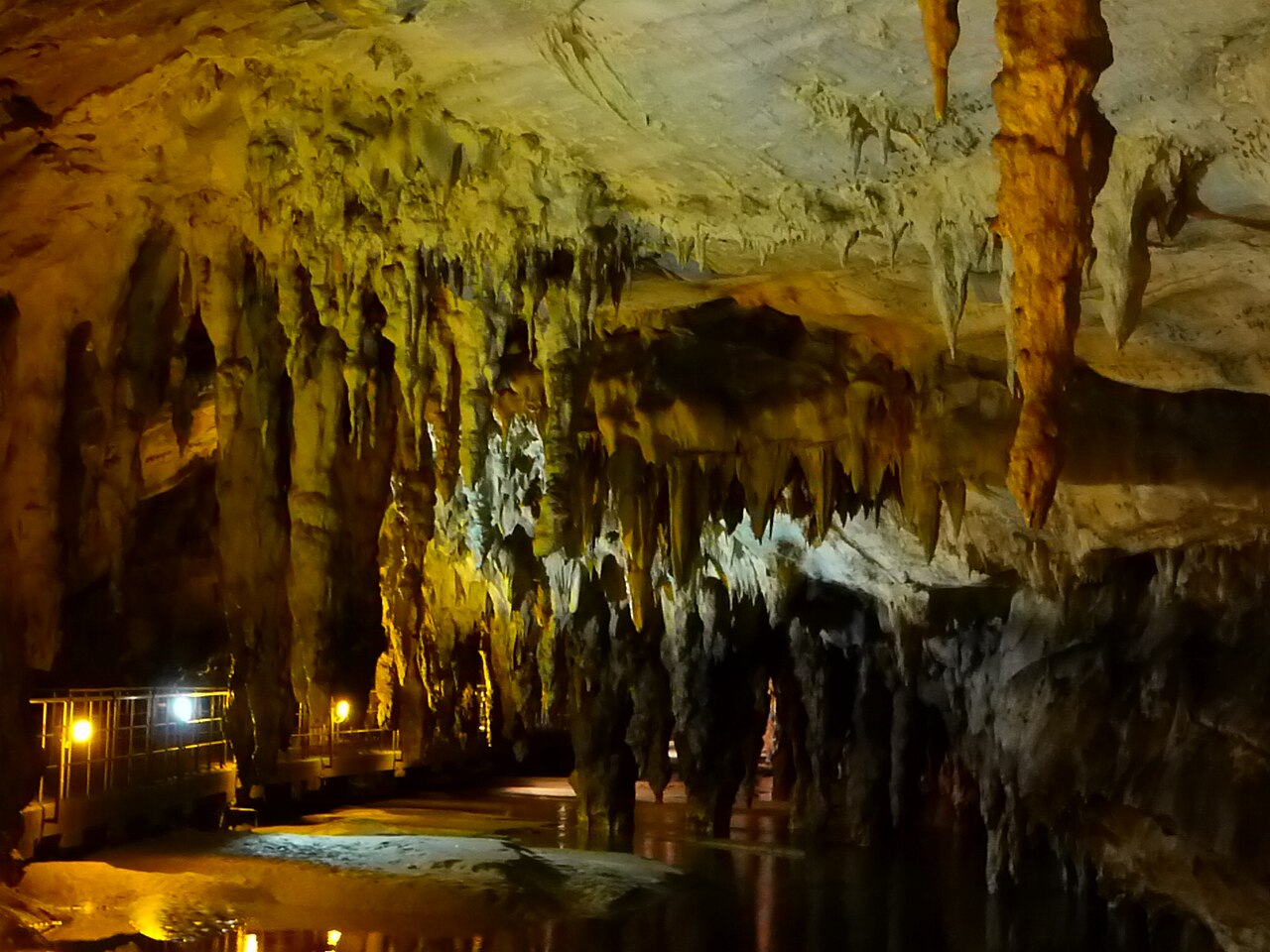
Maaras resurgence (Aggitis Cave)
Development after the August 2010 expedition per Pascal Reilé; earlier totals were 8,544 m (1997), 10,040 m and 10,550 m (2008). Deepest point reached in the S4 bis side sump in 2010 (low passage at -68 m about 1,000 m into the sump).
A large river resurgence at the foot of the Falakro massif in Drama, northern Greece, partly developed as a show cave. Franco-Greek teams have followed its river through a series of sumps; the cave measured 11,800 m after the 2010 expedition.
The Maaras resurgence emerges from marble of the Falakro massif on the edge of the Drama plain. A fluorescein trace injected in the Great Katavothre (swallow hole) at Ohiron reached the spring after 26 h 40 min, over a distance of 9,000 m and a drop of 376 m.
French cavers led by hydrogeologist Pascal Reilé began diving here in 1978 with Greek partners, passing a short first sump into dry passage. The authorities of the prefecture later drove an access tunnel that bypasses the entrance sump, and a road tunnel built in 1983 exposed a palaeontological deposit in an old fossil outlet of the cave. By 1983 the explorers had found 4,280 m of passage.
Local authorities opened part of the cave to visitors in 1992. In 1997 the team obtained a limited exploration permit in a dossier that involved archaeology, the university and the Ministry of Culture, and passed further sumps to a confluence about 5,871 m in, where a warm and a cold tributary meet. Later expeditions in 2000-2008 extended the terminal sumps, and in August 2010 Luigi Casati dived a side sump 3,000 m from the entrance for 1,130 m to 68 m depth, bringing the cave to 11,800 m.
The sumps lie deep inside the cave beyond long carries and are reached only by expedition teams working under permit.
地质
The cave is developed in marbles on the south-western flank of the Falakro anticline, between grabens that formed the Drama and Serres plains.
水况、水流与洪水
Gauging by the regional agriculture and irrigation office in 1985-1986 gave a mean discharge of about 10 m³/s, a maximum flood flow of 31 m³/s and a minimum of 0.3 m³/s. The two tributaries at the confluence differ in temperature (about 16.5 °C and 12 °C). In August 2010 the side sump dived carried about 1 m³/s, roughly double previous years.
为何重要
One of the longest explored river caves in Greece, with palaeontological and archaeological deposits and a show-cave section.
环境条件
Temperatures measured in the tributaries in 1997-2010; flow varies widely with season and floods.
典型范围来自已发表资料,不代表当前实际状况。
测量与探索历史
| 1978 | Pascal Reilé and Vincent Cordier pass the 8 m first sump and survey 300 m of dry passage beyond. [2] |
| 1983 | Sump 4 is passed; 4,280 m of passage is known. [2] |
| 1992 | Local authorities develop part of the cave for public visits. [3] |
| 1997 | Under a limited permit the team reaches a confluence at 5,871 m and surveys 8,544 m. [3] |
| 2010-08 | Luigi Casati dives the S4 bis side sump for 1,130 m to -63 m with a low point at -68 m; the cave reaches 11,800 m. [1] |
入口与潜点
One natural entrance (the resurgence) plus an artificial access tunnel; the first part is a show cave.
该系统暂无单独入口的相关信息。
本页所有信息及其来源 (9)
| 信息条目 | 状态 | 来源 |
|---|---|---|
| The Maaras cave (Aggitis Cave) now develops 11,800 m after the 2010 expedition. | 已核实 | [1] |
| The 11,800 m figure follows the August 2010 dives. | 已核实 | [1] |
| The S4 bis side sump was dived for 1,130 m to -63 m with a low passage at -68 m about 1,000 m in. | 已核实 | [1] |
| Gaugings in 1985-1986 gave a mean discharge of 10 m³/s, a flood maximum of 31 m³/s and a low-water minimum of 0.3 m³/s. | 已核实 | [3] |
| The warm and cold tributaries measured about 16.5 °C and 12 °C; the 2010 side sump was 12 °C. | 已核实 | [1] [3] |
| By 1983, 4,280 m had been discovered; in 1997 the team surveyed 8,544 m to a confluence at 5,871 m. | 已核实 | [2] [3] |
| Local authorities developed part of the cave for visits in 1992; exploration in 1997 proceeded under a limited authorisation in a dossier involving archaeology, the university and the ministry.Most recent access information found dates from the 2010 report. | 信息可能已过时 | [3] |
| Exploration requires authorisation. | 信息可能已过时 | [2] [3] |
| A dye trace with 1 kg of fluorescein from the Grande Katavothre of Ohiron took 26 h 40 min over 9,000 m and a 376 m drop. | 已核实 | [3] |
已核实:来自我们直接查阅的官方或主要来源。已报告:仅来自二手来源。来源存在冲突:注释中列出两种版本。可能已过时:我们找到的最新来源已有一定年代。
由我们根据上述来源以自己的文字整理撰写。 提交更正