Descubra onde mergulhar, quando ir e o que poderá ver.

Descubra onde mergulhar, quando ir e o que poderá ver.
★
Menu
Destinos Pontos de Mergulho Vida Marinha Naufrágios Notícias
Planejar uma viagem Planejador de viagem Quando mergulhar Calculadora de custos Comparações Calendário de vida marinha Temperatura da água Liveaboards Operadores & resorts Parques marinhos Câmaras hiperbáricas Mapa mundial
Mergulho em cavernas Todo o mergulho em cavernas Destinos e Pontos de Mergulho Sistemas de Cavernas e Mapas Formação e qualificações Centros de Mergulho e Guias Equipamento e Tecnologia Pesquisa de segurança e incidentes Ciência, história e conservação Recursos e atualizações
Regiões Austrália, Nova Zelândia e Ásia OrientalCaribe e Atlântico OcidentalEuropa, Atlântico & MediterrâneoOceano Índico e África OrientalIlhas do Pacífico & MicronésiaMar Vermelho & Médio OrienteSudeste Asiático e Triângulo de CoralAs Américas e o Pacífico Oriental Países
Aprender e Ferramentas Todos os guias Certificações Guias de equipamento Vídeos Consulte os Dados Agentes de IA API
Sobre Sobre nós Metodologia Aviso legal Contato
A sua vista
★ Guardado

Os seus destinos, pontos de mergulho e espécies favoritos, guardados neste browser.

API GATEWAY

Acesso JSON gratuito e só de leitura aos dados em cache do atlas.

Modo escuro

Vista Guiada
Novo no mergulho? Profundidades, correntes, níveis de certificação? Explicamos cada termo enquanto navegas, em linguagem simples. Os mesmos dados, com a ajuda incluída.

Vista de Especialista
Já sabe a diferença entre uma parede e um drift dive. Apenas os dados: limpos, rápidos e compactos. Esta é a vista predefinida.

Idioma da interface
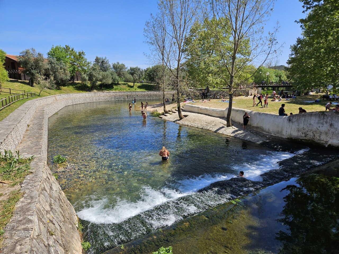
Olhos de Água do Alviela

Olhos de Água do Alviela

Foto: GualdimG · CC BY-SA 4.0
Estado do acesso não verificado · conforme publicado 2002 The expedition's Portuguese partners obtained the necessary authorisations; no current public access rule for diving was found. As regras de acesso mudam: confirme com o proprietário ou a autoridade responsável antes de viajar.
Documentado Também conhecido como: Alviela spring, Nascente do Alviela, Olhos d'Água do Alviela, Alviela
Extensão mapeada
Não publicado
Profundidade documentada
125 m (410 ft)
Entradas listadas
0
Temperatura da água
17 °C
Mapeamento e exploração
FFESSM Commission nationale de plongée souterraine (CNPS), Portuguese cavers (Filipe Worsdell, Olímpio Martins, Piotr Gajek, José António Crispim)

1,370 m surveyed during the CNPS-FFESSM expedition; total cave length not stated. Reached during the CNPS-FFESSM expedition, more than 700 m from the entrance.

The main karst spring of the river Alviela at the foot of the Monsanto syncline in central Portugal, once tapped for Lisbon's water supply. A French-Portuguese expedition surveyed 1,370 m and reached 125 m depth.

The Olhos de Água do Alviela rise at the foot of the Monsanto syncline and drain most of the Planalto de Santo António karst plateau, with part of the water thought to come from the Mira-Minde polje to the north-east. In the early twentieth century the spring was captured and linked by aqueduct to Lisbon, though it was later replaced by other sources.

The flooded cave descends as a sizeable gallery, 4 to 8 m across in places, with side branches. Patrick Jolivet reached about 580 m and 98 m depth in 1988. A national cave-diving commission (CNPS) expedition of the FFESSM, organised with Portuguese cavers who handled accommodation, re-lining and authorisations, re-equipped the line, surveyed 1,370 m including about 200 m of new passage, and stopped at 125 m depth more than 700 m from the entrance.

The account notes a water temperature of about 17 °C and a depigmented crayfish seen 140 m into a side passage.

Água, fluxo e inundações

The spring drains the Planalto de Santo António; tracing work cited by the expedition indicates that part of the water comes from the Mira-Minde polje.

Por que isso importa

A major Portuguese karst spring, historically part of Lisbon's water supply, and the deepest documented cave dive in the sources found for Portugal.

Condições

Visibility on some dives in side passages dropped to 0.5-1.5 m on the return.

Faixas típicas de fontes publicadas, não as condições atuais.

Histórico de levantamento topográfico e exploração

1988Patrick Jolivet reaches about 580 m from the entrance at -98 m. [1]
2002A CNPS-FFESSM expedition with Portuguese cavers re-lines and surveys 1,370 m and reaches -125 m. [1]

Entradas e pontos de mergulho

One entrance, the spring pool; the expedition rigged a tyrolean to move equipment to the pool edge and a rope deviation for the last pitch.

Ainda não há entradas individuais listadas para este sistema.

Fontes: [1] plongeesout.ffspeleo.fr ↗[2] plongeesout.ffspeleo.fr ↗ · verificado 2026-10-14
Cada informação desta página, com sua fonte (7)
InformaçãoStatusFonte
The expedition's deepest dive stopped at -125 m more than 700 m from the entrance. Verificado [1]
The expedition produced 1,370 m of survey and about 200 m of new passage with a maximum depth of -125 m. Verificado [1]
Patrick Jolivet's 1988 terminus was at about 580 m and -98 m. Verificado [1]
The expedition is filed on the FFS site as the 2002 FFESSM account; the text says the CNPS adopted the project in September 2002.Exact expedition dates are not stated in the account. Reportado [1]
The account mentions water at about 17 °C. Verificado [1]
The spring drains most of the Planalto de Santo António, with part of the water coming from the Mira-Minde polje; it was captured for Lisbon's water supply by an aqueduct built early in the twentieth century. Verificado [1]
Portuguese partners handled accommodation, re-equipping the cave and the authorisations for the expedition. Pode estar desatualizado [1]

Verificado: declarado por uma fonte oficial ou primária que consultamos. Relatado: proveniente apenas de uma fonte secundária. Fontes divergem: a nota apresenta as duas versões. Pode estar desatualizado: a fonte mais recente que encontramos é antiga.

Escrito com nossas próprias palavras a partir das fontes acima. Reportar uma correção

Austrália, Nova Zelândia e Ásia Oriental

Cairns & the Ribbon ReefsNingaloo ReefCoral Sea & Osprey ReefOkinawa & the Kerama IslandsPoor Knights IslandsTownsville & the YongalaGreen IslandIzu Peninsula

Caribe e Atlântico Ocidental

BonaireCozumelRiviera Maya & the CenotesBelize Barrier ReefGrand CaymanIsla Mujeres & CancúnRoatánTiger Beach & Grand Bahama

Europa, Atlântico & Mediterrâneo

Malta & GozoSilfra & IcelandThe AzoresCanary IslandsLarnaca & the ZenobiaScapa FlowArctic NorwayMadeira

Oceano Índico e África Oriental

North & South Malé AtollsAri AtollBaa Atoll & Hanifaru BayAliwal Shoal & UmkomaasMafia IslandMauritiusSeychellesSodwana Bay

Ilhas do Pacífico & Micronésia

PalauChuuk (Truk) LagoonFakaravaKona, HawaiʻiRangiroaTaveuni & Rainbow ReefBeqa Lagoon & Pacific HarbourEspiritu Santo

Mar Vermelho & Médio Oriente

Sharm El Sheikh & Ras MohammedBrothers, Daedalus & St John'sDahabHurghada & El GounaMarsa Alam & the Deep SouthAqabaDaymaniyat IslandsMusandam Peninsula

Sudeste Asiático e Triângulo de Coral

Bali & Nusa PenidaKomodoRaja AmpatSipadan & MabulAnilaoCoronKoh TaoLembeh Strait

As Américas e o Pacífico Oriental

Galápagos IslandsCocos IslandFlorida KeysSea of Cortez & Cabo PulmoSocorro & the RevillagigedosBritish ColumbiaCalifornia Channel IslandsCosta Rica Pacific Coast