Узнайте, где нырять, когда ехать и что вы можете увидеть.

Узнайте, где нырять, когда ехать и что вы можете увидеть.
★
Меню
Направления Места для дайвинга Морская жизнь Рэки Новости
Спланировать поездку Планировщик поездок Когда нырять Калькулятор стоимости Сравнения Календарь морской жизни Температура воды Liveaboard Операторы и курорты Морские парки Барокамеры Карта мира
Пещерный дайвинг Весь кейв-дайвинг Направления и дайв-сайты Пещерные системы и карты Обучение и квалификации Дайв-центры и гиды Снаряжение и технологии Безопасность и анализ инцидентов Наука, история и охрана природы Ресурсы и обновления
Регионы Австралия, Новая Зеландия и Восточная АзияКарибское море и Западная АтлантикаЕвропа, Атлантика и СредиземноморьеИндийский океан и Восточная АфрикаОстрова Тихого океана и МикронезияКрасное море и Ближний ВостокЮго-Восточная Азия и Коралловый треугольникАмерика и восточная часть Тихого океана Страны
Обучение и инструменты Все гиды Сертификации Гиды по снаряжению Видео Спросить данные ИИ-агенты API
О нас О нас Методология Отказ от ответственности Контакты
Ваш вид
★ Сохранено

Ваши избранные направления, дайв-сайты и виды, сохранённые в этом браузере.

API GATEWAY

Бесплатный доступ только для чтения к кешированным данным атласа в формате JSON.

Тёмный режим

Режим для новичков
Только начинаете нырять? Глубины, течения, уровни сертификации? Мы объясняем каждый термин прямо в процессе просмотра, простым языком. Те же данные, со встроенной помощью.

Экспертный режим
Вы и так знаете разницу между стенкой и дрейф-дайвом. Только данные: чисто, быстро и компактно. Это вид по умолчанию.

Язык интерфейса
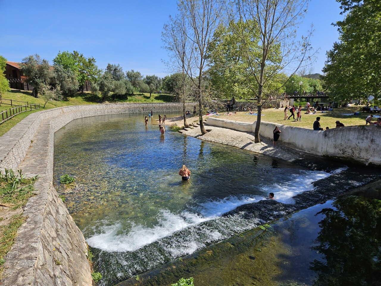
Olhos de Água do Alviela

Olhos de Água do Alviela

Фото: GualdimG · CC BY-SA 4.0
Статус доступа не подтверждён · согласно публикации 2002 The expedition's Portuguese partners obtained the necessary authorisations; no current public access rule for diving was found. Правила доступа меняются: уточняйте у владельца территории или управляющего органа перед поездкой.
Задокументировано Также известен как: Alviela spring, Nascente do Alviela, Olhos d'Água do Alviela, Alviela
Задокументированная протяжённость
Не опубликовано
Задокументированная глубина
125 m (410 ft)
Входов в списке
0
Температура воды
17 °C
Съёмка и исследование
FFESSM Commission nationale de plongée souterraine (CNPS), Portuguese cavers (Filipe Worsdell, Olímpio Martins, Piotr Gajek, José António Crispim)

1,370 m surveyed during the CNPS-FFESSM expedition; total cave length not stated. Reached during the CNPS-FFESSM expedition, more than 700 m from the entrance.

The main karst spring of the river Alviela at the foot of the Monsanto syncline in central Portugal, once tapped for Lisbon's water supply. A French-Portuguese expedition surveyed 1,370 m and reached 125 m depth.

The Olhos de Água do Alviela rise at the foot of the Monsanto syncline and drain most of the Planalto de Santo António karst plateau, with part of the water thought to come from the Mira-Minde polje to the north-east. In the early twentieth century the spring was captured and linked by aqueduct to Lisbon, though it was later replaced by other sources.

The flooded cave descends as a sizeable gallery, 4 to 8 m across in places, with side branches. Patrick Jolivet reached about 580 m and 98 m depth in 1988. A national cave-diving commission (CNPS) expedition of the FFESSM, organised with Portuguese cavers who handled accommodation, re-lining and authorisations, re-equipped the line, surveyed 1,370 m including about 200 m of new passage, and stopped at 125 m depth more than 700 m from the entrance.

The account notes a water temperature of about 17 °C and a depigmented crayfish seen 140 m into a side passage.

Вода, течение и паводки

The spring drains the Planalto de Santo António; tracing work cited by the expedition indicates that part of the water comes from the Mira-Minde polje.

Почему это важно

A major Portuguese karst spring, historically part of Lisbon's water supply, and the deepest documented cave dive in the sources found for Portugal.

Условия

Visibility on some dives in side passages dropped to 0.5-1.5 m on the return.

Типичные диапазоны из опубликованных источников, не текущие условия.

История картирования и исследований

1988Patrick Jolivet reaches about 580 m from the entrance at -98 m. [1]
2002A CNPS-FFESSM expedition with Portuguese cavers re-lines and surveys 1,370 m and reaches -125 m. [1]

Входы и дайв-сайты

One entrance, the spring pool; the expedition rigged a tyrolean to move equipment to the pool edge and a rope deviation for the last pitch.

Отдельные входы в эту систему пока не указаны.

Источники: [1] plongeesout.ffspeleo.fr ↗[2] plongeesout.ffspeleo.fr ↗ · проверено 2026-10-14
Каждый факт на этой странице с указанием источника (7)
ФактСтатусИсточник
The expedition's deepest dive stopped at -125 m more than 700 m from the entrance. Подтверждено [1]
The expedition produced 1,370 m of survey and about 200 m of new passage with a maximum depth of -125 m. Подтверждено [1]
Patrick Jolivet's 1988 terminus was at about 580 m and -98 m. Подтверждено [1]
The expedition is filed on the FFS site as the 2002 FFESSM account; the text says the CNPS adopted the project in September 2002.Exact expedition dates are not stated in the account. Сообщалось [1]
The account mentions water at about 17 °C. Подтверждено [1]
The spring drains most of the Planalto de Santo António, with part of the water coming from the Mira-Minde polje; it was captured for Lisbon's water supply by an aqueduct built early in the twentieth century. Подтверждено [1]
Portuguese partners handled accommodation, re-equipping the cave and the authorisations for the expedition. Может быть устаревшим [1]

Подтверждено: указано официальным или первичным источником, который мы открывали. Сообщается: только из вторичного источника. Источники расходятся: в примечании приведены обе версии. Может устареть: самый свежий найденный нами источник датирован давно.

Написано нашими словами на основе приведённых выше источников. Сообщить об ошибке

Австралия, Новая Зеландия и Восточная Азия

Cairns & the Ribbon ReefsNingaloo ReefCoral Sea & Osprey ReefOkinawa & the Kerama IslandsPoor Knights IslandsTownsville & the YongalaGreen IslandIzu Peninsula

Карибское море и Западная Атлантика

BonaireCozumelRiviera Maya & the CenotesBelize Barrier ReefGrand CaymanIsla Mujeres & CancúnRoatánTiger Beach & Grand Bahama

Европа, Атлантика и Средиземноморье

Malta & GozoSilfra & IcelandThe AzoresCanary IslandsLarnaca & the ZenobiaScapa FlowArctic NorwayMadeira

Индийский океан и Восточная Африка

North & South Malé AtollsAri AtollBaa Atoll & Hanifaru BayAliwal Shoal & UmkomaasMafia IslandMauritiusSeychellesSodwana Bay

Острова Тихого океана и Микронезия

PalauChuuk (Truk) LagoonFakaravaKona, HawaiʻiRangiroaTaveuni & Rainbow ReefBeqa Lagoon & Pacific HarbourEspiritu Santo

Красное море и Ближний Восток

Sharm El Sheikh & Ras MohammedBrothers, Daedalus & St John'sDahabHurghada & El GounaMarsa Alam & the Deep SouthAqabaDaymaniyat IslandsMusandam Peninsula

Юго-Восточная Азия и Коралловый треугольник

Bali & Nusa PenidaKomodoRaja AmpatSipadan & MabulAnilaoCoronKoh TaoLembeh Strait

Америка и восточная часть Тихого океана

Galápagos IslandsCocos IslandFlorida KeysSea of Cortez & Cabo PulmoSocorro & the RevillagigedosBritish ColumbiaCalifornia Channel IslandsCosta Rica Pacific Coast