California Channel Islands
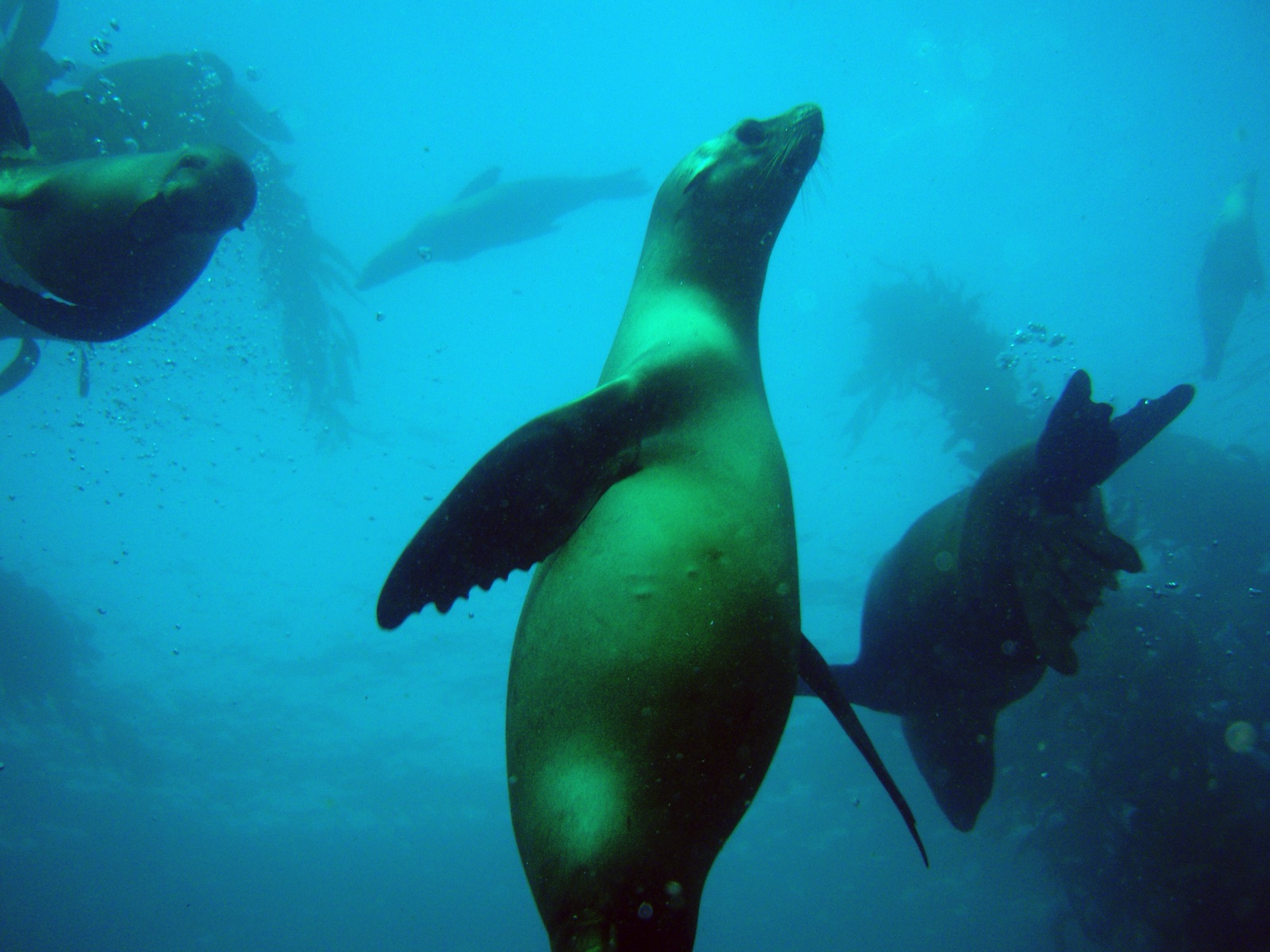
California's Channel Islands rise from the cold Pacific off Los Angeles and Santa Barbara, wrapped in giant kelp forests that function as underwater sequoia groves. Five northern islands form a national park and marine sanctuary; Catalina, to the south, adds an easy shore-diving hub at Avalon's Casino Point. Sea lions, garibaldi, lobster, and the amber light through the canopy define the diving - cool water, thick wetsuits or drysuits, and some of the most distinctive scenery in the sport.
Почему здесь стоит нырять
Kelp diving is its own discipline, and nowhere teaches it better. Giant kelp grows tens of meters from reef to surface, and drifting through the columns with sunlight shafting down remains one of diving's great sensations - part forest, part cathedral. The islands ladder up in wildness: Catalina offers the gentle, fish-tame Casino Point park and the offshore pinnacle of Farnsworth Bank with its protected purple hydrocoral; Anacapa and Santa Cruz give kelp walls, sea caves (Painted Cave is among the world's largest), and sea lion colonies; the outer islands run colder, sharkier, and richer. Marine reserves established in 2003 have visibly fattened the lobster and sheephead populations. Fall is the payoff season - 20 C-plus water at Catalina, 15-25 m visibility, and calm crossings. Spring blooms turn the water green and feed everything. Between garibaldi flashing orange against the blue, sea lions strafing the safety stop, and the occasional giant sea bass looming out of the kelp, California diving makes its case quickly.
По месяцам
Diveable year-round; late summer through fall (August-November) brings the warmest water and best visibility. March-May is plankton-bloom season: green water, rich life. Winter is clear but cool with more weather cancellations.
| Месяц | Вода | Видимость | Как это выглядит |
|---|---|---|---|
| January●●●○○ | 12–15 °C / 54–59 °F | 8–18 m | Cool and often clear between storms. |
| February●●●○○ | 12–15 °C / 54–59 °F | 6–15 m | |
| March●●○○○ | 12–15 °C / 54–59 °F | 5–12 m | Plankton bloom begins: green water, busy reef. |
| April●●○○○ | 13–16 °C / 55–61 °F | 5–12 m | |
| May●●●○○ | 14–17 °C / 57–63 °F | 6–15 m | |
| June●●●○○ | 15–18 °C / 59–64 °F | 8–18 m | |
| July●●●●○ | 16–19 °C / 61–66 °F | 10–20 m | |
| August●●●●○ | 17–21 °C / 63–70 °F | 12–20 m | Warmest water of the year at Catalina. |
| September●●●●● | 17–21 °C / 63–70 °F | 15–25 m | The classic month: warm, clear, calm. |
| October●●●●● | 16–20 °C / 61–68 °F | 15–25 m | |
| November●●●●○ | 14–18 °C / 57–64 °F | 12–22 m | |
| December●●●○○ | 13–16 °C / 55–61 °F | 10–20 m |
Достоверность месячных данных: Documented. Месяцы без строки не имеют верифицированных данных. Мы предпочтём показать пробел, а не придумать данные.
Места для дайвинга (5)
| Место | Тип | Глубина | Уровень | Доступ | |
|---|---|---|---|---|---|
| Casino Point Dive Park (Catalina) Stairway-entry kelp forest, fearless garibaldi, protected lobster herds… | Kelp forest | 5–28 m | Beginner | Shore | |
| Cathedral Cove (Anacapa Island) Sunlit kelp columns, tame reserve-zone marine life, sea lion and seal… | Kelp forest | 5–18 m | Beginner | Boat | |
| Farnsworth Bank Purple hydrocoral gardens, open-water pelagic chances, Catalina's wild… | Seamount | 18–40 m | Advanced | Boat | |
| Painted Cave (Santa Cruz Island) A monumental sea-cave entrance, sea lion flybys in the beam of blue light | Cave | 5–18 m | Intermediate | Boat | |
| Santa Barbara Island Sea Lion Rookery Pup swarms in the shallows, all-day bottom time, the archipelago's quietest… | Kelp forest | 5–20 m | Beginner | Boat |
Морская жизнь, вокруг которой можно строить планы
California Sea Lion
Blue Shark
Mola Mola (Ocean Sunfish)
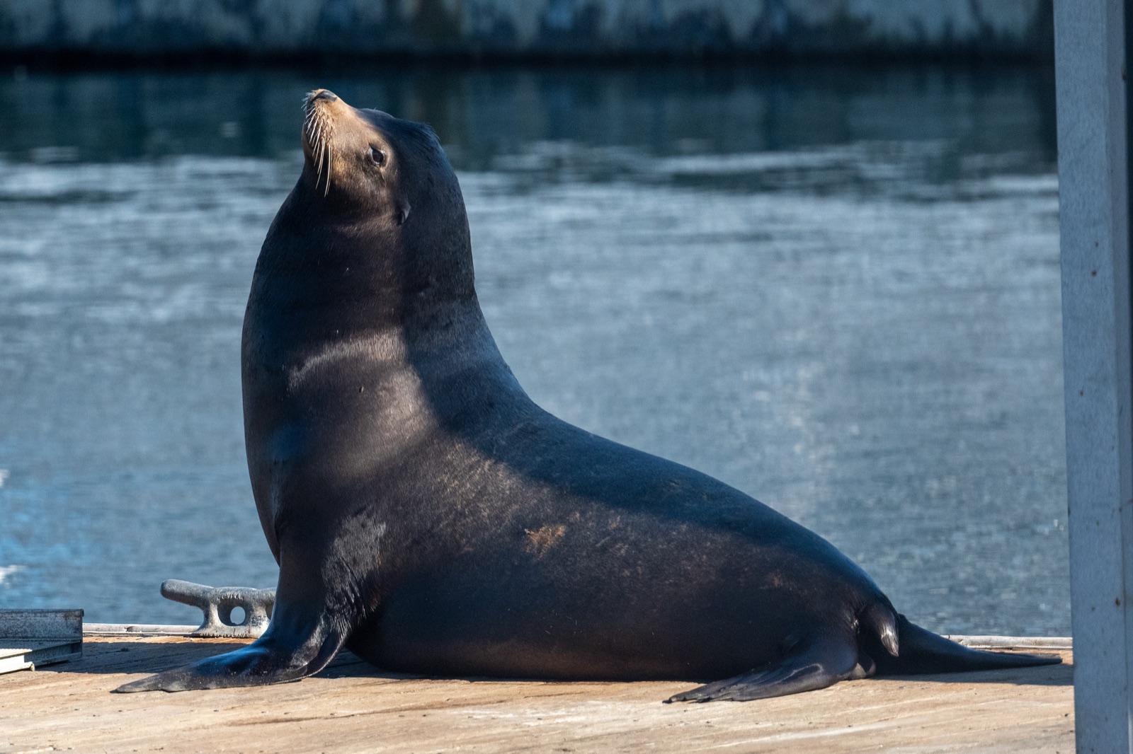
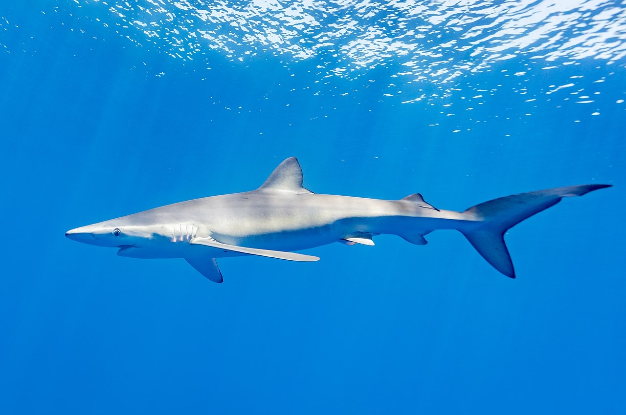
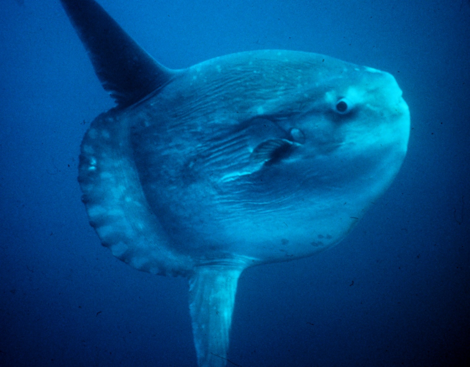
California sea lions and harbor seals, garibaldi, kelp bass, sheephead, spiny lobster, bat rays, nudibranchs including the Spanish shawl, giant sea bass making a slow comeback, mola mola offshore, and dense baitfish in the kelp.
Как добраться и где остановиться
Как добраться: Dive boats leave Ventura, Santa Barbara, San Pedro, and Long Beach for the islands (1-3 hour crossings, many as overnight liveaboard-style trips). Catalina is reached by hourly ferries to Avalon, with Casino Point a short walk from the landing.
Где остановиться: Avalon on Catalina works for a car-free shore-diving weekend; for the northern islands you sleep aboard the boat or day-trip from Ventura.
Расходы: Multi-dive boat trips from Ventura, Santa Barbara, and the Los Angeles ports typically run about US$140-200; Casino Point shore diving costs only air fills and gear. California requires a fishing license and report card only if you hunt - most divers dive the reserves and take nothing.
Между погружениями: Channel Islands National Park hikes and kayaking, whale watching (gray whales in winter, blues and humpbacks in summer), and Avalon's 1920s casino-town charm.
Снорклинг: Casino Point and Avalon's Lover's Cove snorkel well in summer; the kelp canopy is best appreciated with at least a thick wetsuit.
Безопасность и практические советы
Опасности: Kelp entanglement for the unpracticed, surge on exposed reefs, boat traffic at Casino Point's boundaries, cold water, and current at the offshore pinnacles. Crossings to the outer islands can be rough.
Carry a cutting tool and learn the kelp crawl before you need it; never bolt for the surface through canopy. Thick exposure protection (7 mm or drysuit) is standard and affects weighting - check buoyancy on dive one. Emergencies go through 911, the dive fleet's oxygen kits, and DAN.
Ближайшая рекомпрессионная камера: The USC hyperbaric chamber at Big Fisherman's Cove on Catalina has served Southern California divers for decades; availability changes, so emergencies route through 911 and DAN.