
Costa Rica Pacific Coast
Costa Rica's Pacific coast trades coral gardens for volume: bull sharks at the Bat Islands, devil ray squadrons and seasonal giant mantas at the Catalina Islands, and the fish-stacked pinnacles of Cano Island off the Osa Peninsula. Guanacaste's beach towns in the north and Drake Bay in the south serve as bases, with warm surface water, cool green upwellings, and two humpback whale migrations sharing the calendar. It is rich, surgy, plankton-fed diving - closer in spirit to the Galapagos than to the Caribbean.
ここでダイビングする理由
This coast rewards divers who care more about animals than about visibility. The Big Scare at the Bat Islands is one of the few places in the world with reliable, unbaited bull shark diving - big females circling divers kneeling at 25-30 m, no cage, no chum, May through November. The Catalinas, minutes from the Flamingo and Tamarindo beaches, run on rays: mobulas in strings, spotted eagle rays, and in the cooler months genuine giant mantas over the cleaning rocks. South at Cano Island, protected since 1978, Bajo del Diablo piles white-tipped reef sharks, turtles, and barracuda walls onto granite pinnacles in the year's clearest water. Humpbacks from both hemispheres visit - northern whales roughly December-March, southern whales July-October - so whale song underwater is a normal part of the season. Surface intervals happen next to some of the best wildlife land in the tropics, which is why so many divers here are splitting days between tanks and toucans.
月別
May-November (green season) is prime for the Bat Islands bull sharks and calmer northern seas between rains; December-April brings the Papagayo winds, cooler upwelled water, plankton, and the best manta activity at the Catalinas. Cano Island dives well most of the year, best outside the October rain peak.
| 月 | 水 | 透明度 | どんな体験か |
|---|---|---|---|
| January●●●○○ | 22–27 °C / 72–81 °F | 8–15 m | Papagayo winds; cool water and manta season at the Catalinas. |
| February●●●○○ | 21–26 °C / 70–79 °F | 8–15 m | |
| March●●●○○ | 21–26 °C / 70–79 °F | 8–15 m | |
| April●●●○○ | 23–27 °C / 73–81 °F | 10–18 m | Winds ease; water begins to warm. |
| May●●●●○ | 26–29 °C / 79–84 °F | 10–20 m | Bat Islands bull shark season opens. |
| June●●●●○ | 26–29 °C / 79–84 °F | 10–20 m | |
| July●●●●○ | 26–29 °C / 79–84 °F | 10–20 m | Southern humpbacks arrive. |
| August●●●●● | 26–29 °C / 79–84 °F | 10–20 m | Bulls, whales, and settled morning seas. |
| September●●●●● | 26–29 °C / 79–84 °F | 12–20 m | |
| October●●●●○ | 26–29 °C / 79–84 °F | 10–18 m | Rainiest month; afternoon downpours. |
| November●●●●○ | 25–28 °C / 77–82 °F | 10–18 m | |
| December●●●○○ | 23–27 °C / 73–81 °F | 8–15 m | Northern humpbacks and the first Papagayo blows. |
月別データの信頼度: Editorial estimate. 行のない月は確認済みデータがありません。不確かな情報を掲載するより、空欄のままにすることを選んでいます。
ダイブサイト (4)
| サイト | タイプ | 水深 | レベル | アクセス | |
|---|---|---|---|---|---|
| Bajo del Diablo (Cano Island) Granite pinnacle topography, barracuda walls, whale song in season, the… | Pinnacle | 12–28 m | Intermediate | Boat | |
| Catalina Islands Giant mantas in the cool months, eagle ray squadrons, easy logistics from… | Pinnacle | 8–25 m | Intermediate | Boat | |
| Cueva del Tiburon (Cano Island) Resting whitetips at close, calm range, easy profile in the reserve's clear… | Reef | 8–20 m | Beginner | Boat | |
| The Big Scare (Bat Islands) Unbaited bull sharks at depth, disciplined small-group protocol, wild… | Pinnacle | 18–30 m | Advanced | Boat |
計画できる海洋生物との出会い
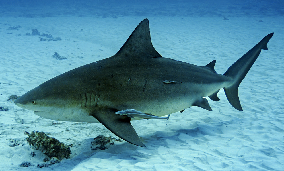
Bull Shark
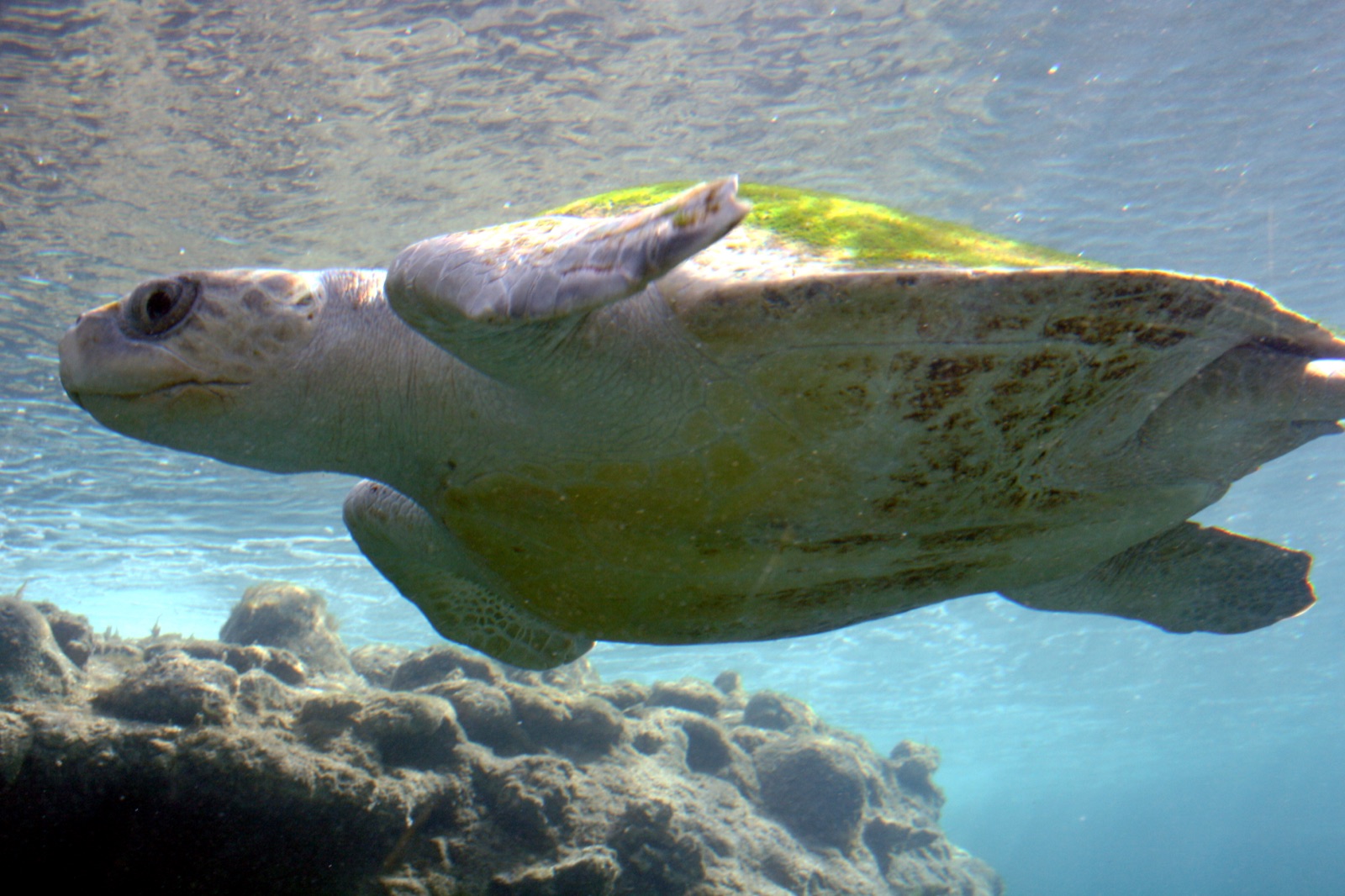
Olive Ridley Turtle
Bull sharks at the Bat Islands, giant mantas and mobulas at the Catalinas, white-tipped reef sharks everywhere, spotted eagle rays, olive ridley turtles (mass nesting at nearby Ostional), big grouper and jack schools, humpbacks in two seasons, and occasional whale sharks.
アクセスと宿泊
アクセス: For the northern sites, fly into Liberia and base in Playas del Coco, Flamingo, or Tamarindo. For Cano Island, reach Drake Bay via San Jose by light aircraft or by road to Sierpe and a river-mouth boat ride.
宿泊先: Playas del Coco has the widest choice of dive operators; Drake Bay is remoter, greener, and built around eco-lodges with dive programs.
費用: Two-tank trips from Guanacaste beach towns run about US$95-150; Bat Islands and Cano Island trips price higher for distance and park fees.
ダイビングの合間に: National parks (Santa Rosa, Rincon de la Vieja, Corcovado), surfing, zip lines, wildlife watching, and whale-watching boat trips in both humpback seasons.
スノーケリング: Cano Island's shallows and the Gulf of Papagayo beaches snorkel well; the signature shark and ray sites are dives, not snorkels.
安全性と実用情報
危険生物・リスク: Surge and swell on exposed pinnacles, cool thermoclines, plankton-limited visibility, seasonal Papagayo winds in the north, and real currents at the Bat Islands and Catalinas. Bull shark dives demand calm, bottom-hugging discipline.
The Big Scare is an advanced dive: depth, current, and large predators together. Follow operator protocols exactly - grouped descents, hands to yourself, controlled ascents with DSMBs. Elsewhere, standard recreational care applies; emergencies route through EMS and DAN.