Fernando de Noronha
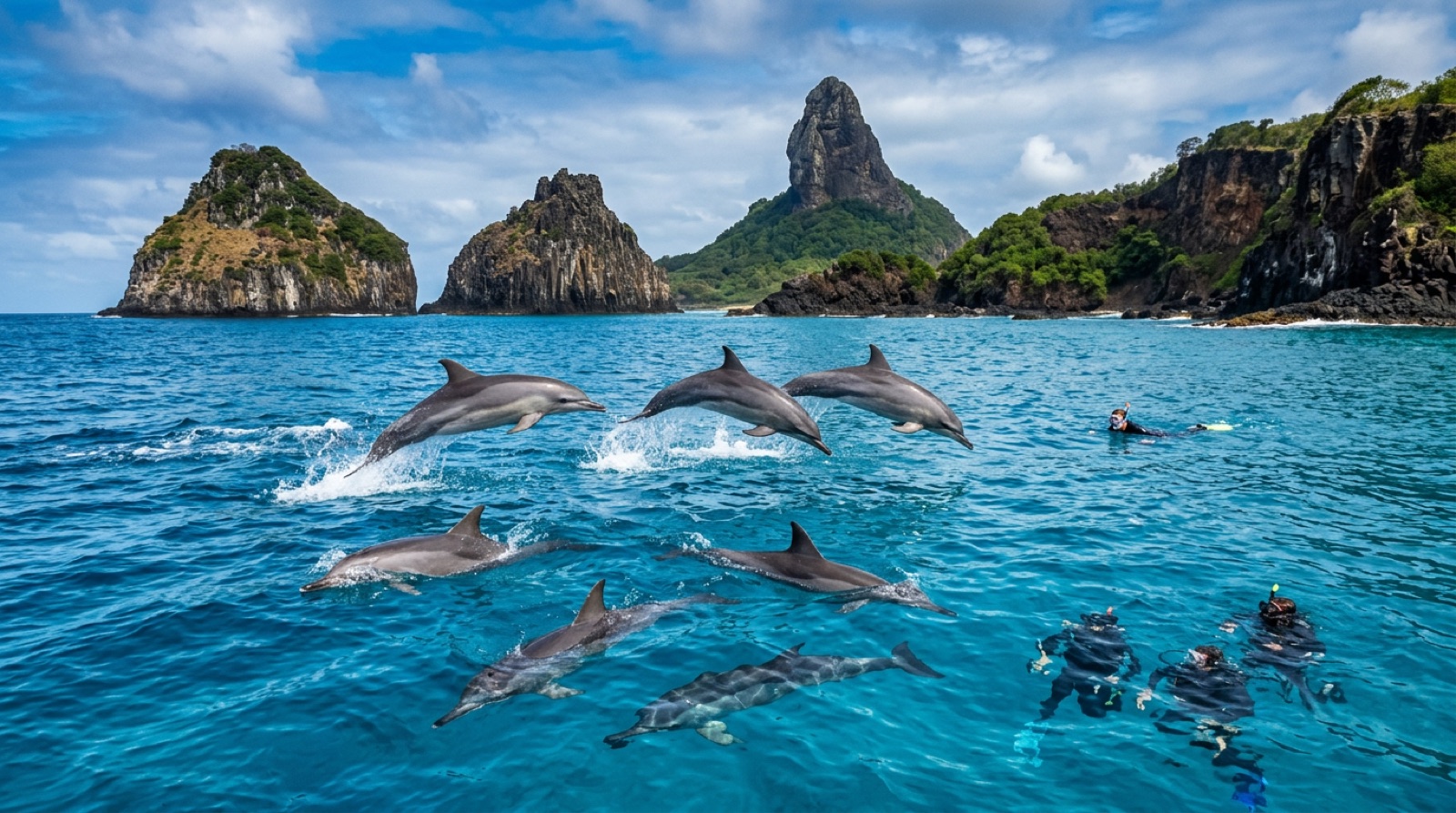
Fernando de Noronha is a volcanic archipelago 350 km off Brazil's northeastern shoulder, a marine national park and UNESCO site with the clearest, warmest diving in the country. Spinner dolphins pass in pods of hundreds, lemon and reef sharks patrol shallow sand channels, turtles graze under strict TAMAR-project protection, and the wreck of the corvette Ipiranga waits in deep water for technical divers. Visitor numbers, fees, and park rules keep the place deliberately uncrowded.
Why dive here
Noronha runs on clarity and confidence. Visibility of 25-40 m is normal in the dry season, the water holds 26-28 C all year, and the marine park's decades of protection have produced animals that simply do not flee: lemon sharks cruising the shallows, nurse sharks stacked under ledges, green turtles by the dozen, and reef sharks working the current points. The topography is volcanic - pinnacles, canyons, and swim-throughs like Pedras Secas - and the inner sea calms to lake conditions from roughly April through November. Deep off the north coast lies the Corveta Ipiranga V17, a Brazilian Navy corvette lost in 1983, upright and intact at around 60 m: one of South America's great technical dives. Above the surface, the archipelago rations tourism with a daily environmental tax and park fees, so sites stay quiet even in high season. Divers who make the two-flight journey get Brazil's best diving plus the spinner dolphin spectacle at dawn, and most leave planning a longer return.
Month by month
April-November offers the calmest inner-sea conditions, with the driest months (roughly August-November) delivering peak visibility. December-March brings North Atlantic swell - surf season on the inner coast - which stirs the shallows and shifts diving to protected corners.
| Month | Water | Visibility | What it's like |
|---|---|---|---|
| January●●●○○ | 26–28 °C / 79–82 °F | 15–30 m | North swell; inner-sea sites can be washed out. |
| February●●●○○ | 26–28 °C / 79–82 °F | 15–30 m | |
| March●●●○○ | 26–28 °C / 79–82 °F | 15–30 m | |
| April●●●●○ | 26–28 °C / 79–82 °F | 20–35 m | Swell fades; rainy but diveable and calm. |
| May●●●●○ | 26–28 °C / 79–82 °F | 20–35 m | |
| June●●●●○ | 26–28 °C / 79–82 °F | 20–35 m | |
| July●●●●○ | 26–28 °C / 79–82 °F | 20–35 m | |
| August●●●●● | 26–28 °C / 79–82 °F | 25–40 m | Dry season; visibility at its long-range best. |
| September●●●●● | 26–28 °C / 79–82 °F | 25–40 m | |
| October●●●●● | 26–28 °C / 79–82 °F | 25–40 m | |
| November●●●●● | 26–28 °C / 79–82 °F | 25–40 m | |
| December●●●○○ | 26–28 °C / 79–82 °F | 15–30 m | Surf season begins on the inner coast. |
Monthly figures confidence: Editorial estimate. Months without a row have no verified data — we would rather show a gap than invent one.
The dive sites (4)
| Site | Type | Depth | Level | Access | |
|---|---|---|---|---|---|
| Caverna da Sapata A daylight cavern in a sheer volcanic point, resting nurse sharks, the… | Cave | 10–22 m | Intermediate | Boat | |
| Corveta Ipiranga (V17) An intact upright warship in exceptional visibility, one of South America's… | Wreck | 45–63 m | Technical | Boat | |
| Laje Dois Irmaos Lemon sharks in the shallows, reef sharks on the slab edge, dolphin… | Reef | 8–25 m | Intermediate | Boat | |
| Pedras Secas Canyon and tunnel swim-throughs in glass-clear water, turtles in the… | Reef | 8–22 m | Intermediate | Boat |
Marine life you can plan around
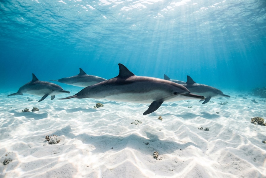
Spinner dolphins in large resident pods, lemon and Caribbean reef sharks, nurse sharks, green and hawksbill turtles, spotted eagle rays, big barracuda, dense reef fish, and seasonal pelagic visitors along the drop-offs.
Getting there & staying
Getting there: Fly to Recife or Natal on the Brazilian mainland, then take the short onward flight to the island. Dive boats leave from the harbor at Santo Antonio; nothing on the island is more than a short buggy ride away.
Where to stay: Accommodation is in pousadas ranging from simple to luxurious; capacity is capped, so book lodging before flights in Brazilian holiday periods.
Costs: Two-tank boat dives typically run about US$120-190. Budget separately for the island's daily environmental tax and the marine park entry fee, both charged per visitor.
Between dives: Baia do Sancho's much-photographed beach, dawn spinner dolphin watching, sea-turtle spotting at Sueste Bay, surfing December-March, and hiking the island's viewpoints.
Snorkeling: Outstanding in the bays - turtles at Sueste and reef fish at Baia do Sancho - under ranger-enforced rules.
Safety & practicalities
Hazards: Swell and surge December-March, current at the exposed points, boat traffic near the harbor, and the usual tropical suspects on the reef. The Ipiranga is a deep technical dive far beyond recreational limits.
Recreational diving here is friendly, but respect park rules: no gloves, no touching, distance from turtles and dolphins. The Ipiranga requires technical certification, appropriate gas, and an operator set up for staged decompression. Emergencies route through island EMS, mainland evacuation, and DAN.