Riviera Maya & the Cenotes
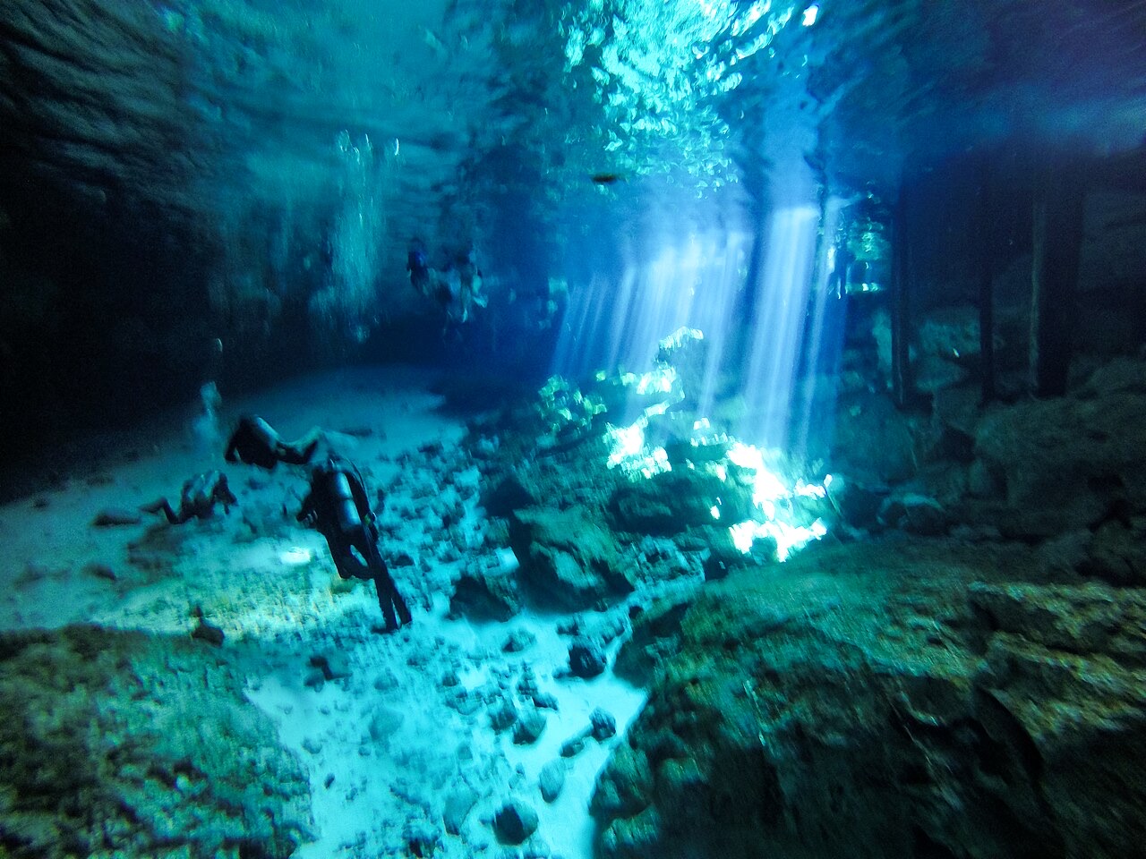
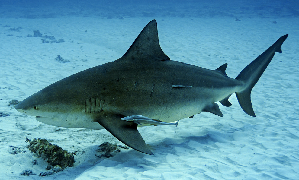
The Riviera Maya's signature diving happens inland. Rain and time have dissolved the Yucatan's limestone into thousands of kilometers of flooded cave, and cenotes (collapsed sinkholes) are the doorways. Guided cavern dives put certified divers beneath stalactite ceilings and cathedral light beams while staying within recreational limits, and the coast adds reef dives plus, in winter, bull sharks off Playa del Carmen. The water holds near 25 °C with visibility measured in tens of meters.
Pourquoi plonger ici
Nowhere else can an ordinary certified diver see this much of the underworld this safely. In the daylight cavern zones of systems like Sac Actun and Ox Bel Ha (among the longest underwater caves ever surveyed), permanent guidelines wind past columns, fossil beds, and air domes. Each cenote has its own character: Dos Ojos is blue light and dense formations, The Pit drops through a hydrogen-sulfide haze in a shaft of morning sun, Angelita fakes a misty riverbed 30 m down, and Casa Cenote braids fresh and salt water through a mangrove channel. The halocline alone justifies the trip, smearing vision like oil over glass until you fully cross it. Winter adds bull sharks gathering on the sand off Playa del Carmen. The rules deserve respect: cave-trained guides, small ratios, a light per diver, and no passing beyond the daylight zone without full cave certification.
Mois par mois
Cenote water sits near 24–26 °C all year, so seasons are about light and crowds: high sun from late spring through summer drives the famous beams into The Pit and Dos Ojos, bull sharks visit Playa del Carmen roughly November through February, and December–April brings the busiest parking lots.
| Mois | Eau | Visibilité | Ce que c'est comme |
|---|---|---|---|
| January●●●●○ | 24–26 °C / 75–79 °F | 30–100 m | Cool air, same warm water; bull sharks off Playa. |
| February●●●●○ | 24–26 °C / 75–79 °F | 30–100 m | Dry and busy; book guides ahead. |
| March●●●●○ | 24–26 °C / 75–79 °F | 30–100 m | High season tapers; sharks thin out. |
| April●●●●● | 24–26 °C / 75–79 °F | 30–100 m | Sun climbs; light beams strengthen. |
| May●●●●● | 24–26 °C / 75–79 °F | 30–100 m | Midday beams near their best. |
| June●●●●● | 24–26 °C / 75–79 °F | 30–100 m | Strong shafts of light; afternoon showers topside. |
| July●●●●● | 24–26 °C / 75–79 °F | 30–100 m | Peak light in the deep shafts. |
| August●●●●● | 24–26 °C / 75–79 °F | 30–100 m | Hot topside; the caverns stay cool. |
| September●●●●○ | 24–26 °C / 75–79 °F | 25–80 m | Rainy season can tint open cenotes. |
| October●●●●○ | 24–26 °C / 75–79 °F | 25–80 m | Tannic surface layers in some pools. |
| November●●●●○ | 24–26 °C / 75–79 °F | 30–100 m | Drying out; bull sharks return off Playa. |
| December●●●●○ | 24–26 °C / 75–79 °F | 30–100 m | Holiday crowds at the famous pools. |
Fiabilité des données mensuelles: Documented. Les mois sans ligne ne disposent d'aucune donnée vérifiée. Nous préférons montrer un vide plutôt qu'en inventer un.
Les sites de plongée (7)
| Site | Type | Profondeur | Niveau | Accès | |
|---|---|---|---|---|---|
| Carwash Underwater lily garden, amber tannic light in summer, easy cavern mouth… | Cenote | 3–15 m | Beginner | Shore | |
| Casa Cenote Mangrove-lined channel, shimmering halocline, juvenile tarpon, easy… | Cenote | 2–8 m | Beginner | Shore | |
| Cenote Angelita The false lake of hydrogen sulfide, drowned trees in the mist, surreal deep… | Cenote | 5–40 m | Advanced | Shore | |
| Chac Mool & Kukulkan Kukulkan's light beams, textbook halocline, air-dome chamber, close to… | Cenote | 4–14 m | Beginner | Shore | |
| Dos Ojos Twin sunlit pools, Barbie and Bat Cave guideline circuits, dense stalactite… | Cenote | 3–10 m | Beginner | Shore | |
| Playa del Carmen Bull Shark Dive Close passes from mature bull sharks, seasonal aggregation, minutes from… | Drift | 20–25 m | Advanced | Boat | |
| The Pit Light beams down a huge shaft, the sulfide cloud at 30 m, silhouettes over… | Cenote | 10–40 m | Advanced | Shore |
La vie marine, planifiée à l'avance
Atlantic Tarpon
Green Sea Turtle
Bull Shark
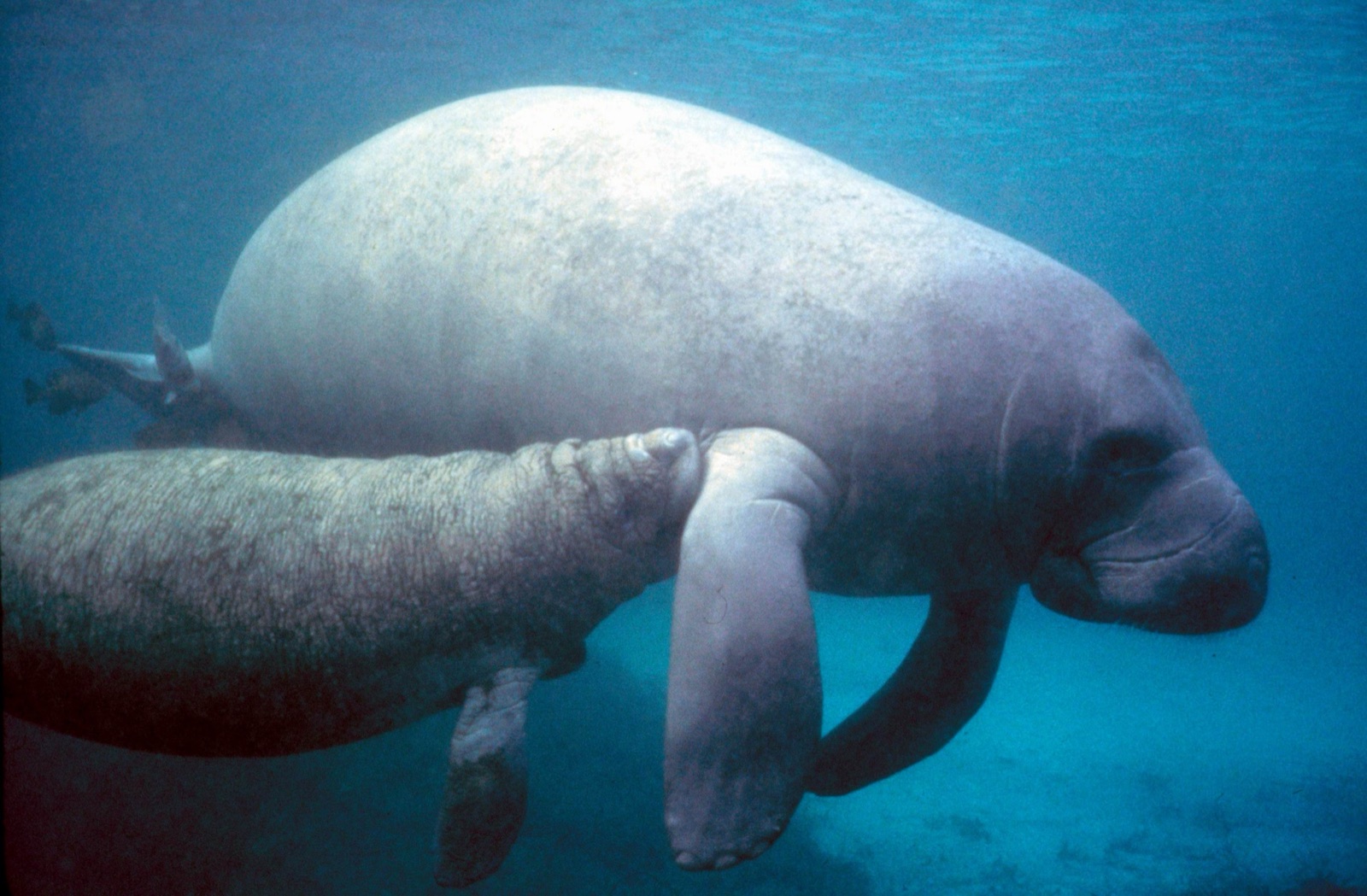
West Indian Manatee
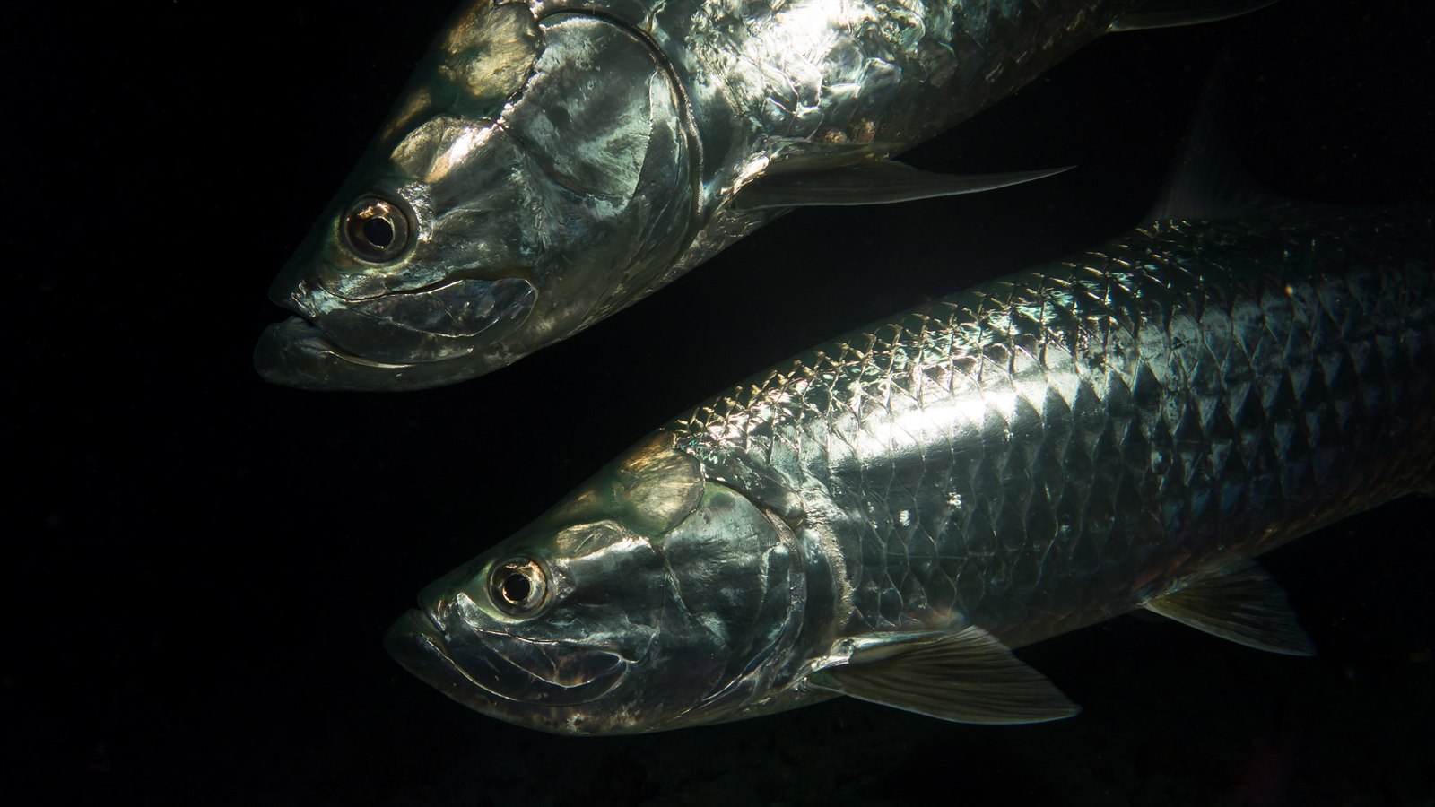
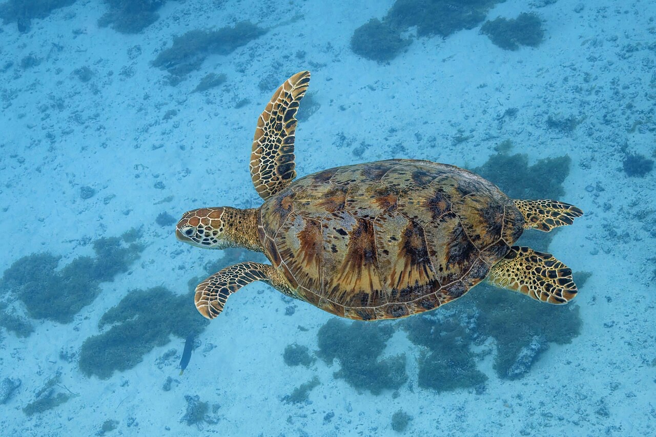
Cenote life is sparse and strange: tetras and mollies in the sunlit pools, blind cave fish and pale crustaceans farther in, motmot birds nesting in the karst overhead. Casa Cenote adds juvenile tarpon and, rarely, a visiting manatee; the winter sand flats off Playa del Carmen belong to bull sharks.
Comment s'y rendre & se loger
Comment s'y rendre: Fly into Cancun and drive Highway 307 south; the marquee cenotes cluster around Puerto Aventuras and Tulum, 60–90 minutes from the airport. Shops in Playa del Carmen and Tulum run daily guided trips.
Où séjourner: Tulum is closest to Dos Ojos, The Pit, and the Coba-road cenotes; Playa del Carmen balances cavern runs with reef and winter bull-shark boat diving.
Coûts: Guided two-cenote day trips usually include tanks, weights, and transport; rising cenote entrance fees are sometimes billed separately. Cavern tours require a guide; full cave training is a separate multi-day investment.
Entre les plongées: Tulum's clifftop ruins, the pyramids at Coba, Sian Ka'an biosphere reserve, and the beach towns strung along the highway.
Sécurité & aspects pratiques
Dangers: Overhead environment: no direct ascent from the cavern zone, fragile formations, silt that can erase visibility in seconds, and haloclines that disorient. Open-water instincts do not transfer unmodified.
Dive cenote caverns only with a cave-trained guide on fixed lines, in small teams, with at least one light per diver. The cave zone beyond daylight is for full cave certification only. That boundary exists because untrained divers have died past it. Respect the depth plans at The Pit and Angelita.
Caisson de recompression le plus proche: Hyperbaric chambers operate in Playa del Carmen; verify current availability through your operator and DAN.