Turks and Caicos
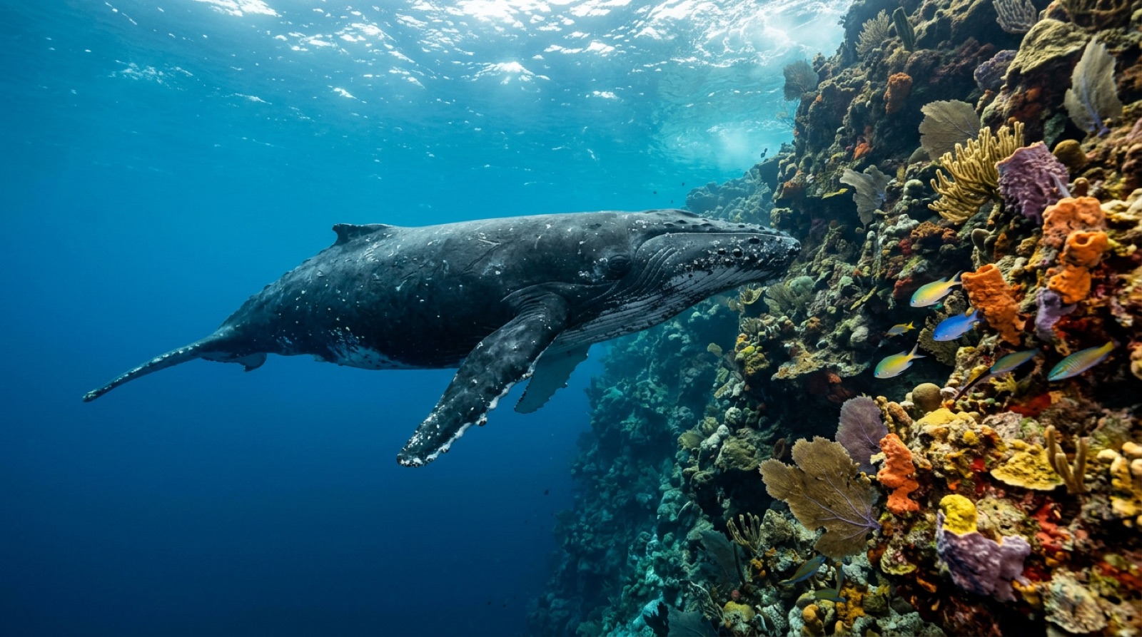
The Turks and Caicos sit on two shallow banks separated by a 2,000-meter-deep passage, and nearly all the diving happens where those banks end. Walls off Grand Turk begin a few hundred meters from the beach; Providenciales boats work Northwest Point, West Caicos, and French Cay; and from January to March humpback whales funnel through the Turks Island Passage on their way to the Silver Bank.
Why dive here
This is wall diving in its purest Atlantic form. The drop-offs start shallow, often at eight to ten meters, so you spend real time against the edge rather than glancing at it, and the faces are cut with sand chutes, black coral, and sponges the size of armchairs. Grand Turk keeps its old-Caribbean pace, with sites like Black Forest and The Library minutes offshore of a sleepy cruise-free morning. Provo's operators run faster boats to wilder edges: reef sharks at Shark Hotel, the huge elephant ear sponge in its namesake canyon at West Caicos, and gray reef silhouettes at French Cay. In late winter, humpback song carries through the water clearly enough to stop a dive, and Salt Cay whale-watching trips sometimes see mothers with calves in the channel. A liveaboard fleet mops up the remote banks in single itineraries.
Month by month
December through April brings the calmest, clearest conditions and the humpback migration. Hurricane season peaks August-October.
| Month | Water | Visibility | What it's like |
|---|---|---|---|
| January●●●●● | 25–26 °C / 77–79 °F | 25–40 m | Humpbacks moving through the passage. |
| February●●●●● | 25–26 °C / 77–79 °F | 25–40 m | Peak whale season; superb visibility. |
| March●●●●● | 25–27 °C / 77–81 °F | 25–40 m | |
| April●●●●● | 26–27 °C / 79–81 °F | 25–40 m | |
| May●●●●○ | 26–28 °C / 79–82 °F | 20–35 m | |
| June●●●●○ | 27–29 °C / 81–84 °F | 20–35 m | |
| July●●●●○ | 28–29 °C / 82–84 °F | 20–30 m | |
| August●●●○○ | 28–30 °C / 82–86 °F | 20–30 m | |
| September●●○○○ | 28–30 °C / 82–86 °F | 15–30 m | Peak hurricane risk; some operations pause. |
| October●●●○○ | 27–29 °C / 81–84 °F | 15–30 m | |
| November●●●●○ | 26–28 °C / 79–82 °F | 20–35 m | |
| December●●●●● | 25–27 °C / 77–81 °F | 25–40 m |
Monthly figures confidence: Documented. Months without a row have no verified data — we would rather show a gap than invent one.
The dive sites (5)
| Site | Type | Depth | Level | Access | |
|---|---|---|---|---|---|
| Black Forest Shallow black coral under dramatic overhangs, whale song in season | Wall | 8–40 m | Intermediate | Boat | |
| Elephant Ear Canyon Giant elephant ear sponge, sand-river canyon through the wall | Wall | 10–40 m | Intermediate | Boat | |
| Shark Hotel Reliable unbaited reef sharks, classic Northwest Point wall scenery | Wall | 12–40 m | Intermediate | Boat | |
| The Library Gentle buttressed wall, fish-rich shallows over the lip | Wall | 9–40 m | Intermediate | Boat | |
| Thunderdome Game-show ruin turned fish haven, shallow bright conditions | Artificial reef | 3–8 m | Beginner | Boat |
Marine life you can plan around
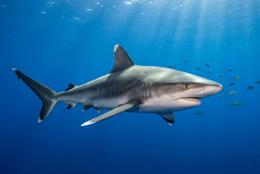
Caribbean reef sharks patrol every wall, with nurse sharks in the shallows and hawksbill turtles on the sponge gardens. Spotted eagle rays cruise the sand lines, garden eels carpet the chutes, and from January to March humpback whales pass close enough that divers hear them singing through the wall.
Getting there & staying
Getting there: Fly to Providenciales from the US, Canada, or London, then a short hop or ferry-plus-flight to Grand Turk if that side is your base.
Where to stay: Provo offers Grace Bay resorts and villas near the boats; Grand Turk and Salt Cay are for travelers who want quiet streets and short rides to the wall.
Liveaboards: Liveaboards based out of Providenciales cover West Caicos, French Cay, and the remote southern banks in week-long loops.
Costs: Providenciales is one of the pricier Caribbean dive bases; Grand Turk day rates run somewhat lower. Editorial estimate; confirm current rates.
Between dives: Grace Bay beach, kiteboarding the shallows, island-hopping to Salt Cay's salt-raking ruins, and winter whale watching.
Safety & practicalities
Hazards: Deep walls invite unnoticed depth creep; hurricane season June-November; boat rides to West Caicos and French Cay cross open water.
Set a hard depth limit before splashing on any wall dive and watch your gauge against the featureless blue.
Nearest recompression: A hyperbaric chamber has operated on Providenciales; availability changes, so emergencies go through EMS and DAN first.