Cold Water
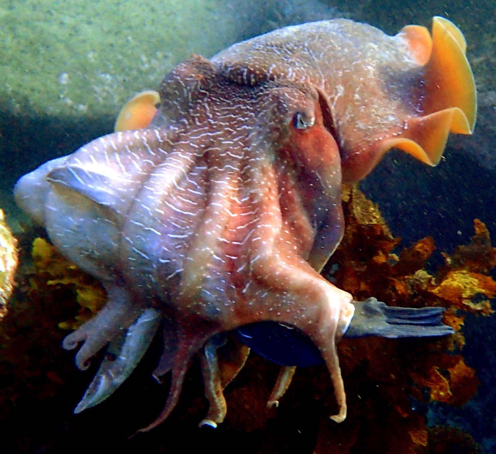
Australian Giant Cuttlefish
Sepia apama · Cephalopod mollusk, family Sepiidae; the largest cuttlefish species
Every austral winter the upper Spencer Gulf hosts the only known dense breeding aggregation of cuttlefish anywhere: tens of thousands of Sepia apama packed onto a few kilometers of shallow rocky reef near Whyalla, in green water that can drop below 12 °C. Males outnumber females several times over, so the reef becomes a tournament: meter-long heavyweights strobing zebra patterns at rivals while smaller sneaker males dim their colors, tuck their arms, and pass as females to slip through the cordon. It all happens in two to eight meters, snorkel-accessible, roughly May through August with a June–July peak. Across the rest of southern Australia the species lives as solitary, frankly curious reef residents that study divers as openly as they are studied. Bring drysuit-grade insulation, move slowly, and touch nothing: these animals breed once and die.
Onde e quando ver um
"Residente" significa que a maioria dos mergulhos naquele destino os encontra; "sazonal" significa presença confiável nos meses listados; qualquer outra coisa é um bônus, não um plano.
| Destino | Fiabilidade | Meses | Notas |
|---|---|---|---|
| South AustraliaAustralia | Seasonal: reliable in season | May–Aug |
Melhor mês, em resumo
| Mês | Destinos fiáveis |
|---|---|
| May | South Australia |
| June | South Australia |
| July | South Australia |
| August | South Australia |
Entendendo-os
Habitat: Temperate rocky reef, kelp, and seagrass; the famous breeding aggregation packs onto a few kilometers of shallow stone reef in the upper Spencer Gulf.
Distribuição: Southern Australian coast from Queensland's border waters around to Western Australia, including Tasmania.
Comportamento: Solitary and curious most of the year; each austral winter tens of thousands converge near Whyalla to breed, males dueling in color while smaller sneaker males dim their patterns and pass as females to reach mates.
Dieta: Crabs, shrimp, and fishes taken with ambush patience and tentacle strikes.
Tamanho: normalmente cerca de 0.4 m; documentado até 0.5 m (mantle length; total length approaches 1 m and big males exceed 10 kg).
Como se comportar perto de um
Thick exposure protection, slow fins, and no touching at the aggregation: the animals die after breeding, and every disrupted pairing spends a genuine last chance. Follow local sanctuary-zone rules.
Conservação
Assessed Near Threatened; the Whyalla aggregation crashed in the early 2010s before rebounding under fishing closures and a sanctuary zone that remain load-bearing.
Pontos mapeados conhecidos por eles
Os locais destacados foram cartografados para esta espécie pelos nossos editores; os números são registos de ocorrência do GBIF num raio de cerca de 5 km do local desde 1990.
Assista
Dos canais oficiais

Wildlife of Monterey | New film in our auditorium

Live Aviary Cam | Monterey Bay Aquarium

Live Aviary Cam | Monterey Bay Aquarium
Os vídeos são ligações incorporadas para os canais dos próprios criadores. Não alojamos nada e creditamos tudo.