Puntos de buceo, temporadas y vida marina — investigados, cartografiados, planificados.
Menú
Destinos Puntos de buceo Vida marina Pecios Noticias
Planifica un viaje Planificador de viajes Cuándo bucear Calculadora de costes Comparativas Calendario de fauna marina Temperatura del agua Liveaboards Operadores y resorts Parques marinos Cámaras hiperbáricas Mapa mundial
Regiones Australia, Nueva Zelanda y Asia OrientalCaribe y Atlántico occidentalEuropa, Atlántico y MediterráneoOcéano Índico y África OrientalIslas del Pacífico y MicronesiaMar Rojo y Oriente MedioSudeste Asiático y el Triángulo del CoralLas Américas y el Pacífico Oriental Países
Aprender y herramientas Todas las guías Certificaciones Guías de equipo Vídeos Consulta los datos Agentes de IA API
Acerca de Quiénes somos Metodología Aviso legal Contacto
Tu vista
★ Guardado

Tus destinos, sitios y especies favoritos — guardados en este navegador.

API GATEWAY

Acceso JSON gratuito de solo lectura a los datos en caché del atlas.

Modo oscuro

🧭 Vista guiada
¿Nuevo en el buceo? ¿Profundidades, corrientes, niveles de certificación? Explicamos cada término mientras navegas, en un lenguaje claro. Los mismos datos, con la ayuda integrada.

⚡ Vista experta
Ya conoces la diferencia entre una pared y un drift dive. Solo los datos — claros, rápidos y concisos. Esta es la vista predeterminada.

Idioma de la interfaz
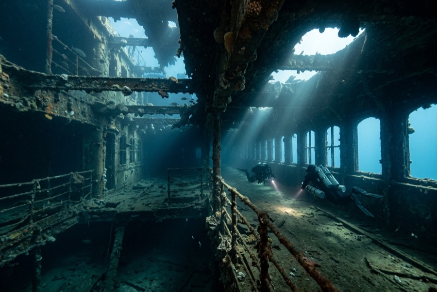
Heian Maru — illustrative image

Heian Maru

Japanese submarine tender (converted NYK passenger-cargo liner) Hundido 1944 12–34 m Chuuk (Truk) Lagoon
Ilustración generada por IA
Tumba de guerra Aquí murieron personas que, en algunos casos, siguen a bordo. Bucea en este lugar como si visitaras un memorial: no toques, no te lleves nada, no perturbes nada.
Bien documentado
Profundidad hasta cubierta
12 m / 39 ft
Profundidad máxima
34 m / 112 ft
Construido / hundido
1930 / 1944
Longitud
155 m
Tonelaje
11,616 GRT
Orientación
On Her Port Side
Nivel
Intermediate
Mejores meses
Dec–Apr

La historia

At over 11,000 gross tons, the Heian Maru is the largest ship on the floor of Truk Lagoon. She began in 1930 as a comfortable NYK liner on the Yokohama–Seattle run, her name lettered on the bow in both English and katakana — both still readable underwater, which never stops being strange. Requisitioned in 1941 and converted to tend the submarines of the Sixth Fleet, she was serving as their flagship depot ship when Operation Hailstone caught her at anchor. Bombed and set ablaze across the raid's two days, she rolled onto her port side as she sank. Her scale defines the dive: swimming her length is a full tank's work, past long-lance torpedoes lying in racks, spare periscopes bundled like lumber, and cavernous holds. Submariners' stores went down with submariners' comrades; remains have been found within, and she is dived as the war grave she is.

Cómo se hundió: Bombed and burned during Operation Hailstone, 17–18 February 1944.

Buceando aquí hoy

Condición: Substantially intact for her size; interior decks are slowly shedding fittings as steel fatigues.

Penetración: Full With Training. Passageways and holds are spacious but rotated ninety degrees, which disorients; wreck training and a lagoon guide are the standard. Acceder a cualquier entorno de penetración exige formación específica — como mínimo una certificación en pecios, y formación técnica en pecios para penetración completa.

Certificación recomendada: Advanced Open Water; wreck training for interiors

Corriente: Mild · Visibilidad: 15–30 m

Vida marina: Encrusting corals and sponges shingle the upturned hull, fusiliers stream along the promenade rails, and eagle rays pass over the sand.

Riesgos: Sideways geometry confuses navigation inside; silt banks lie deep in the holds; torpedoes and munitions are live and untouchable.

Protección y legislación

Chuuk lagoon monument protection; state dive permit/fee applies.

Human remains rest aboard — enter with restraint and take only photographs of the ship, never of the dead.

Removal of any object is illegal under Chuuk state law.

Ver

Desde los canales oficiales

Todos los vídeos →

Los vídeos son enlaces incrustados a los canales propios de sus creadores — no alojamos nada y acreditamos todo.

Fuentes: CombinedFleet.com ↗Wikipedia ↗ · Datos verificados frente a las fuentes anteriores; los campos sin respaldo se marcan como aún no verificados.

Australia, Nueva Zelanda y Asia Oriental

Cairns & the Ribbon ReefsNingaloo ReefCoral Sea & Osprey ReefOkinawa & the Kerama IslandsPoor Knights IslandsTownsville & the YongalaGreen IslandIzu Peninsula

Caribe y Atlántico occidental

BonaireCozumelRiviera Maya & the CenotesBelize Barrier ReefGrand CaymanIsla Mujeres & CancúnRoatánTiger Beach & Grand Bahama

Europa, Atlántico y Mediterráneo

Malta & GozoSilfra & IcelandThe AzoresCanary IslandsLarnaca & the ZenobiaScapa FlowArctic NorwayMadeira

Océano Índico y África Oriental

North & South Malé AtollsAri AtollBaa Atoll & Hanifaru BayAliwal Shoal & UmkomaasMafia IslandMauritiusSeychellesSodwana Bay

Islas del Pacífico y Micronesia

PalauChuuk (Truk) LagoonFakaravaKona, HawaiʻiRangiroaTaveuni & Rainbow ReefBeqa Lagoon & Pacific HarbourEspiritu Santo

Mar Rojo y Oriente Medio

Sharm El Sheikh & Ras MohammedBrothers, Daedalus & St John'sDahabHurghada & El GounaMarsa Alam & the Deep SouthAqabaDaymaniyat IslandsMusandam Peninsula

Sudeste Asiático y el Triángulo del Coral

Bali & Nusa PenidaKomodoRaja AmpatSipadan & MabulAnilaoCoronKoh TaoLembeh Strait

Las Américas y el Pacífico Oriental

Galápagos IslandsCocos IslandFlorida KeysSea of Cortez & Cabo PulmoSocorro & the RevillagigedosBritish ColumbiaCalifornia Channel IslandsCosta Rica Pacific Coast