Pontos de mergulho, épocas e vida marinha — pesquisados, mapeados, planeados.
Menu
Destinos Pontos de Mergulho Vida Marinha Naufrágios Notícias
Planejar uma viagem Planejador de viagem Quando mergulhar Calculadora de custos Comparações Calendário de vida marinha Temperatura da água Liveaboards Operadores & resorts Parques marinhos Câmaras hiperbáricas Mapa mundial
Regiões Austrália, Nova Zelândia e Ásia OrientalCaribe e Atlântico OcidentalEuropa, Atlântico & MediterrâneoOceano Índico e África OrientalIlhas do Pacífico & MicronésiaMar Vermelho & Médio OrienteSudeste Asiático e Triângulo de CoralAs Américas e o Pacífico Oriental Países
Aprender e Ferramentas Todos os guias Certificações Guias de equipamento Vídeos Consulte os Dados Agentes de IA API
Sobre Sobre nós Metodologia Aviso legal Contato
A sua vista
★ Guardado

Os seus destinos, sítios de mergulho e espécies favoritos — guardados neste browser.

API GATEWAY

Acesso JSON gratuito e só de leitura aos dados em cache do atlas.

Modo escuro

🧭 Vista Guiada
Novo no mergulho — profundidades, correntes, níveis de certificação? Explicamos cada termo enquanto navega, em linguagem simples. Os mesmos dados, com a ajuda integrada.

⚡ Vista de Especialista
Já sabe a diferença entre uma parede e um drift dive. Apenas os dados — claros, rápidos e compactos. Esta é a vista predefinida.

Idioma da interface
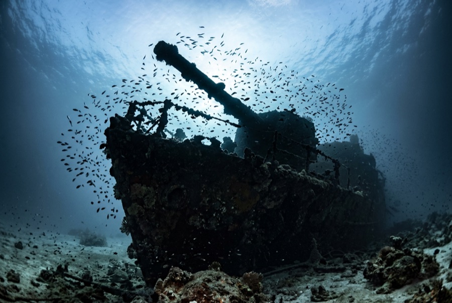
Maldive Victory — illustrative image

Maldive Victory

Interisland cargo and supply ship Afundado 1981 16–35 m North & South Malé Atolls
Ilustração gerada por IA
Houve vidas perdidas aquiNone recorded. Os operadores locais pedem que o naufrágio seja mergulhado com o respeito correspondente.
Documentado
Profundidade até o convés
16 m / 52 ft
Profundidade máxima
35 m / 115 ft
Construído / afundado
? / 1981
Orientação
Upright
Nível
Advanced
Melhores meses
Dec–Apr

A história

On a Friday the 13th in February 1981, the freighter Maldive Victory closed on Malé at night with a hold full of imported goods for the capital and misjudged the reef edge off Hulhulé, the airport island. She struck, hung, and went down at the channel mouth, coming to rest upright on sand at about 35 meters with her masts reaching well up into the current. The crew got off; the cargo mostly did not, and salvage and years of visiting divers stripped whatever the sea left loose. As the only substantial wreck within minutes of Malé, she became the standard deep dive of the central atolls and remains a fixture on North Malé itineraries and liveaboard first days. She is no gentle novelty, though: the channel funnels serious tidal current across the site, so boats dive her on slack, drop divers straight onto a mast or line, and keep the tour tight. In exchange, the current has dressed her superbly — rails, masts and bridge wear dense soft-coral growth, batfish escort divers around the superstructure, and snapper and grouper crowd the shaded holds.

Como afundou: Struck the reef off Hulhulé on Friday, 13 February 1981, and sank.

A mergulhar nela hoje

Condição: Upright and coherent; superstructure corroding and lighter fittings collapsing after four decades of current

Penetração: Limited. Holds and bridge are open for brief, well-lit entries on slack water; the depth and current argue against anything ambitious. Entrar em qualquer ambiente fechado requer formação específica — no mínimo uma certificação de mergulho em naufrágios, e formação técnica em naufrágios para penetração total.

Certificação recomendada: Advanced Open Water

Corrente: Strong · Visibilidade: 15–30 m

Vida marinha: Soft corals sheath the masts and rails, longfin batfish follow divers, bluestripe snapper and sweetlips pack the holds, and trevally hunt along the hull on the tide.

Perigos: Strong tidal current, depth, and boat traffic near the airport channel

Proteção & legislação

Anything portable disappeared decades ago; leave the corals that replaced it undisturbed.

Assista

Dos canais oficiais

Todos os vídeos →

Os vídeos são links incorporados dos próprios canais dos criadores — não hospedamos nada e creditamos tudo.

Fontes: Maldives Marketing and PR Corporation ↗ · Factos verificados em relação às fontes acima; os campos sem suporte estão assinalados como não verificado ainda.

Austrália, Nova Zelândia e Ásia Oriental

Cairns & the Ribbon ReefsNingaloo ReefCoral Sea & Osprey ReefOkinawa & the Kerama IslandsPoor Knights IslandsTownsville & the YongalaGreen IslandIzu Peninsula

Caribe e Atlântico Ocidental

BonaireCozumelRiviera Maya & the CenotesBelize Barrier ReefGrand CaymanIsla Mujeres & CancúnRoatánTiger Beach & Grand Bahama

Europa, Atlântico & Mediterrâneo

Malta & GozoSilfra & IcelandThe AzoresCanary IslandsLarnaca & the ZenobiaScapa FlowArctic NorwayMadeira

Oceano Índico e África Oriental

North & South Malé AtollsAri AtollBaa Atoll & Hanifaru BayAliwal Shoal & UmkomaasMafia IslandMauritiusSeychellesSodwana Bay

Ilhas do Pacífico & Micronésia

PalauChuuk (Truk) LagoonFakaravaKona, HawaiʻiRangiroaTaveuni & Rainbow ReefBeqa Lagoon & Pacific HarbourEspiritu Santo

Mar Vermelho & Médio Oriente

Sharm El Sheikh & Ras MohammedBrothers, Daedalus & St John'sDahabHurghada & El GounaMarsa Alam & the Deep SouthAqabaDaymaniyat IslandsMusandam Peninsula

Sudeste Asiático e Triângulo de Coral

Bali & Nusa PenidaKomodoRaja AmpatSipadan & MabulAnilaoCoronKoh TaoLembeh Strait

As Américas e o Pacífico Oriental

Galápagos IslandsCocos IslandFlorida KeysSea of Cortez & Cabo PulmoSocorro & the RevillagigedosBritish ColumbiaCalifornia Channel IslandsCosta Rica Pacific Coast