Puntos de buceo, temporadas y vida marina — investigados, cartografiados, planificados.
Menú
Destinos Puntos de buceo Vida marina Pecios Noticias
Planifica un viaje Planificador de viajes Cuándo bucear Calculadora de costes Comparativas Calendario de fauna marina Temperatura del agua Liveaboards Operadores y resorts Parques marinos Cámaras hiperbáricas Mapa mundial
Regiones Australia, Nueva Zelanda y Asia OrientalCaribe y Atlántico occidentalEuropa, Atlántico y MediterráneoOcéano Índico y África OrientalIslas del Pacífico y MicronesiaMar Rojo y Oriente MedioSudeste Asiático y el Triángulo del CoralLas Américas y el Pacífico Oriental Países
Aprender y herramientas Todas las guías Certificaciones Guías de equipo Vídeos Consulta los datos Agentes de IA API
Acerca de Quiénes somos Metodología Aviso legal Contacto
Tu vista
★ Guardado

Tus destinos, sitios y especies favoritos — guardados en este navegador.

API GATEWAY

Acceso JSON gratuito de solo lectura a los datos en caché del atlas.

Modo oscuro

🧭 Vista guiada
¿Nuevo en el buceo? ¿Profundidades, corrientes, niveles de certificación? Explicamos cada término mientras navegas, en un lenguaje claro. Los mismos datos, con la ayuda integrada.

⚡ Vista experta
Ya conoces la diferencia entre una pared y un drift dive. Solo los datos — claros, rápidos y concisos. Esta es la vista predeterminada.

Idioma de la interfaz
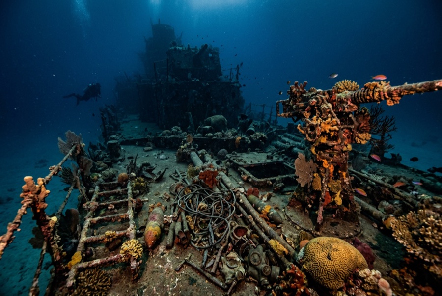
Million Dollar Point — illustrative image

Million Dollar Point

Second World War military equipment dump (debris field, not a vessel) Hundido 1945 1–40 m Espiritu Santo
Ilustración generada por IA
Aquí se perdieron vidasNone. Los operadores locales piden que el pecio se bucee con el respeto correspondiente.
Documentado
Profundidad hasta cubierta
1 m / 3 ft
Profundidad máxima
40 m / 131 ft
Construido / hundido
? / 1945
Orientación
A Jumbled Slope Of Machinery From The Shoreline Into Deep Water
Nivel
Beginner
Mejores meses
Apr–Oct

La historia

When the Pacific war ended, Espiritu Santo held one of the largest American bases on earth, and shipping mountains of used equipment home made no economic sense. The story told on Santo — supported by what lies on the seabed — is that the US offered the lot to the Anglo-French authorities at a token price, the local administration stalled in the expectation of getting it free, and the Americans answered by building a ramp and driving the inventory into the sea: bulldozers, six-wheeled trucks, jeeps, cranes, forklifts, sheet steel, engines, and crate upon crate of stores, with Coca-Cola bottles beyond counting. The name records the estimated value of what went over. Today the point is a shore dive down a slope of interlocked machinery, axles and tracks fused by coral into a single sardonic monument to logistics. Two later shipwrecks lie among the debris, casualties of salvage attempts on the very metal being thrown away.

Cómo se hundió: US forces deliberately dumped surplus equipment into the sea at the end of the war after disposal negotiations failed.

Buceando aquí hoy

Condición: A rust garden in slow collapse; recognizable machines emerge and disappear as the pile settles and storms rearrange the shallows.

Penetración: None. There is no hull to enter — only unstable stacked machinery, and wriggling into gaps between forty-ton machines is how divers get hurt.

Certificación recomendada: Open Water

Corriente: Mild · Visibilidad: 5–15 m

Vida marina: Corals colonize axles and cab frames, octopus den in engine blocks, lionfish and sweepers fill the truck beds, and reef fish swarm the shallows where snorkelers drift.

Riesgos: Sharp, unstable metal throughout; surge in the shallows; broken glass near the old bottle dumps.

Protección y legislación

Protected alongside the Coolidge under Vanuatu's wreck-site rules; local fees apply at the shore entry.

Bottles and brass have walked away for decades — the site is protected now, so leave every piece in the pile.

Ver

Desde los canales oficiales

Todos los vídeos →

Los vídeos son enlaces incrustados a los canales propios de sus creadores — no alojamos nada y acreditamos todo.

Fuentes: Vanuatu Tourism ↗Wikipedia ↗ · Datos verificados frente a las fuentes anteriores; los campos sin respaldo se marcan como aún no verificados.

Australia, Nueva Zelanda y Asia Oriental

Cairns & the Ribbon ReefsNingaloo ReefCoral Sea & Osprey ReefOkinawa & the Kerama IslandsPoor Knights IslandsTownsville & the YongalaGreen IslandIzu Peninsula

Caribe y Atlántico occidental

BonaireCozumelRiviera Maya & the CenotesBelize Barrier ReefGrand CaymanIsla Mujeres & CancúnRoatánTiger Beach & Grand Bahama

Europa, Atlántico y Mediterráneo

Malta & GozoSilfra & IcelandThe AzoresCanary IslandsLarnaca & the ZenobiaScapa FlowArctic NorwayMadeira

Océano Índico y África Oriental

North & South Malé AtollsAri AtollBaa Atoll & Hanifaru BayAliwal Shoal & UmkomaasMafia IslandMauritiusSeychellesSodwana Bay

Islas del Pacífico y Micronesia

PalauChuuk (Truk) LagoonFakaravaKona, HawaiʻiRangiroaTaveuni & Rainbow ReefBeqa Lagoon & Pacific HarbourEspiritu Santo

Mar Rojo y Oriente Medio

Sharm El Sheikh & Ras MohammedBrothers, Daedalus & St John'sDahabHurghada & El GounaMarsa Alam & the Deep SouthAqabaDaymaniyat IslandsMusandam Peninsula

Sudeste Asiático y el Triángulo del Coral

Bali & Nusa PenidaKomodoRaja AmpatSipadan & MabulAnilaoCoronKoh TaoLembeh Strait

Las Américas y el Pacífico Oriental

Galápagos IslandsCocos IslandFlorida KeysSea of Cortez & Cabo PulmoSocorro & the RevillagigedosBritish ColumbiaCalifornia Channel IslandsCosta Rica Pacific Coast