Siti di immersione, stagioni e fauna marina — ricercati, mappati, pianificati.
Menu
Destinazioni Siti di immersione Vita marina Relitti Notizie
Pianifica un viaggio Pianificatore di viaggi Quando immergersi Calcolatore dei costi Confronti Calendario della fauna marina Temperatura dell'acqua Liveaboard Operatori & resort Parchi marini Camere iperbariche Mappa del mondo
Regioni Australia, Nuova Zelanda e Asia OrientaleCaraibi e Atlantico occidentaleEuropa, Atlantico e MediterraneoOceano Indiano e Africa OrientaleIsole del Pacifico & MicronesiaMar Rosso & Medio OrienteAsia meridionale e Triangolo dei CoralliLe Americhe e il Pacifico orientale Paesi
Impara e strumenti Tutte le guide Brevetti Guide all'attrezzatura Video Interroga i dati AI Agent API
Informazioni Chi siamo Metodologia Disclaimer Contatti
La tua vista
★ Salvato

Le tue destinazioni, siti e specie preferiti — salvati in questo browser.

API GATEWAY

Accesso JSON gratuito in sola lettura ai dati in cache dell'atlante.

Modalità scura

🧭 Visualizzazione Guidata
Sei nuovo alle immersioni — profondità, correnti, livelli di brevetto? Spieghiamo ogni termine mentre navighi, in modo semplice e chiaro. Gli stessi dati, con il supporto integrato.

⚡ Visualizzazione Esperta
Conosci già la differenza tra una parete e una drift dive. Solo i dati — chiari, rapidi e compatti. Questa è la visualizzazione predefinita.

Lingua dell'interfaccia
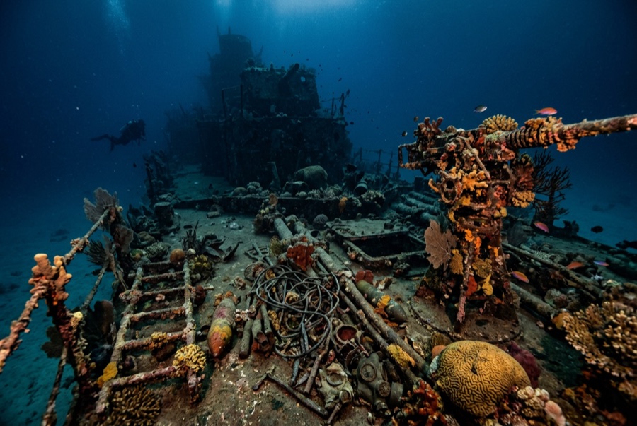
Million Dollar Point — illustrative image

Million Dollar Point

Second World War military equipment dump (debris field, not a vessel) Affondata 1945 1–40 m Espiritu Santo
Illustrazione generata dall'AI
Qui si sono perse delle viteNone. Gli operatori locali chiedono che il relitto venga visitato con il dovuto rispetto.
Documentato
Profondità al ponte
1 m / 3 ft
Profondità massima
40 m / 131 ft
Costruito / affondato
? / 1945
Orientamento
A Jumbled Slope Of Machinery From The Shoreline Into Deep Water
Livello
Beginner
Mesi migliori
Apr–Oct

La storia

When the Pacific war ended, Espiritu Santo held one of the largest American bases on earth, and shipping mountains of used equipment home made no economic sense. The story told on Santo — supported by what lies on the seabed — is that the US offered the lot to the Anglo-French authorities at a token price, the local administration stalled in the expectation of getting it free, and the Americans answered by building a ramp and driving the inventory into the sea: bulldozers, six-wheeled trucks, jeeps, cranes, forklifts, sheet steel, engines, and crate upon crate of stores, with Coca-Cola bottles beyond counting. The name records the estimated value of what went over. Today the point is a shore dive down a slope of interlocked machinery, axles and tracks fused by coral into a single sardonic monument to logistics. Two later shipwrecks lie among the debris, casualties of salvage attempts on the very metal being thrown away.

Come è affondata: US forces deliberately dumped surplus equipment into the sea at the end of the war after disposal negotiations failed.

Immersioni su di essa oggi

Condizione: A rust garden in slow collapse; recognizable machines emerge and disappear as the pile settles and storms rearrange the shallows.

Penetrazione: None. There is no hull to enter — only unstable stacked machinery, and wriggling into gaps between forty-ton machines is how divers get hurt.

Certificazione consigliata: Open Water

Corrente: Mild · Visibilità: 5–15 m

Vita marina: Corals colonize axles and cab frames, octopus den in engine blocks, lionfish and sweepers fill the truck beds, and reef fish swarm the shallows where snorkelers drift.

Pericoli: Sharp, unstable metal throughout; surge in the shallows; broken glass near the old bottle dumps.

Tutela & normativa

Protected alongside the Coolidge under Vanuatu's wreck-site rules; local fees apply at the shore entry.

Bottles and brass have walked away for decades — the site is protected now, so leave every piece in the pile.

Guarda

Dai canali ufficiali

Tutti i video →

I video sono link incorporati ai canali dei rispettivi autori — non ospitiamo nulla e diamo sempre credito a tutti.

Fonti: Vanuatu Tourism ↗Wikipedia ↗ · Dati verificati rispetto alle fonti indicate; i campi privi di riscontro sono contrassegnati come non ancora verificati.

Australia, Nuova Zelanda e Asia Orientale

Cairns & the Ribbon ReefsNingaloo ReefCoral Sea & Osprey ReefOkinawa & the Kerama IslandsPoor Knights IslandsTownsville & the YongalaGreen IslandIzu Peninsula

Caraibi e Atlantico occidentale

BonaireCozumelRiviera Maya & the CenotesBelize Barrier ReefGrand CaymanIsla Mujeres & CancúnRoatánTiger Beach & Grand Bahama

Europa, Atlantico e Mediterraneo

Malta & GozoSilfra & IcelandThe AzoresCanary IslandsLarnaca & the ZenobiaScapa FlowArctic NorwayMadeira

Oceano Indiano e Africa Orientale

North & South Malé AtollsAri AtollBaa Atoll & Hanifaru BayAliwal Shoal & UmkomaasMafia IslandMauritiusSeychellesSodwana Bay

Isole del Pacifico & Micronesia

PalauChuuk (Truk) LagoonFakaravaKona, HawaiʻiRangiroaTaveuni & Rainbow ReefBeqa Lagoon & Pacific HarbourEspiritu Santo

Mar Rosso & Medio Oriente

Sharm El Sheikh & Ras MohammedBrothers, Daedalus & St John'sDahabHurghada & El GounaMarsa Alam & the Deep SouthAqabaDaymaniyat IslandsMusandam Peninsula

Asia meridionale e Triangolo dei Coralli

Bali & Nusa PenidaKomodoRaja AmpatSipadan & MabulAnilaoCoronKoh TaoLembeh Strait

Le Americhe e il Pacifico orientale

Galápagos IslandsCocos IslandFlorida KeysSea of Cortez & Cabo PulmoSocorro & the RevillagigedosBritish ColumbiaCalifornia Channel IslandsCosta Rica Pacific Coast